Real-time high-precision global multi-dimensional troposphere zenith delay grid model construction method
A construction method and high-precision technology, which can be used in special data processing applications, design optimization/simulation, etc., and can solve problems such as single data source and insufficient spatial resolution.
- Summary
- Abstract
- Description
- Claims
- Application Information
AI Technical Summary
Problems solved by technology
Method used
Image
Examples
Embodiment 1
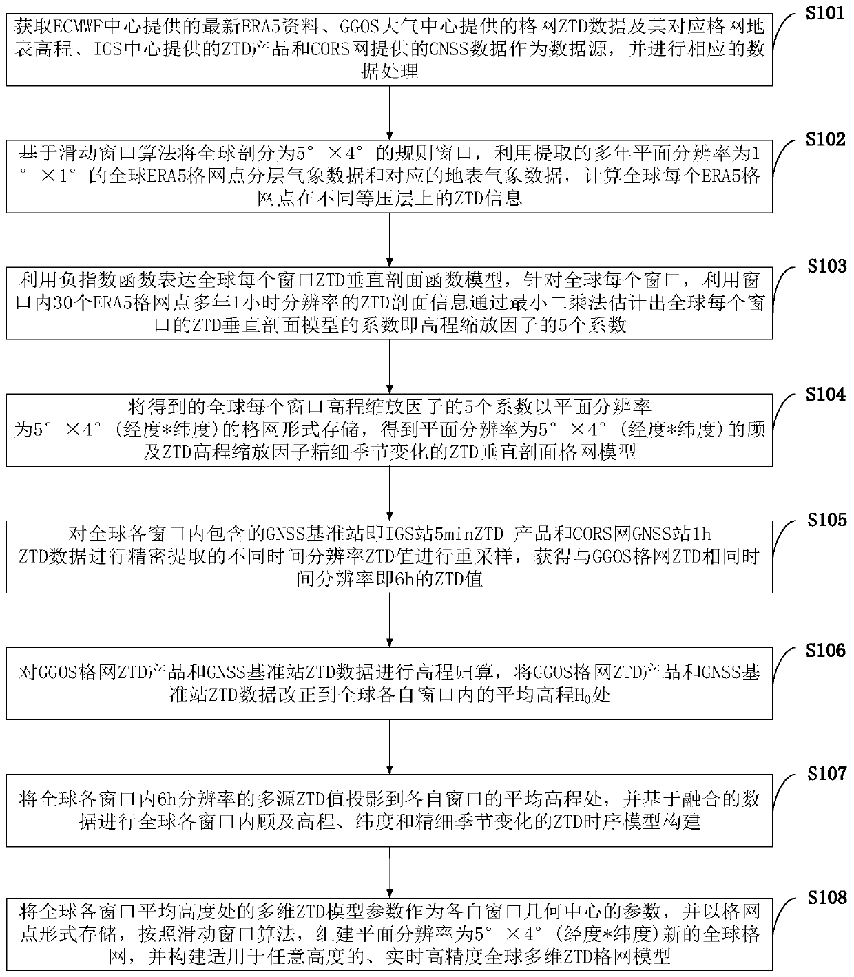
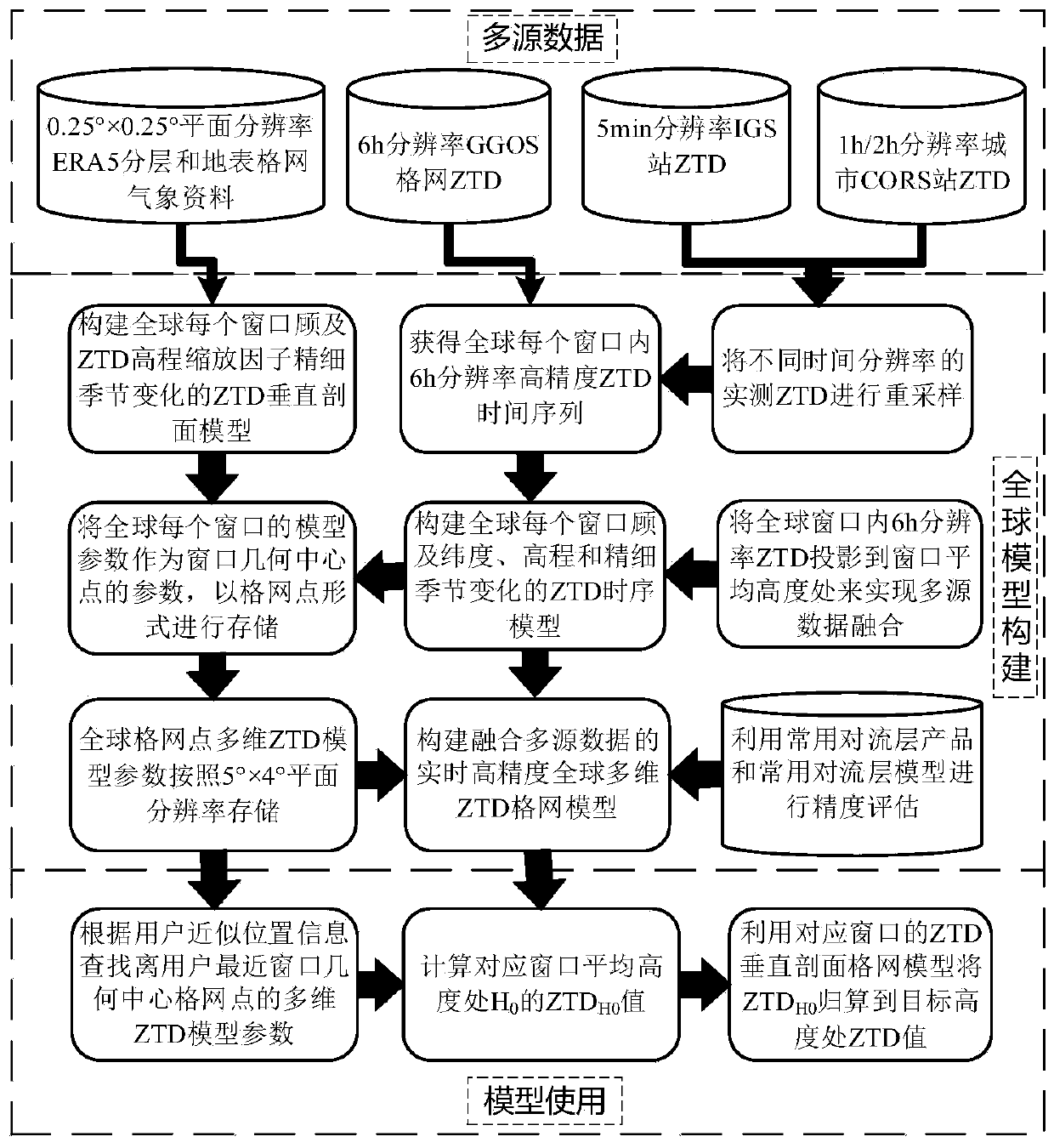
[0123] (1) Data source introduction and processing. The data sources involved in the model construction of the present invention are: the latest ERA5 data provided by the ECMWF Center, the grid ZTD data provided by the GGOS Atmospheric Center and its corresponding grid surface elevation, the ZTD products provided by the IGS Center and the GNSS data provided by the CORS network. The horizontal resolution of the ERA5 reanalysis data is 0.25°×0.25°, the time resolution is 1h, and the vertical resolution is 37 isobaric layers; the horizontal resolution of the GGOS atmospheric grid ZTD product is 2.5°×2° (longitude *latitude), the time resolution is 6h; the IGS Center provides ZTD products of thousands of GNSS reference stations around the world, the time resolution is 5min, and the accuracy is better than 5mm; for the GNSS reference station data provided by the CORS network, the Bernese The precision GNSS processing software calculates the ZTD information of each GNSS reference st...
PUM
 Abstract
Description
Claims
Application Information
 - R&D
- Intellectual Property
- Life Sciences
- Materials
- Tech Scout
- Unparalleled Data Quality
- Higher Quality Content
- 60% Fewer Hallucinations
Browse by: Latest US Patents, China's latest patents, Technical Efficacy Thesaurus, Application Domain, Technology Topic, Popular Technical Reports.
© 2025 PatSnap. All rights reserved.Legal|Privacy policy|Modern Slavery Act Transparency Statement|Sitemap|About US| Contact US: help@patsnap.com


