
Navigation mark tide level observation device and navigation mark tide level observation method are adopted

An observation device and tidal level technology, which is applied in the direction of measurement devices, surveying and navigation, open-air water source survey, etc., can solve the problems of low frequency of observation records, no guarantee of equipment safety, limited power supply, etc., and meet the needs of high-frequency observations , It is not easy for fishermen to be damaged, and the effect of improving measurement accuracy

Active Publication Date: 2020-08-25
QINGDAO HUAXING HAIYANG ENG TECH CO LTD
View PDF3 Cites 2 Cited by
  • Summary
  • Abstract
  • Description
  • Claims
  • Application Information

AI Technical Summary

Problems solved by technology

[0003] At present, although the GNSS (satellite altitude) method can be used for tidal observation far from the coast, there are several problems in the following aspects. First, the price of GNSS observation equipment is relatively high, and it depends on the GPS in the United States; second, the observation data requires more technology Processing, the current accuracy after processing is about 5cm, which is lower than the standard requirement for tide level observation (1cm), so this technology is not very practical
The second is the "reverse echo" observation equipment arranged on the seabed. Although the observation accuracy of this equipment can meet the standard requirements for tide level observation, there are the following problems when it is deployed on the seabed for several months. First, it is easy to be dragged away by fishing nets. The safety is not guaranteed; the second is that it is difficult to maintain the high-frequency (1 time / minute) demand for long-term continuous observation by relying on battery power
[0004] In order to solve the above problems, the method of transforming standard aids to navigation is adopted to realize the observation of water depth and tide level changes, which solves a series of problems such as unsafe, low observation accuracy, limited power supply, and low frequency of observation records, and provides a safe way for deep sea depth observation. Practical and cheap observation technology means

Method used


Image

  • Navigation mark tide level observation device and navigation mark tide level observation method are adopted
  • Navigation mark tide level observation device and navigation mark tide level observation method are adopted
  • Navigation mark tide level observation device and navigation mark tide level observation method are adopted

Examples


Embodiment Construction

[0047] The following will clearly and completely describe the technical solutions in the embodiments of the present invention with reference to the accompanying drawings in the embodiments of the present invention. Obviously, the described embodiments are only some, not all, embodiments of the present invention.

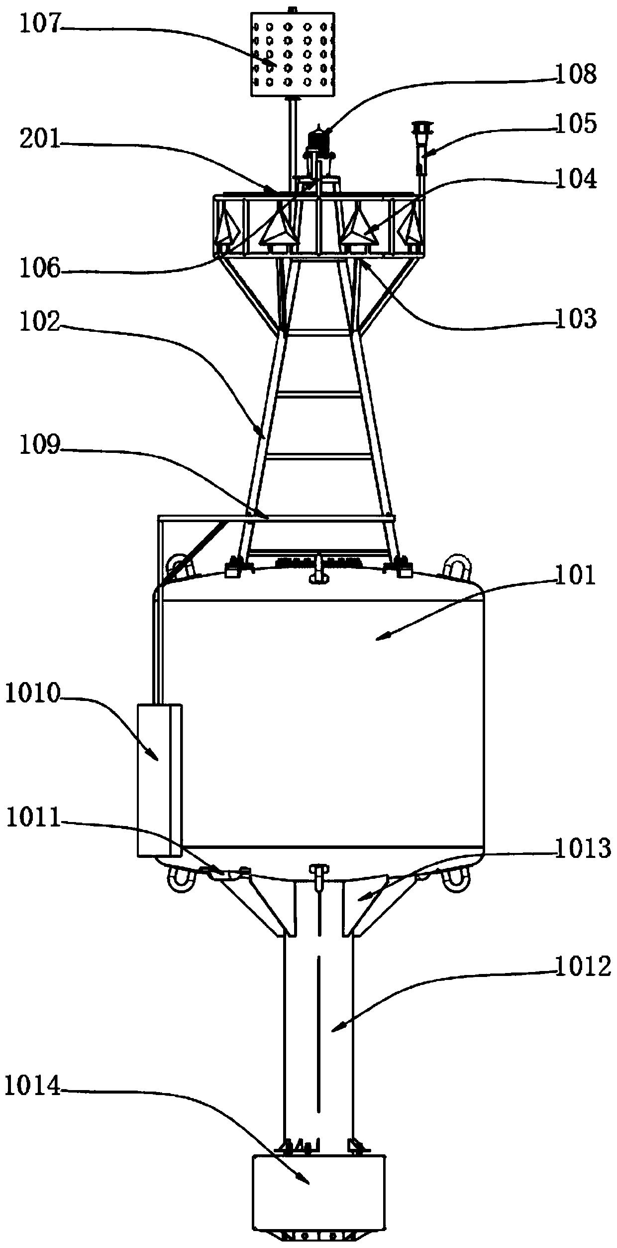
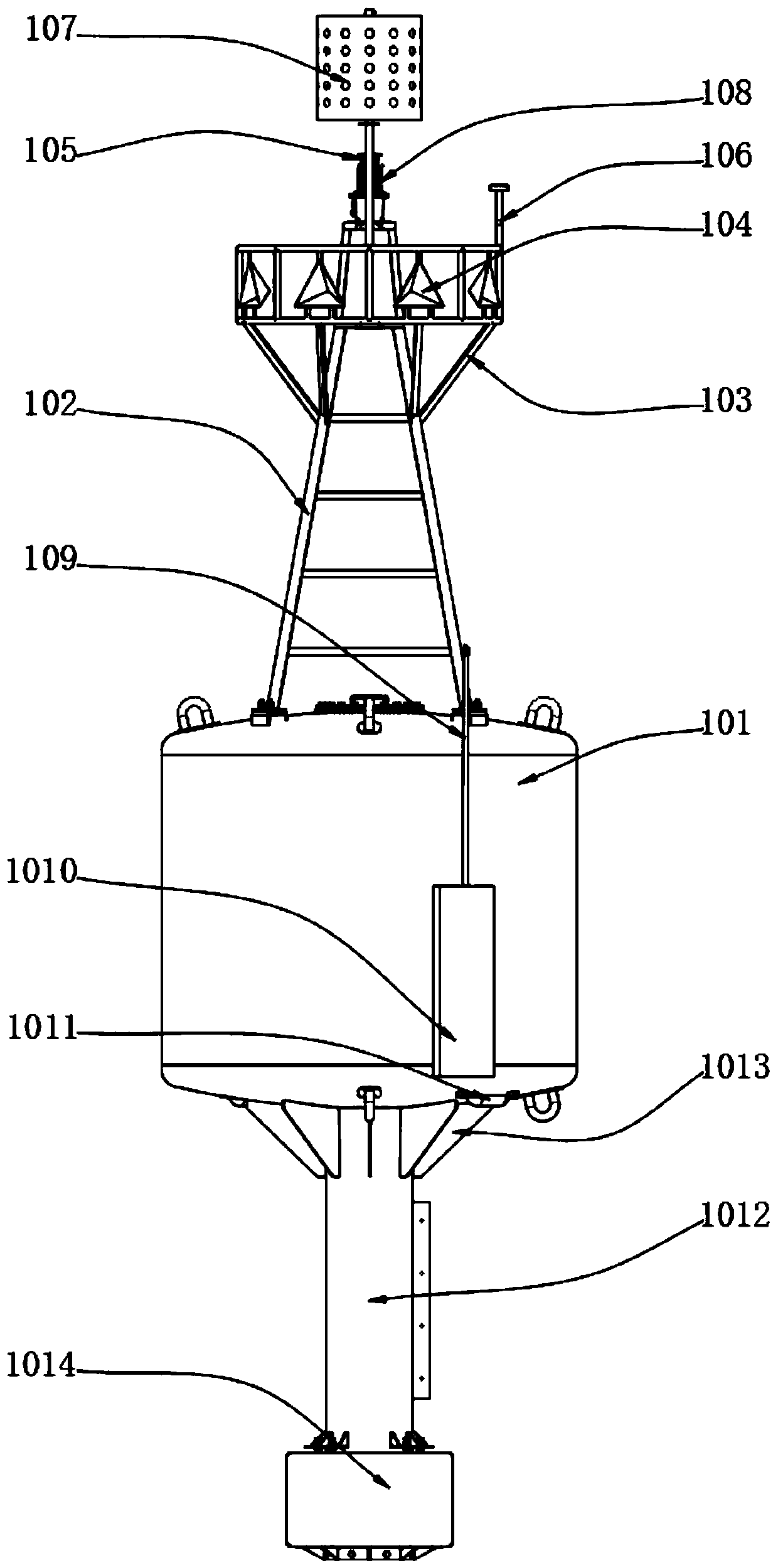
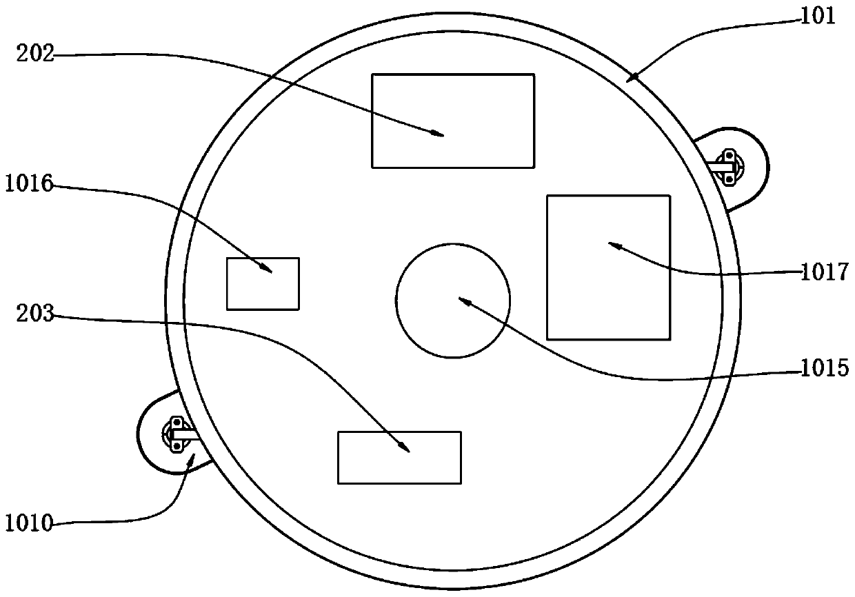
[0048] Refer to attached Figure 1-4 As shown, the navigation mark body assembly 1, the navigation mark body assembly 1 includes a floating body 101, an upper support 102, a fixed support 103, a radar reflector 104, a weather instrument 105, a Beidou antenna 106, a top mark 107, a navigation mark light 108, and an underwater support 109. Depth sounding sensor 1010, zinc anode 1011, tailpipe 1012, reinforcement plate 1013, counterweight 1014, angle sensor 1015, data acquisition control unit 1016, and first Beidou transceiver 1017, and the overall body components are sandblasted and derusted, Apply epoxy zinc-rich primer 2 times and polyurethane topcoat 2 times. The c...


PUM


Abstract

The invention provides a navigation mark tide level observation device and a navigation mark tide level observation method. The system comprises a navigation mark body assembly, a self-powered systemand a data processing system, the shape of the navigation mark body assembly and the shape of the standard navigation mark are the same, so that the observation device has higher survival probability,does not easily suffer from ship collision and fisherman damage and is more secure, by setting the self-powered system, the power supply requirement of a continuous system can be met; compared with areverse echo device arranged at the seabed, the self-powered system on the navigation mark can meet the requirement of high-frequency observation; data collected by the navigation mark body assemblyis transmitted to the land client through the Beidou satellite and then analyzed and stored through the data processing system. Compared with reverse echo device arranged at the seabed, the observation device not only has complete local data record, but also sends observation data through Beidou communication, the data is safer, the distance measurement precision is improved by adopting a small-range depth measurement sensor, and the precision requirement of tide observation of 1cm is met.

Description

technical field [0001] The invention relates to the technical field of ocean observation, in particular to a tide level observation device and a method thereof. Background technique [0002] It is essential for tide level correction for ocean bathymetry. In the coastal waters, due to the different topography and coastline shape, the tidal properties are constantly changing, especially in the Bohai Sea. There is a more significant change in the nature of the internal tides. In other words, the controllable distance of a tide gauge point is very limited, sometimes only tens of kilometers. In this case, when tidal observations cannot be made away from the coast, “steps” will appear in the bathymetry data (figure) (that is, there is a significant difference in bathymetry between the two survey areas). For the above situation, we have no solution and related technical means for a long time. [0003] At present, although the GNSS (satellite altitude) method can be used for tid...

Claims


Application Information

Patent Timeline
IPC IPC(8): G01C13/00G01W1/02
CPCG01C13/008G01W1/02Y02A90/10
Inventor 潘斌吉国于航朱冠锟
Owner QINGDAO HUAXING HAIYANG ENG TECH CO LTD
Learn More