
Roadway surface displacement deformation monitoring method based on laser ranging principle

A technology of laser distance measurement and displacement monitoring, which is applied in the direction of measuring devices, optical devices, instruments, etc., and can solve the problems of manual labor, high labor intensity of measuring personnel, and position deviation.

Inactive Publication Date: 2020-10-27
NORTHEASTERN UNIV
View PDF15 Cites 7 Cited by
  • Summary
  • Abstract
  • Description
  • Claims
  • Application Information

AI Technical Summary

Problems solved by technology

These monitoring methods are easy to operate and can meet the general measurement accuracy requirements, so they are widely used in the field of roadway displacement monitoring; but in actual monitoring work, there are the following defects: ① It is difficult to arrange monitoring points in roadways with relatively soft engineering rock mass ②With the increase of the cross-sectional area of ​​the roadway, the measurement error will also increase; ③The measurement work is intermittent, and the surface displacement of the roadway cannot be continuously monitored and recorded; ④The monitoring workload is large, the labor intensity of the surveyors is high, and the work efficiency Low
There are three defects in this method: ①Using a non-contact angular displacement sensor to control the laser rangefinder to rotate 360° to scan and measure around the roadway wall, because when the angular displacement sensor controls the rotation of the laser rangefinder, the laser rangefinder will After the measurement is rotated 360°, it is operated again without mechanical reset. It is easy to cause position deviation when the laser rangefinder rotates twice before and after the fixed angle to project the laser to the arranged measuring point. In the case of long-term operation of the system, multiple rotations Accumulative mechanical errors will be generated, resulting in a certain measurement error in the data processing of a single measuring point, which will affect the monitoring accuracy of the monitoring device
②The data recorder for saving monitoring data is installed at the diagonal position of the laser rangefinder, which requires manual data collection, which increases the workload of workers

Method used


Image

  • Roadway surface displacement deformation monitoring method based on laser ranging principle
  • Roadway surface displacement deformation monitoring method based on laser ranging principle
  • Roadway surface displacement deformation monitoring method based on laser ranging principle

Examples


Embodiment Construction

[0032] The present invention will be further described below in conjunction with drawings and embodiments.

[0033] In this embodiment, a mine adopts the method of the present invention to monitor the surface displacement and deformation of its roadway, and the steps are as follows:

[0034] Step 1. Install the monitoring device

[0035] Such as figure 1 and Figure 4 As shown, the monitoring device used in the monitoring method includes a displacement monitoring device 3 and a data receiving device 5 .

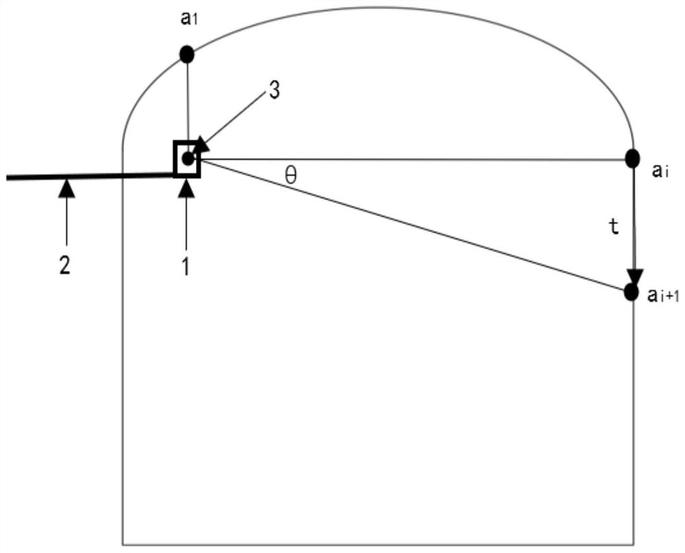
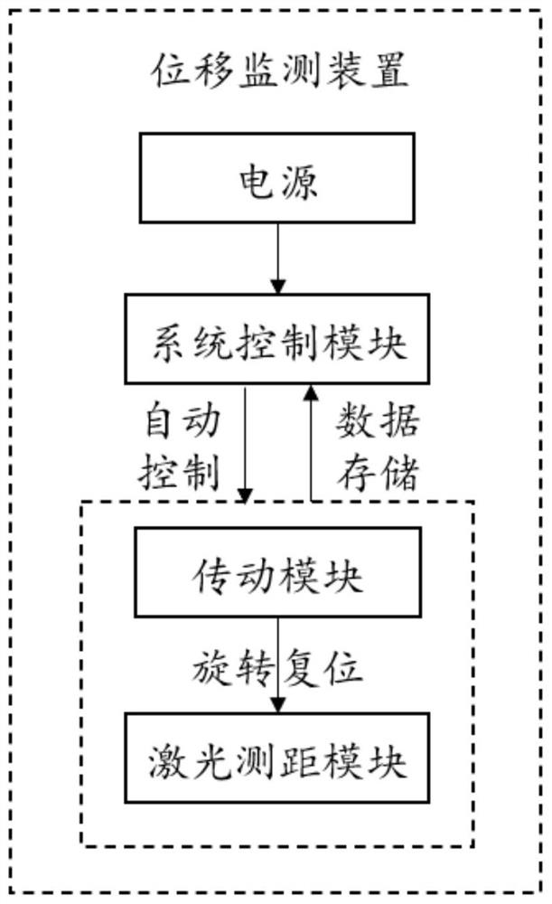
[0036] Such as figure 2As shown, the displacement monitoring device 3 is divided according to the specific functions of the internal modules, including a laser ranging module, a transmission module and a system control module; wherein the laser ranging module is used to collect roadway surface displacement and deformation data; the transmission module is used to control the laser The ranging module rotates and resets at a fixed angle along the cross-section of the roadwa...


PUM


Abstract

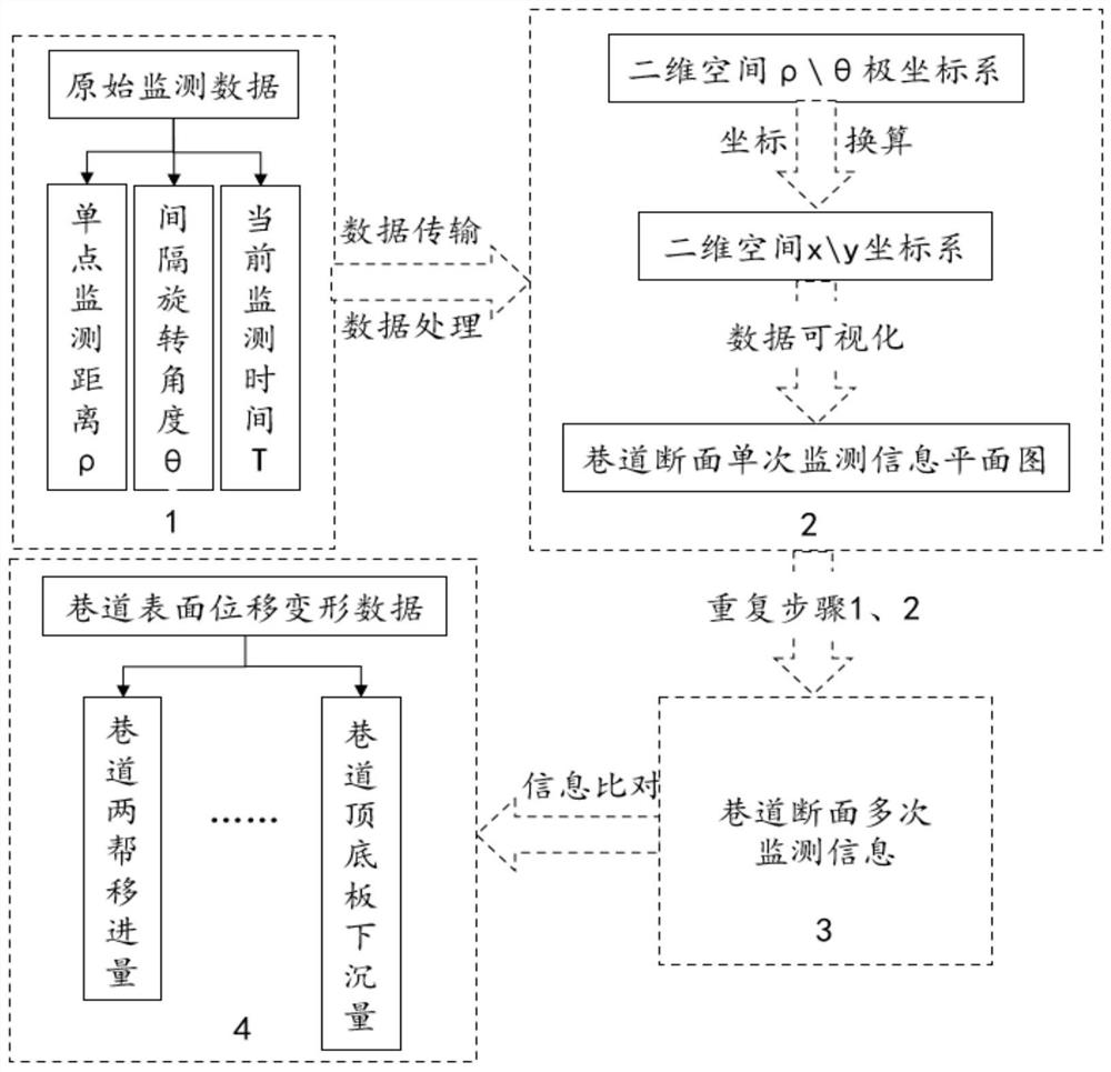
The invention provides a roadway surface displacement deformation monitoring method based on the laser ranging principle. The method comprises steps that a displacement monitoring device composed of alaser ranging module, a transmission module and a system control module is installed on a platform on an upper portion of a wall of a roadway, and a data receiving device is arranged at the bottom ofthe roadway; the laser ranging module performs 360-degree periodic rotation and resetting according to the set rotation angle theta and the rotation interval time t, emits a laser beam to a roadway section monitoring point every time the laser ranging module rotates by one angle theta to serve as a single-point distance measurement, and records and stores a distance between the laser ranging module and the monitoring point and the corresponding angle; repeated monitoring is carried out to obtain multiple monitoring data of the roadway section; a roadway section two-dimensional monitoring information plane graph is constructed and compared to obtain the displacement of two sides of the roadway and the displacement of a top plate and a bottom plate. The monitoring method is advantaged in that the laser ranging module rotates multiple times without generating accumulated mechanical errors to influence the measurement precision; data analysis is carried out from the overall perspective byutilizing a two-dimensional monitoring information plane graph, so monitoring precision can be further improved.

Description

technical field [0001] The invention relates to the field of roadway surface displacement and deformation monitoring, in particular to a roadway surface displacement and deformation monitoring method based on the principle of laser ranging. Background technique [0002] In the process of underground mining in mines, with the continuous increase of excavation depth, the ground stress also increases, and the resulting problem of roadway deformation has become increasingly prominent, which has greatly affected the stability of the surrounding rock of the roadway and the safety of mine production and construction. hidden dangers. [0003] The traditional roadway surface displacement monitoring mainly adopts contact measurement, and the staff hold the monitoring equipment to manually measure and record the deformation of the surrounding rock of the roadway. According to different monitoring instruments, there are steel tape measure monitoring method, measuring rod monitoring met...

Claims


Application Information

Patent Timeline
Patent Type & Authority Applications(China)
IPC IPC(8): G01B11/02G01B11/16
CPCG01B11/02G01B11/16
Inventor 徐帅字海军李飞王禹璇高根符富
Owner NORTHEASTERN UNIV
Learn More