Single-lens unmanned aerial vehicle flight parameter setting method
A technology for flight parameters and drones, applied in the field of drones, can solve the problems of large processing time and large amount of photos, and achieve the effect of shortening data collection time, improving work efficiency, and reducing the amount of collection
- Summary
- Abstract
- Description
- Claims
- Application Information
AI Technical Summary
Problems solved by technology
Method used
Image
Examples
Embodiment Construction
[0032] The present invention will be further described below in conjunction with accompanying drawing.
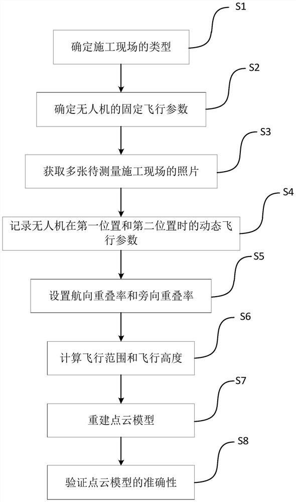
[0033] Such as figure 1 As shown, it is a flow chart of a preferred embodiment of a single-lens UAV flight parameter setting method of the present invention, which specifically includes the following steps:
[0034] S1: Determine the type of construction site.
[0035] According to the terrain height difference of the construction site, the construction site is divided into flat site and high slope site. The flat site includes a flat site or a flat site with a deep foundation pit. Slope sites or high slope sites with deep foundation pits.
[0036] S2: Determine the fixed flight parameters of the single-lens UAV.
[0037] According to the difference of the drone model, determine the equivalent focal length of the airborne camera lens of the single-lens drone, the effective pixel of the image sensor, the maximum photo size taken by the airborne camera, the maximum flight s...
PUM
 Abstract
Description
Claims
Application Information
 - R&D
- Intellectual Property
- Life Sciences
- Materials
- Tech Scout
- Unparalleled Data Quality
- Higher Quality Content
- 60% Fewer Hallucinations
Browse by: Latest US Patents, China's latest patents, Technical Efficacy Thesaurus, Application Domain, Technology Topic, Popular Technical Reports.
© 2025 PatSnap. All rights reserved.Legal|Privacy policy|Modern Slavery Act Transparency Statement|Sitemap|About US| Contact US: help@patsnap.com


