

Automatic terrain sundry identification method
An automatic recognition and terrain technology, applied in scene recognition, character and pattern recognition, biological neural network model, etc., can solve the problem of poor classification effect of sparse point cloud structure, weak generalization ability of complex scenes, difficult to identify fine-grained pattern recognition, etc. question
- Summary
- Abstract
- Description
- Claims
- Application Information
AI Technical Summary
Problems solved by technology
Method used
Image

Examples
Embodiment Construction
[0089] The principles and features of the present invention will be described below in conjunction with the accompanying drawings, and the examples given are only used to explain the present invention, and are not intended to limit the scope of the present invention.
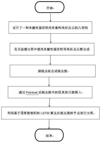
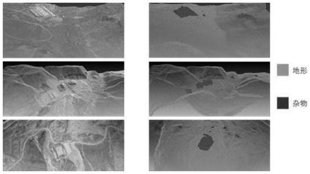
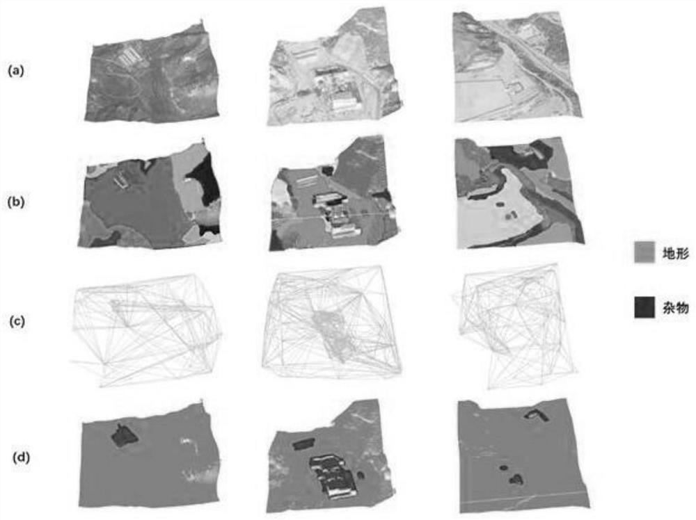
[0090] The data of the present invention come from the topography of the Loess Plateau obtained by the remote sensing technology of the UAV, and the obtained topographic point cloud data has a large amount of data, low precision, and sparse point cloud data of local sundries. The acquired terrain data is about 3.5 kilometers from east to west, 2.5 kilometers from north to south, and an area of about 8.75 kilometers. Figure 6 The converted point cloud scene graph is shown.
[0091] In the present invention, for the input terrain point cloud scene, it is necessary to reconstruct the geometric features and color features of the terrain point cloud and extract multi-attribute descriptors to obtain more local info...
PUM
 Abstract
Description
Claims
Application Information