High-resolution three-dimensional model optimization method and system based on elevation data, electronic equipment and readable storage medium

A technology of elevation data and three-dimensional models, applied in the field of satellite photogrammetry, to achieve the effect of simplifying processing and improving positioning accuracy

Active Publication Date: 2021-03-19
CENT SOUTH UNIV
View PDF5 Cites 3 Cited by
  • Summary
  • Abstract
  • Description
  • Claims
  • Application Information

AI Technical Summary

Problems solved by technology

The present invention converts the data registration problem of the two-dimensional image of the high-resolution stereo image and the three-dimensional point cloud into the registration problem between the three-dimensional point clouds by generating the corresponding DSM three-dimensional point cloud of the high-resolution stereo image, and then effectively Solved the registration problem of high-precision elevation data and high-resolution satellite images, and finally applied it to the optimization of high-resolution stereo models, improving the positioning accuracy of satellite images

Method used


Image

  • High-resolution three-dimensional model optimization method and system based on elevation data, electronic equipment and readable storage medium
  • High-resolution three-dimensional model optimization method and system based on elevation data, electronic equipment and readable storage medium
  • High-resolution three-dimensional model optimization method and system based on elevation data, electronic equipment and readable storage medium

Examples


Embodiment Construction

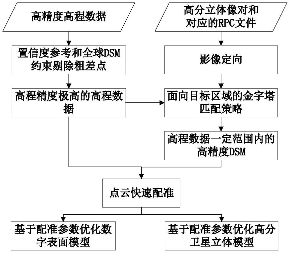
[0051] The invention provides a high-resolution stereo model optimization method based on elevation data, which converts the matching problem of high-resolution stereo image pairs and high-precision elevation data into the registration problem between three-dimensional point clouds, and then effectively solves the problem of high-precision Registration of elevation data and high-resolution satellite imagery. The present invention will be further described below in conjunction with examples.

[0052] In this embodiment, the optimization method includes the following steps:

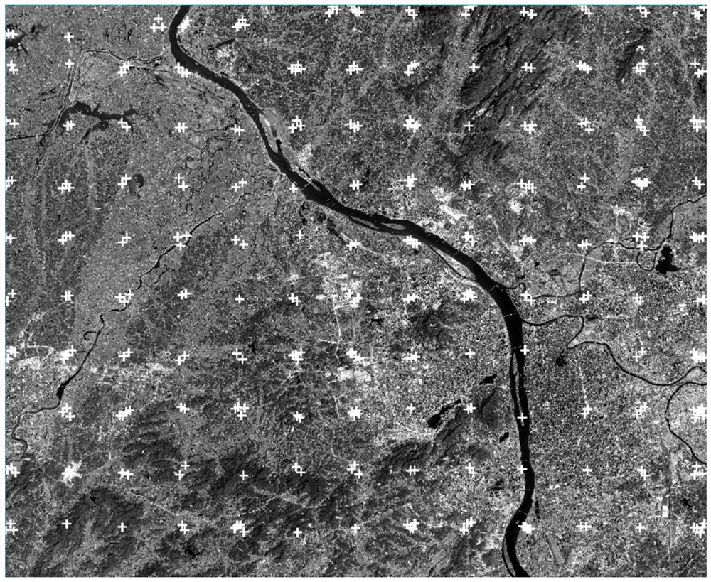
[0053] S1: Obtain high-resolution stereo image pairs and their positioning model RPC (Rational Polynomial Coefficients, rational polynomial coefficients, used for positioning), and obtain elevation data. In this embodiment, Changsha City and its surrounding areas are taken as the research area, the high-resolution stereo images are selected as the front-view and rear-view images of the Ziyuan-3 satellite, ...


PUM


Abstract

The invention discloses a high-resolution three-dimensional model optimization method and system based on elevation data, electronic equipment and a readable storage medium, and the method comprises the following steps: S1, obtaining a high-resolution three-dimensional image pair and a positioning model RPC thereof, and obtaining the elevation data; S2, generating a DSM three-dimensional point cloud corresponding to the high-resolution stereo image pair; S3, registering the DSM three-dimensional point cloud and the elevation data to obtain registration parameters, and optimizing a positioningmodel RPC by using the registration parameters. According to the method, the DSM three-dimensional point cloud corresponding to the high-resolution stereo image pair is generated, and the data registration problem of the two-dimensional image and the three-dimensional point cloud of the high-resolution stereo image is converted into the registration problem between the three-dimensional point clouds, so that the registration problem of high-precision elevation data and a high-resolution satellite image is effectively solved.

Description

technical field [0001] The invention belongs to the technical field of satellite photogrammetry, and in particular relates to a method, a system, an electronic device and a readable storage medium for optimizing a high-resolution three-dimensional model based on elevation data under the condition of no ground control point. Background technique [0002] Satellite photogrammetry is an important means of obtaining geospatial information. At present, the attitude measurement accuracy of most high-resolution satellite images in orbit cannot meet the needs of high-precision uncontrolled positioning, which leads to a high degree of dependence on ground control points for traditional satellite geometry processing. However, there are problems such as high cost and low efficiency in obtaining ground control points; it is difficult to obtain high-precision control points in difficult areas such as forests, deserts, and snow fields; it is difficult to measure ground control points abro...

Claims


Application Information

Patent Timeline
Patent Type & Authority Applications(China)
IPC IPC(8): G06T7/33G06T5/00G06T3/00G06K9/62
CPCG06T7/344G06T3/0006G06T5/002G06T2207/10028G06T2207/20016G06F18/22Y02T10/40
Inventor 潘红播周平邹思远
Owner CENT SOUTH UNIV
Why Eureka
Try Eureka