
All-weather surface temperature near-real-time inversion method fused with multi-source satellite remote sensing

A technology of surface temperature and satellite remote sensing, which is applied in the field of satellite remote sensing of surface temperature, can solve the problems of missing data in the orbit gap area, unable to meet the surface surface, unable to achieve all-weather, etc., and achieve the effect of short time consumption and high result accuracy.

Pending Publication Date: 2021-07-23
UNIV OF ELECTRONICS SCI & TECH OF CHINA +1
View PDF10 Cites 10 Cited by
  • Summary
  • Abstract
  • Description
  • Claims
  • Application Information

AI Technical Summary

Problems solved by technology

However, at present, all methods focus on the reconstruction of historical archive data, which cannot meet the requirements of real-time or near-real-time (NRT) monitoring of the surface.
At the same time, the problem of lack of data in the orbital gap area caused by passive microwave data (such as AMSR2) due to the satellite’s polar orbit operation has not been well resolved. In other words, the fusion of passive microwave and thermal infrared remote sensing cannot achieve a true all-weather

Method used


Image

  • All-weather surface temperature near-real-time inversion method fused with multi-source satellite remote sensing
  • All-weather surface temperature near-real-time inversion method fused with multi-source satellite remote sensing
  • All-weather surface temperature near-real-time inversion method fused with multi-source satellite remote sensing

Examples


Embodiment Construction

[0039] In order to make the object, technical solution and advantages of the present invention clearer, the implementation manner of the present invention will be further described in detail below in conjunction with the accompanying drawings.

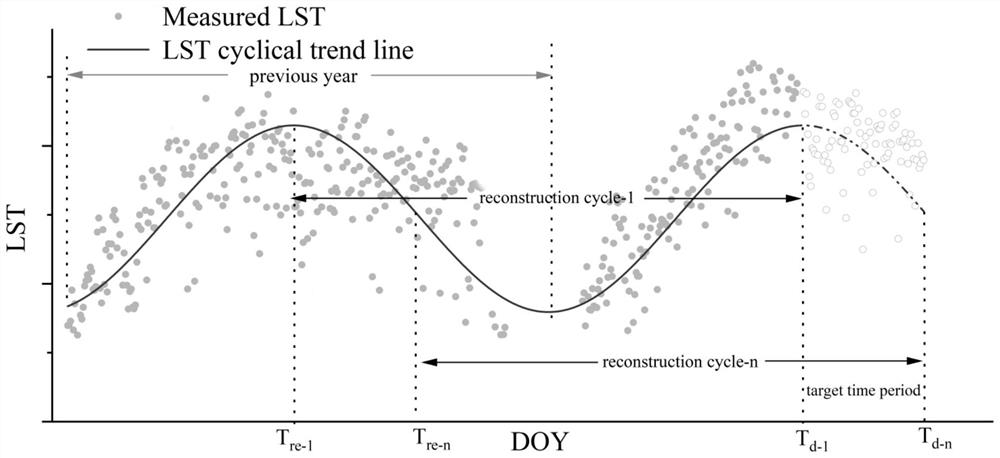
[0040] The all-weather surface temperature near-real-time inversion method that integrates multi-source satellite remote sensing provided by the embodiment of the present invention is first based on the microwave brightness temperature data (BT) provided by the microwave radiometer (MWRI) carried by the China Fengyun Meteorological Satellite to fill in the AMSR2 (Advanced Microwave Scanning Radiometer 2) Missing values ​​in the orbital gap of microwave brightness temperature data, and then build a spatially seamless AMSR2 BT and TIR LST (such as MODIS) annual scale model, and apply it to adjacent annual scale time periods to obtain the latest targets The LST of the moment.

[0041] The all-weather surface temperature near-real-time inv...


PUM


Abstract

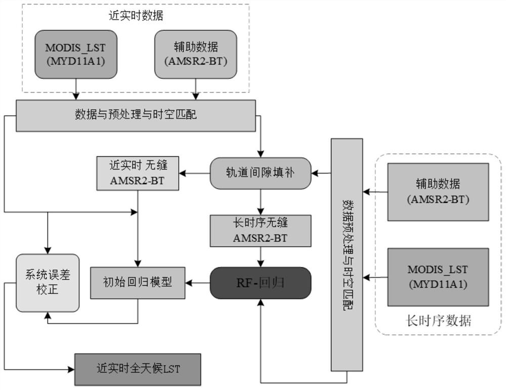
The invention discloses an all-weather surface temperature near-real-time inversion method fused with multi-source satellite remote sensing, and belongs to the technical field of satellite remote sensing surface temperature. The method comprises the following steps: firstly, constructing a regression mapping model between brightness temperature data of a microwave radiometer and passive microwave brightness temperature data, then constructing an estimation model of passive microwave brightness temperature in an orbit gap region, and obtaining seamless passive microwave brightness temperature in a specified period of a target region; and constructing a random forest regression relationship based on the microwave brightness temperature data of the passive microwave data of the target area and the surface temperature of the medium-resolution imaging spectrometer so as to obtain an all-weather surface temperature estimation value in the reconstruction period, and performing system error correction processing based on the surface temperature of the corresponding medium-resolution imaging spectrometer. The method does not need to depend on complete cycle data, can meet different application requirements and data production requirements of monitoring periods with different lengths, is good in precision, is higher in image quality, and can display more space detail information of the surface temperature.

Description

technical field [0001] The invention belongs to the technical field of satellite remote sensing of surface temperature, and in particular relates to an all-weather near real-time inversion method of surface temperature integrated with multi-source satellite remote sensing. Background technique [0002] Land surface temperature (LST) is a key physical quantity in the interaction process between the land surface and the atmosphere. It is of great significance to grasp the temporal and spatial distribution of LST at regional and global scales, especially comprehensive, complete and continuous information. With the continuous advancement and development of remote sensing technology, the launch of sensors on various platforms makes it possible to obtain regional and global LST quickly and in real time. LST is of great significance to the study of land surface emissivity (LSE) between land-atmosphere radiation and equilibrium, which has become an important part of the field of qu...

Claims


Application Information

Patent Timeline
IPC IPC(8): G06F30/27G06K9/62G06N20/00G06F111/08G06F119/08
CPCG06F30/27G06N20/00G06F2119/08G06F2111/08G06F18/24323
Inventor 张晓东周纪马晋唐文彬薛东剑
Owner UNIV OF ELECTRONICS SCI & TECH OF CHINA
Learn More