

Groundwater pollution source space comprehensive recognition method applying numerical simulation
A numerical simulation and identification method technology, applied in CAD numerical modeling, special data processing applications, electrical digital data processing, etc.
- Summary
- Abstract
- Description
- Claims
- Application Information
AI Technical Summary
Problems solved by technology
Method used
Image

Examples
Embodiment Construction
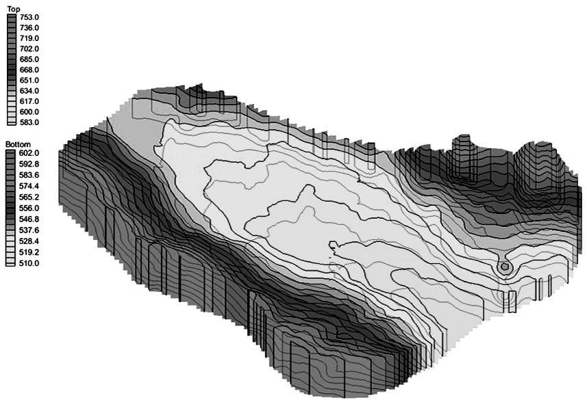
[0050] Taking a certain area in the north as an example, the research area is located in the Yanghe River Basin, and the simulated area is about 120km 2 . The groundwater flow in the study area mainly moves horizontally, and the movement conforms to Darcy's law at normal temperature and pressure. The study area belongs to the intermountain basin hydrogeological area, and the main sources of groundwater recharge in the Yanghe Basin are the Yanghe River runoff recharge, atmospheric precipitation, piedmont runoff recharge, and irrigation reinfiltration. According to relevant data analysis, the vertical infiltration recharge of atmospheric precipitation accounts for about 15% of the atmospheric precipitation. As for the lateral recharge of the basin margin mountains, according to the regional hydrogeological census report, the surrounding mountains in Wanquan area recharge the plain groundwater in the form of subsurface flow up to 11.45m 3 / h.
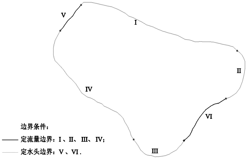
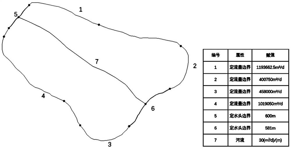
[0051] combine Figure 1 to Fig...
PUM
 Abstract
Description
Claims
Application Information