
Multi-mode data observation method based on unmanned aerial vehicle formation for semi-airborne electromagnetic surveying

a technology of electromagnetic surveying and data observation, applied in the field of geophysical prospecting, can solve the problems of large amount stacking, low transmitting power, and large size and weight of the transmitting system, and achieve the effect of precise and reliable surveying and high signal-to-noise ratio

Active Publication Date: 2020-11-17
INST OF GEOLOGY & GEOPHYSICS CHINESE ACAD OF SCI
View PDF2 Cites 3 Cited by
  • Summary
  • Abstract
  • Description
  • Claims
  • Application Information

AI Technical Summary

Benefits of technology

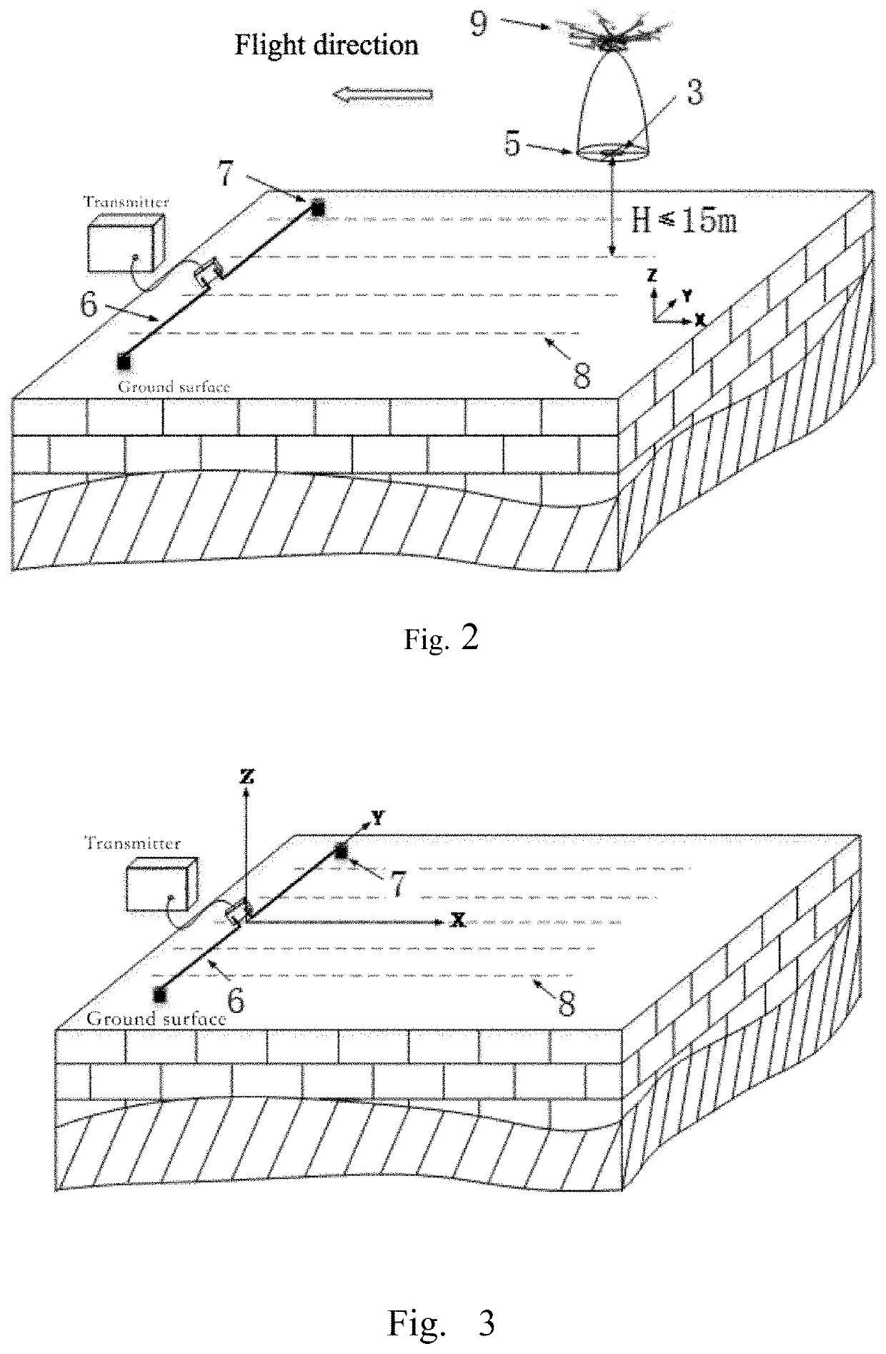
The invention provides a method to observe underground electrical anomalies more precisely and reliably through a multi-field and multi-component observation data of the response field with higher signal-to-noise ratio and multi-scale and multi-directional gradient data of the response field. This helps to achieve more powerful technical services for high-resolution, economical and rapid survey of deep large deposits.

Problems solved by technology

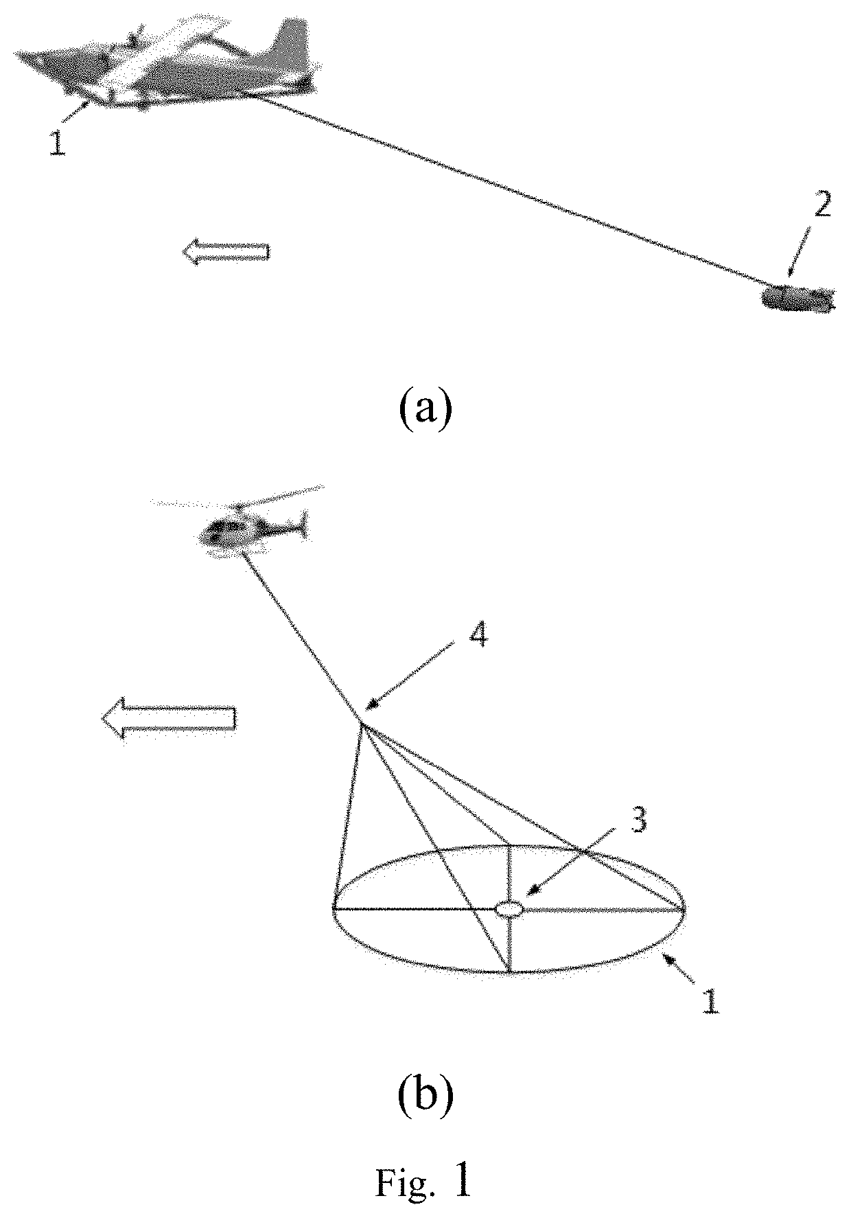
Also, due to the limitation of the power supply and carrying capacity of the flight platform, the size and weight of the transmitting system are relatively small, and the transmitting power is relatively low.
(1) Failure in Increase of the Signal-to-Noise Ratio Through Stacking of a Large Amount of Periods
But for the flight observation, the observation position changes continuously with the flight, and the amount of data that can be used for stacking for a single observation point may be very limited; taking the time domain method as an example, during the ground observation, the number of periods for stacking often reaches several hundred, but in the semi-airborne observation, the number of periods for stacking is generally less than 10; and as a result, the signal-to-noise ratio of the data often fails to meet the requirements, and thus the system cannot reach the expected maximum surveying depth;
(2) Failure in Multi-Direction Gradient Surveying
In fact, part of the common reasons for the above-mentioned problems (2) and (3) lie in the fact that the carrying capacity of low-cost UAVs often cannot support carrying multiple sensors (mainly referring to inductive magnetometers used in the existing system).
If a heavy-duty drone or even a manned aircraft is adopted, on the one hand, the flight cost may be greatly increased, making the method lose the economic advantage; on the other hand, even if the heavy-duty drone or the manned aircraft can be used, the above problems cannot be completely solved.

Method used


Image

  • Multi-mode data observation method based on unmanned aerial vehicle formation for semi-airborne electromagnetic surveying
  • Multi-mode data observation method based on unmanned aerial vehicle formation for semi-airborne electromagnetic surveying
  • Multi-mode data observation method based on unmanned aerial vehicle formation for semi-airborne electromagnetic surveying

Examples


Embodiment Construction

[0039]In order to make the object, technical solution and advantages of the invention clearer, the embodiments of the invention are described in detail in combination with the drawings below. It should be noted that the embodiments of the present invention and the features in the embodiments can be in any combination with each other in case of no conflict.

[0040]The technical solutions of the present invention will be described in detail below with particular embodiments.

[0041]In a traditional semi-airborne electromagnetic surveying method, usually a flight platform carrying an observation system (including a sensor and a receiver) is used for operation. Due to the motion observation property of the flight platform, it's difficult to increase the signal-to-noise ratio through stacking of a large amount of periods during the processing of data. This is because the stacking of a large amount of periods means an increase in observation time “in the same position”, but the motion propert...


PUM


Abstract

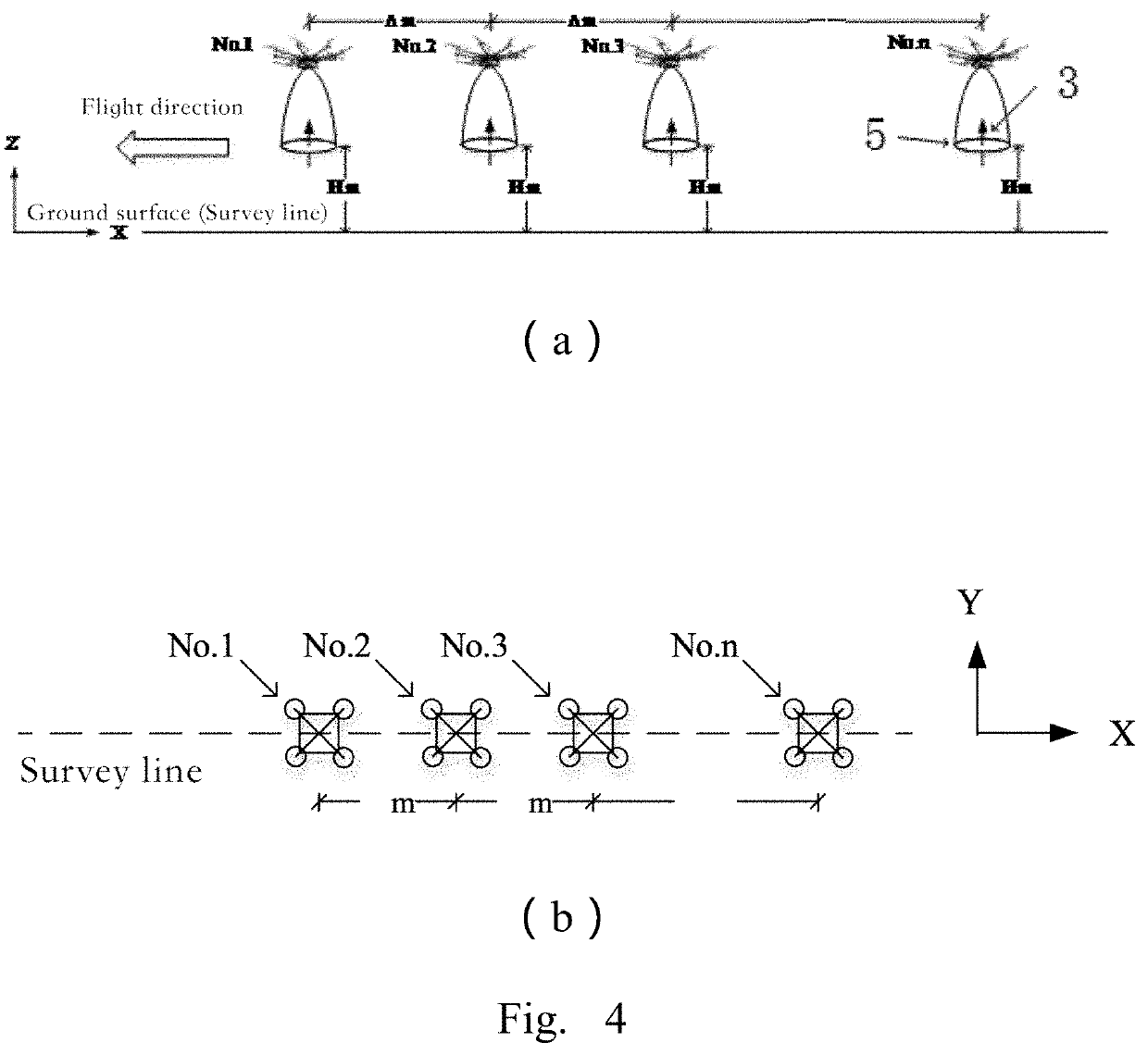
Disclosed in the present invention is a multi-mode data observation method based on unmanned aerial vehicle formation for semi-airborne electromagnetic surveying. The method includes four basic formation modes: a ZX formation mode for obtaining the Z component of the response field with a high signal-to-noise ratio and the X direction gradient data of the Z component of the response field in different scales; a ZZ formation mode for obtaining the Z direction gradient data of the Z component of the response field in different scales; an XX formation mode for obtaining the X component of the response field with a high signal-to-noise ratio and the X direction gradient data of the X component of the response field in different scales; an XZ formation mode for obtaining the Z direction gradient data of the X component of the response field in different scales.

Description

TECHNICAL FIELD[0001]The present invention relates to an airborne transient electromagnetic prospecting technology and belongs to the field of geophysical prospecting.BACKGROUND ART[0002]An electromagnetic method is a geophysical prospecting method based on the principle of electromagnetic induction, which observes, based on the difference in physical properties of the underground medium such as the conductivity, a response electromagnetic field (i.e., a secondary field) generated by the earth under excitation of natural or artificial field sources, and finally extracts underground structural information by analyzing spatial and temporal distribution of the secondary field, thus being widely applied in the fields of investigation of resources such as mineral products, groundwater and geothermal resources, as well as the fields of geological mapping and environmental engineering.[0003]Traditional electromagnetic surveying methods are all ground methods, i.e., the entire observation s...

Claims


Application Information

Patent Timeline
IPC IPC(8): G01V3/10G01V3/165
CPCG01V3/165G01V3/16
Inventor WU, XINXUE, GUOQIANGDI, QINGYUN
Owner INST OF GEOLOGY & GEOPHYSICS CHINESE ACAD OF SCI
Learn More