
Device and method for energy-minimizing human ground routing

a technology of human ground and energy-minimizing devices, applied in surveying and navigation, navigation instruments, instruments, etc., can solve the problem that no existing software automatically develops cross-country ground routes for humans, and achieve the effect of minimizing the human energy expended traveling

Inactive Publication Date: 2005-11-24
FRONT EDGE TECH
View PDF3 Cites 11 Cited by
  • Summary
  • Abstract
  • Description
  • Claims
  • Application Information

AI Technical Summary

Benefits of technology

[0011] It is a first object of the invention to provide a device and method for computing overland ground routes for humans on foot over arbitrary terrain, between any set of two or more sequential points, that minimize the human energy expended traveling between the points.
[0012] It is a further object of the invention to provide a computer readable medium bearing instructions that cause a computer to compute overland ground routes for humans on foot over arbitrary terrain, between any set of two or more sequential points, that minimize the human energy expended traveling between the points.
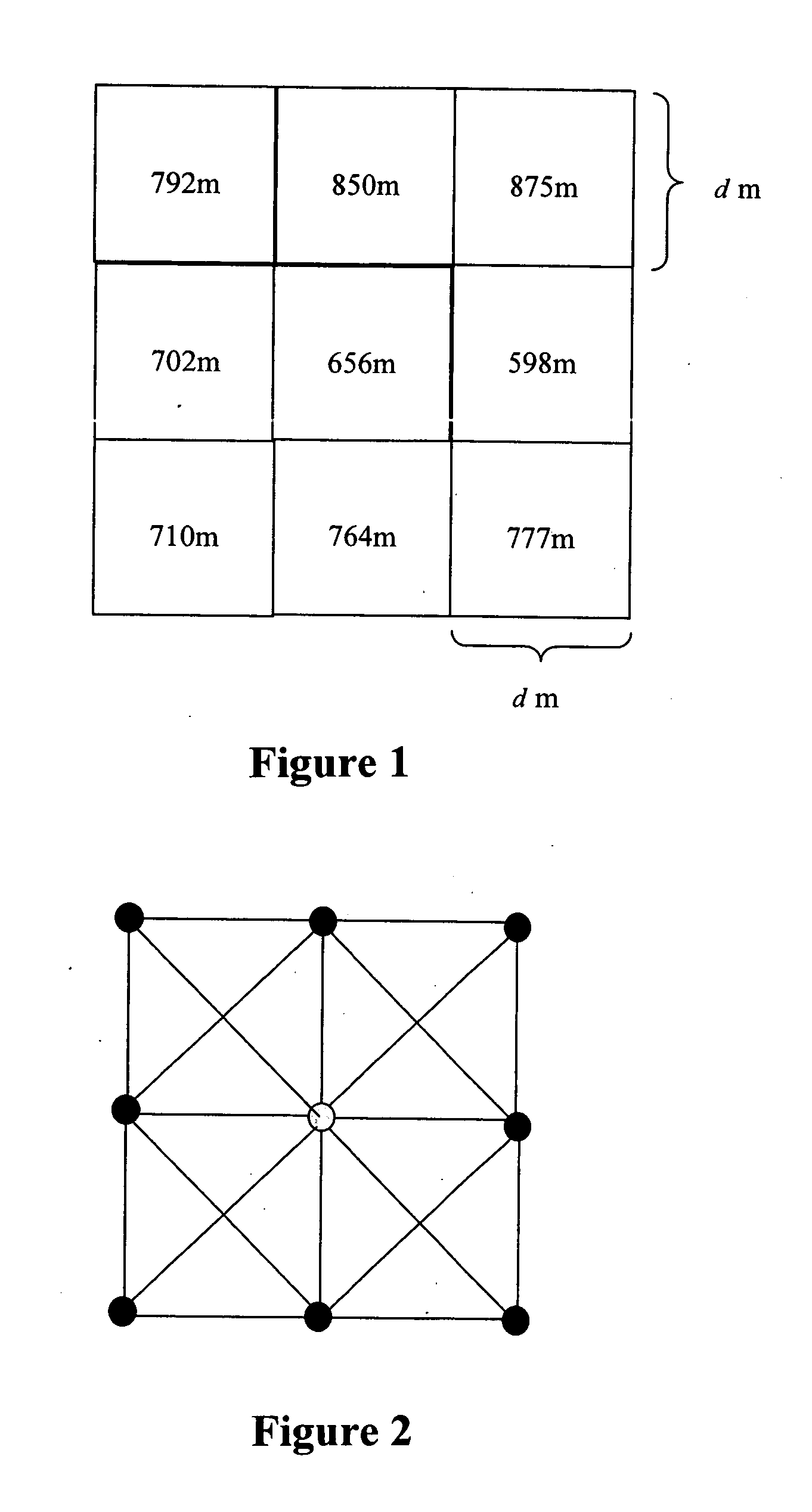
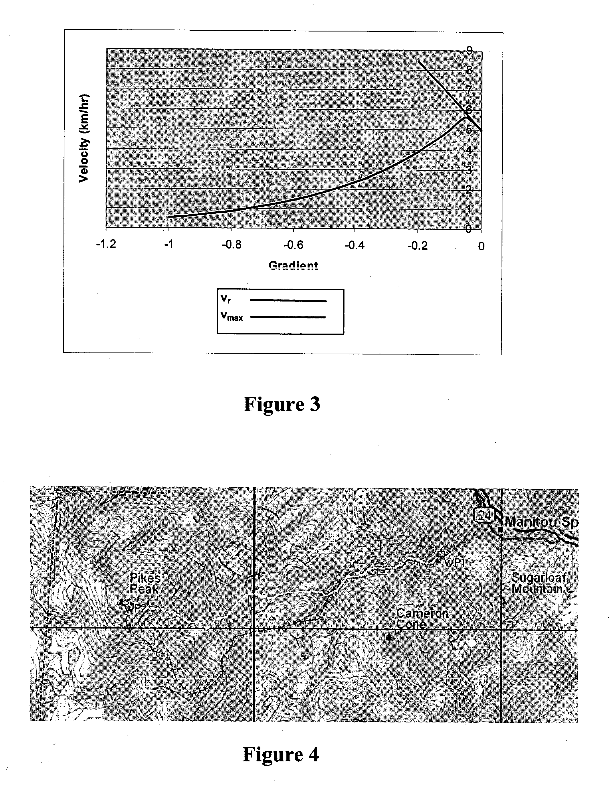
[0013] The above objectives are met by developing analytical equations for human specific energy expenditure as a function of terrain gradient r and terrain surface type (e.g., asphalt, grass, sand, etc.), automatically developing a terrain network representation from standard grid cell terrain elevation data (FIGS. 1 and 2), applying the developed human energy expenditure equations as the “cost” functions in the terrain network (FIG. 2), and automatically finding the route (i.e., the sequential set of arcs and nodes) from any user-designated starting point (node) in the network to any other point (node) in the network (and to any number of additional sequential points (nodes) in the network) using any one of the available network path optimization algorithms39. FIG. 4 is an illustration of the optimal route through terrain between two points in Colorado produced by the present invention employing Dijktra's algorithm40. The benefit of the present invention is that those using it can find and use the ground route that minimizes the energy expended in traveling on foot from a point to one or more subsequent points, leaving more energy at the destination point for remaining required / desired activities.

Problems solved by technology

However, no existing software automatically develops cross-country ground routes for humans by minimizing human energy expenditure or on any other basis.

Method used


Image

  • Device and method for energy-minimizing human ground routing
  • Device and method for energy-minimizing human ground routing
  • Device and method for energy-minimizing human ground routing

Examples


Embodiment Construction

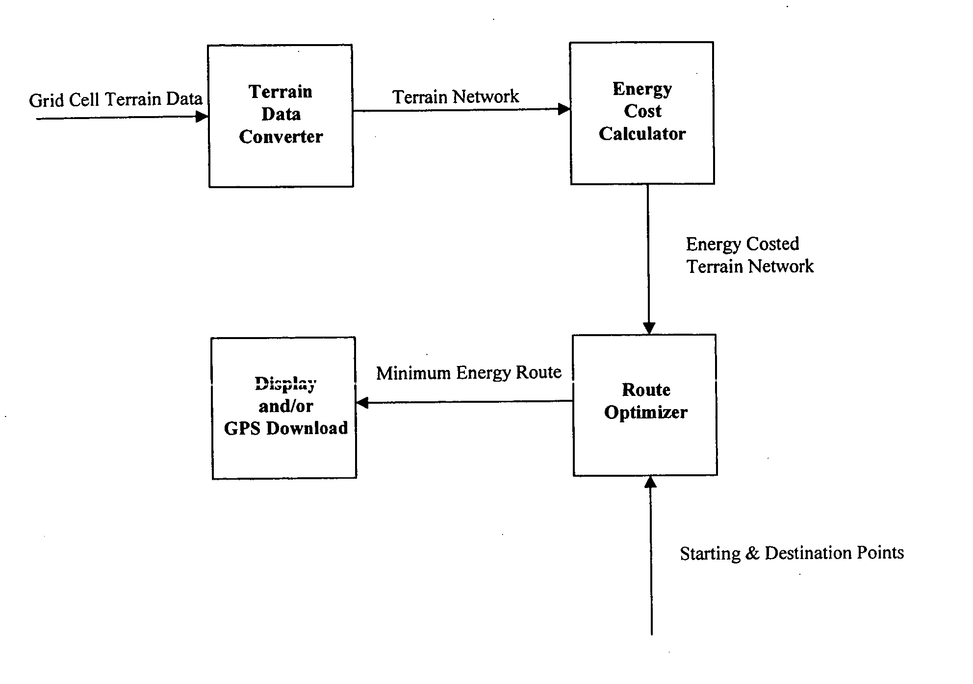
[0020] Artisans skilled in art will appreciate the value of illustrating the present invention by means of an example. Consider the problem of finding a ground route over rugged terrain from a starting point A to some objective point B (and by extension to additional objective points C, D, etc.) that minimizes the specific energy expended by a human or humans hiking from point A to point B (and to points C, D, etc.). FIG. 5 illustrates the process the present invention uses to produce an energy-minimizing route between user-selected points over intervening terrain for humans on foot. Each sub-process is described in what follows:

[0021] Network Creation

[0022] The present invention imports standard USGS or NIMA terrain elevation data and terrain surface type (asphalt, grass, sand, etc.) data in grid cell format (FIG. 1) and automatically converts it to terrain network format (FIG. 2). Each node in the network is assigned a terrain type and elevation from the original grid cell data....


PUM


Abstract

There are certain tasks that require humans to proceed on foot over intervening terrain (that may include “improved” segments such as paved roads and bridges) from some starting point A to some objective or destination point B, and perhaps thence to additional points C and D. Exemplars of civilian endeavors include forest firefighting, search and rescue, surveying, exploration, and recreational hiking. Military applications include infantry and special operations forces movements. In many of these endeavors, it is desired to be as rested as possible when reaching the destination in order to have the energy remaining to successfully or optimally accomplish some “objective” activity. The present invention provides a methodology for computing the route for a human being traveling on foot over arbitrary terrain from any point A to any other point B (and if desired to points C, D, etc. beyond) such that the human energy expended walking from Point A to point B (and any points beyond) is minimized. The energy-minimizing human ground routing system (EHGRS) enables recreational hikers, Army and Marine Corps infantry patrols, special operations forces, forest firefighters, geologists and search and rescue teams to quickly find the energy-minimizing route between any two points over any terrain so that they arrive at their destination with the minimum possible degradation of their performance due to fatigue, in contrast to routing developed based on human judgment.

Description

BACKBROUND OF THE INVENTION [0001] 1. Field of the Invention [0002] A method and device for computing overland ground routes for humans traveling on foot over arbitrary terrain between any set of two or more sequential points that identifies an optimal route that will minimize the human energy expended traveling between the points. [0003] 2. Prior Art [0004] The following review of prior art covers two relevant areas. The first area reviews the results of empirical research into the physiology of human energy expenditure documented in the literature, augmented by additional field research and computer modeling by the inventors. The second area reviews the results of research and algorithm development in the field of finding optimal paths in networks or graphs. [0005] Research on human energy expenditure conducted by Ainsworth1, Douglas and Haldane2, Keys, et al.3, Mahadeva, et al.4, Margaria, et al.5, 6, Minetti, et al.7, 8, Passmore and Dumin9, and Susta, et al.10 provides data rel...

Claims


Application Information

Patent Timeline
Patent Type & Authority Applications(United States)
IPC IPC(8): G01C21/30G01C21/34
CPCG01C21/20
Inventor CROWDER, GEORGE E. JR.MEHLBERG, JERRY L.
Owner FRONT EDGE TECH
Learn More