Method and system for identifying and defining geofences

a geofence and method technology, applied in the field of methods and systems for identifying and defining geofences, can solve the problems of difficult to fully represent, difficult to create a geofence, difficult to add, etc., and achieve the effect of quick and easy addition of geofences to devices and easy creation of geofences

Active Publication Date: 2006-09-07
TELECOMM SYST INC
View PDF99 Cites 219 Cited by
  • Summary
  • Abstract
  • Description
  • Claims
  • Application Information

AI Technical Summary

Benefits of technology

[0018] It is another object of the present invention to provide a method and system to allow a user to select an object on a map, such as a map element and/or POI object for adding a geofence to a mobile device. A user only has to select the object to add it to the handset within the map view. Additionally, a user can also drag-and-drop th

Problems solved by technology

As people that are skilled in the art will agree, creating a geofence is a difficult spatial concept to represent in one's mind without the aid of a spatial map.
Even then it is very difficult to fully represent due to map scales, etc.
For example, a golf course might represent on a map an irregular shaped polygon which is hard to represent with a circle

Method used


Image

  • Method and system for identifying and defining geofences
  • Method and system for identifying and defining geofences
  • Method and system for identifying and defining geofences

Examples


Embodiment Construction

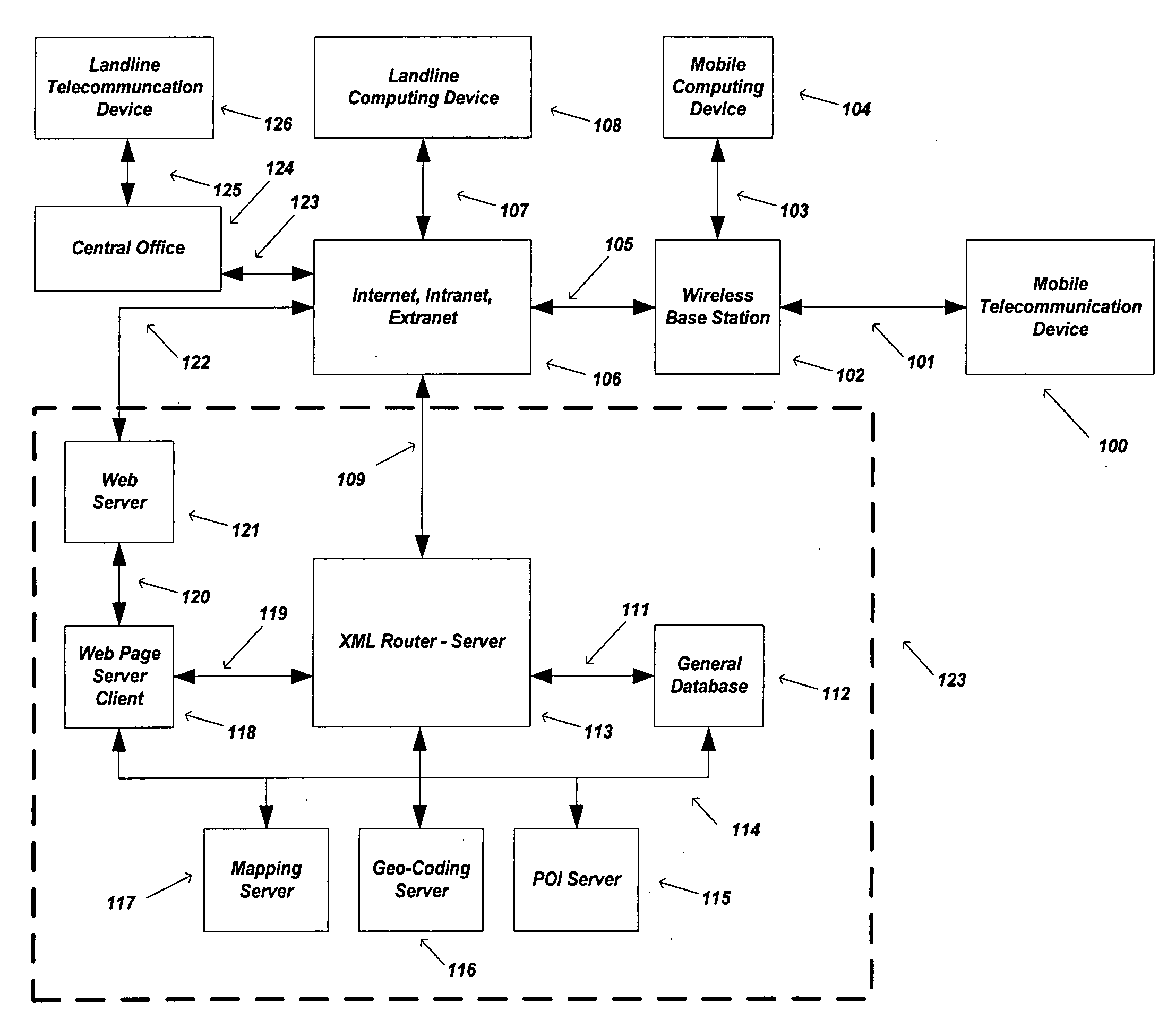
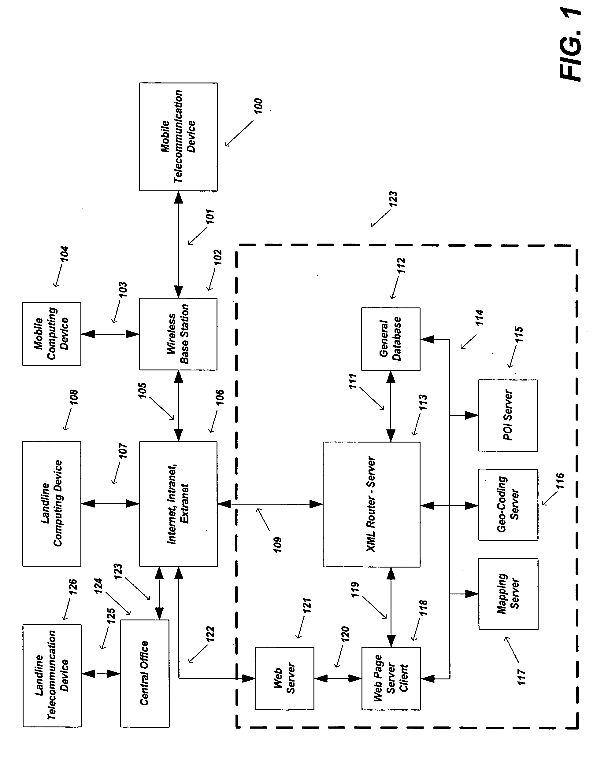
[0026] This present invention relates to a method and system for selecting, assigning, and creating Geofences based on using known map elements and / or point of interest (POI) data, such as parks, golf courses, schools, building, etc. using a plurality of user interface (UI) computing devices. Additionally, this invention combines the use of saving these Geofences on a Telecommunication Device (i.e., mobile device) that has location capability for the purpose of acting on said Geofences.

[0027] The present invention may be embodied in a pre-commercial (non-public) and internal application called “AtlasLink” which is owned and licensed by Networks In Motion, Inc. of Irvine, Calif.

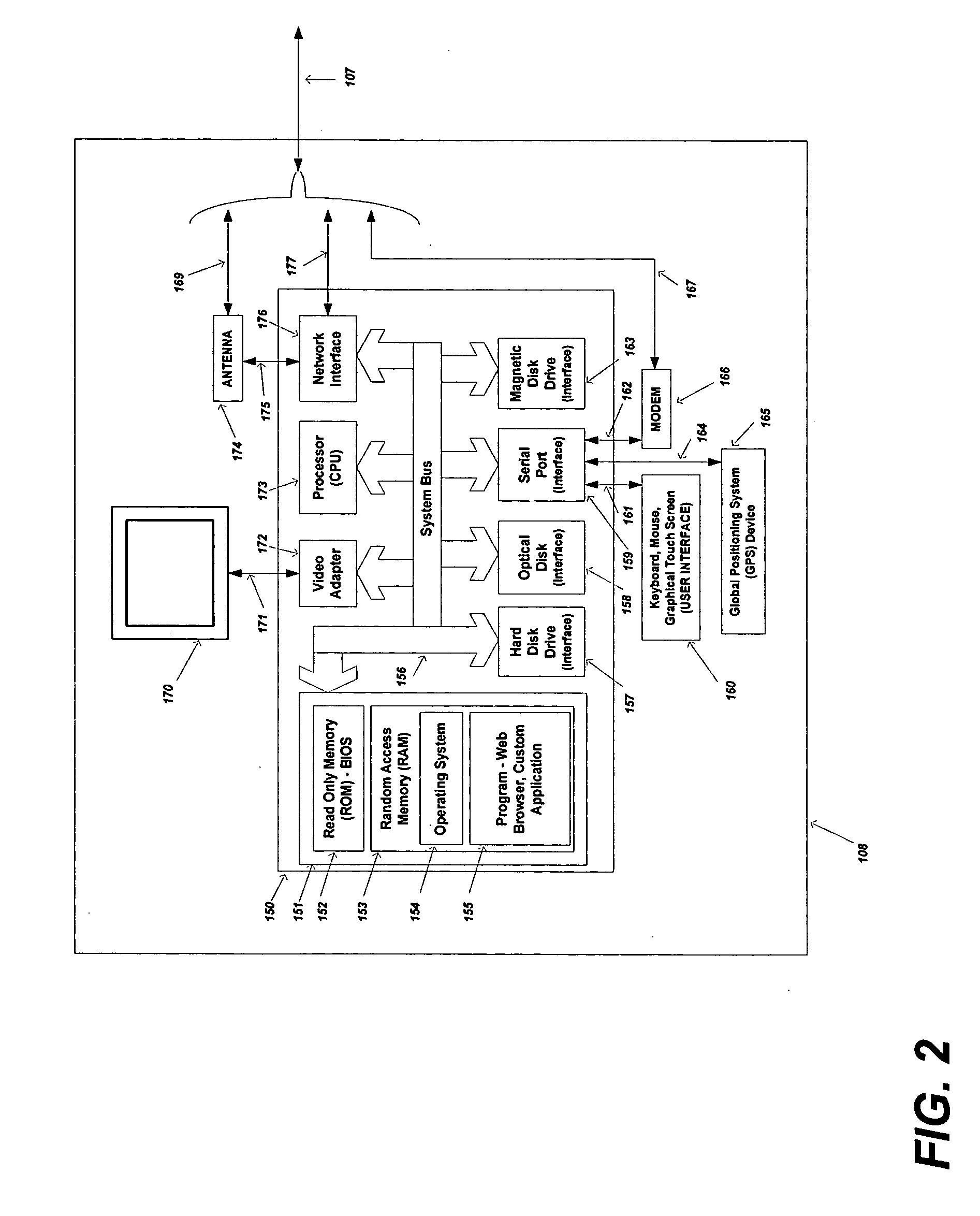
[0028]FIG. 1 and FIG. 2 illustrate high-level diagrams of one embodiment that is a suitable computing and networking environment in which the invention may be implemented. The invention will be described in the general context of an application that executes on an operating system in conjunction with a perso...


PUM


Abstract

The preferred embodiments of the present invention are directed to an improved mapping and navigational system. Specifically, the present invention is directed to a system for defining and assigning geographical boundaries to points of interests on a graphical map, where the geographical boundaries preferably correlate to spatially defined boundaries of the respective points of interests. In accordance with one embodiment of the present invention, the points of interest, along with the respective defined geographical boundaries, can be transferred from a personal computing device to a telecommunication device, such as a portable communication device, so as to be used for mapping purposes and to set off proximity alerts when the portable communication device, equipped with a GPS unit, enters or exits the geographical boundary of a particular point of interest.

Description

CROSS-REFERENCE TO RELATED APPLICATIONS [0001] The present invention claims the benefit under 35 USC 119(e) of U.S. provisional patent application Ser. No. 60 / 659,643 filed Mar. 7, 2005, the contents of which are incorporated by reference herein.BACKGROUND ART [0002] 1. Field of Invention [0003] This present invention relates to a method and system for selecting, assigning, and creating Geofences based on using known map elements and / or point of interest (POI) data, such as parks, golf courses, schools, buildings, etc. using a plurality of user interface (UI) computing devices. Additionally, this invention combines the use of saving these Geofences on a Telecommunication Device (i.e., mobile device) that has location capability for the purpose of acting on said Geofences. [0004] 2. Description of the Related Art [0005] Telecommunication devices, specifically wireless telephones, are achieving widespread use today. Such telecommunication devices are commonly used to establish communi...

Claims


Application Information

Patent Timeline
IPC IPC(8): G01C21/28H04M1/72457H04W4/021
CPCG01C21/20G09B29/007G09B29/10H04M1/72572G08B25/10H04W4/021H04W4/022H04L67/18H04M2250/10H04M1/72457H04L67/52H04W88/02
Inventor SHEHA, MICHAEL A.SHEHA, ANGIE
Owner TELECOMM SYST INC
Why Eureka
Try Eureka