
Method for Geologic Modeling Through Hydrodynamics-Based Gridding (Hydro-Grids)

Active Publication Date: 2007-09-20
EXXONMOBIL UPSTREAM RES CO
View PDF21 Cites 100 Cited by
  • Summary
  • Abstract
  • Description
  • Claims
  • Application Information

AI Technical Summary

Benefits of technology

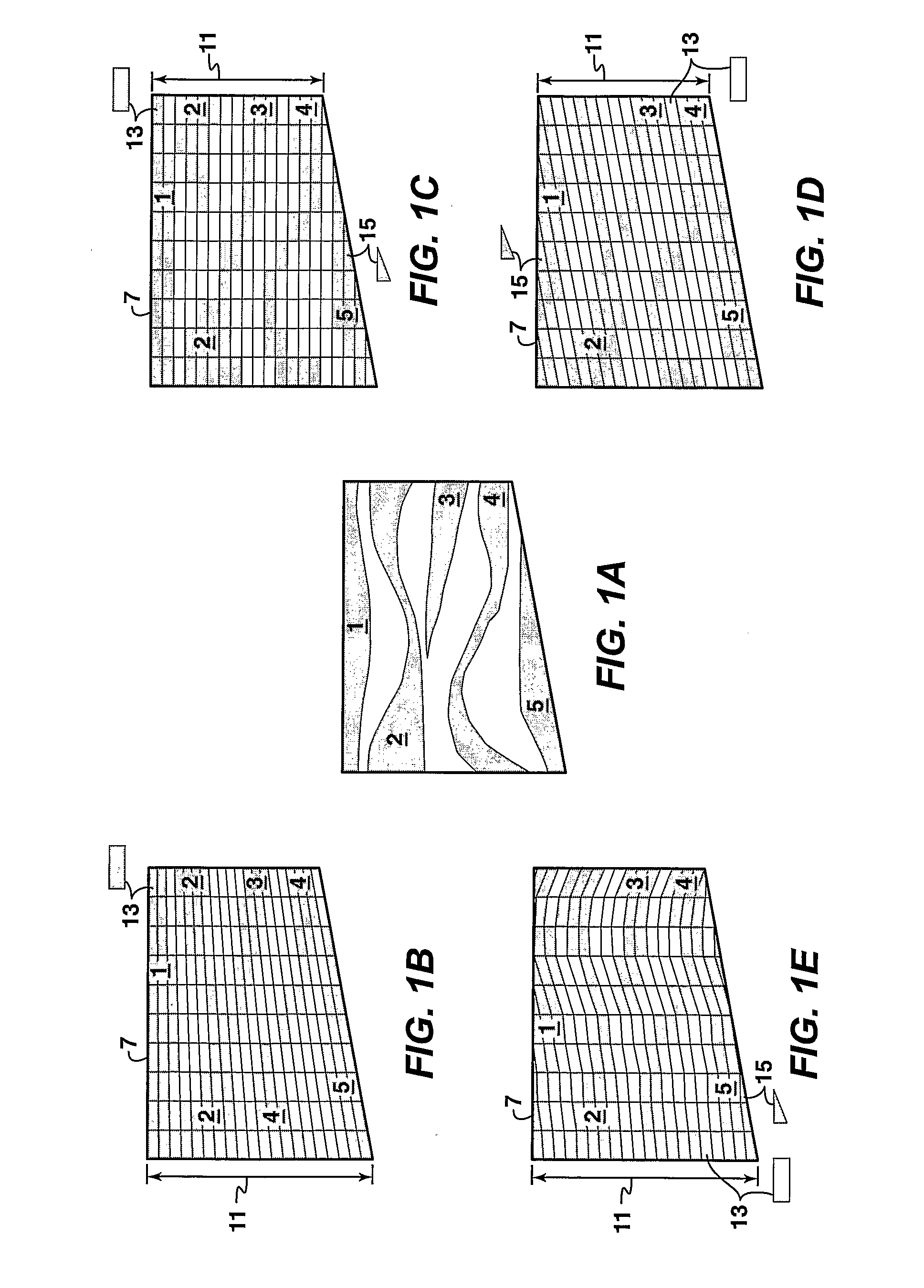
[0022] Under the present techniques, various embodiments of a hydrodynamics-based gridding method, called “Hydro-Grids”, may generate grid surfaces conforming to time surfaces during the process of sedimentation, which create a subsurface sedimentary volume. The location of these time surfaces is typically determined by sedimentary process simulation and interpretation of geologic data. Since these surfaces can precisely follow the geometry of sand bodies and shale barriers, geologic models conforming to these surfaces may accurately characterize sedimentary connectivity and may preserve their accuracy during upscaling for reservoir performance simulation.
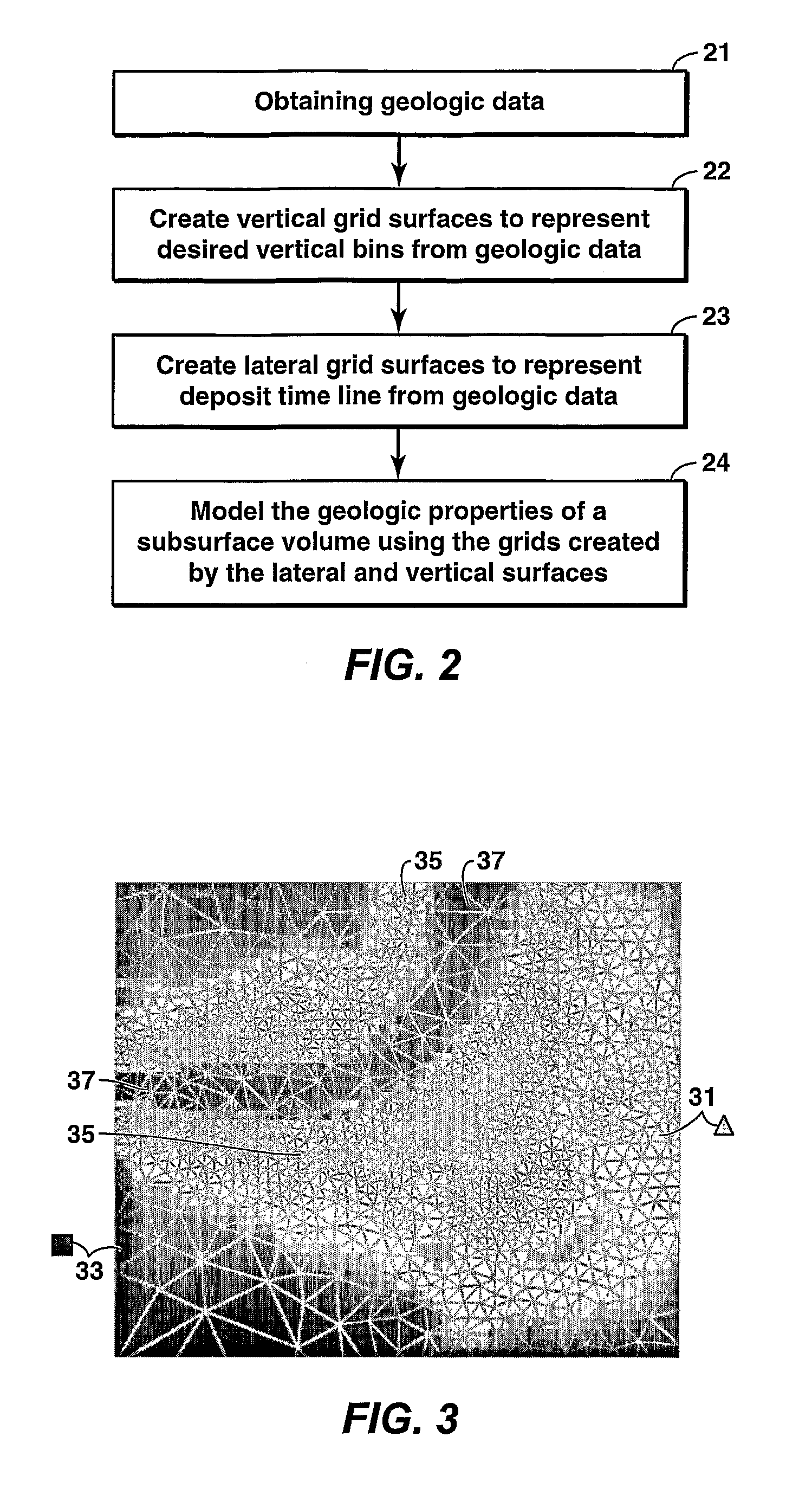
[0026] A second embodiment for geologic modeling of a subsurface volume is also disclosed. This embodiment comprises obtaining geologic data, creating vertical grid surfaces to divide the subsurface volume into “columns”, creating lateral grid surfaces to correspond with surfaces of constant geologic time during the creation of the geologic structures in the subsurface volume, representing the geologic properties of the subsurface volume within the grid cells bounded by the vertical and lateral grid surfaces, merging selected grid cells to reduce the number of cells in the model, and establishing new values for the geologic properties in the merged grid cells.

Problems solved by technology

At present, the conclusions, which can be made after the data interpretation stage, are generally limited to broad descriptions of the size and general nature of subsurface structures due to the limited resolution of seismic data.
However, present technology does not allow the analyst to determine production rates from the subsurface formations if hydrocarbons are discovered.
In addition, when an exploration well has been drilled, present technology does not allow an analyst to be able to accurately characterize the nature of the subsurface internal geometry in locations other than in the most immediate region of any such well.
In particular, reservoir permeability and continuity are not well characterized by present technology.
The problem is that none of these gridding methods represent the true internal geometry accurately.
Furthermore, some sand bodies are erroneously disconnected from the fluid flow since some cells in these sand bodies only contact their neighbor cells at the corners, without face connections.
Misalignment between the sand bodies and grids is the direct cause of this distortion problem.
The grids constructed by the above-mentioned prior art methods do not properly align themselves with the reservoir internal geometry.
First, any lack of alignment distorts the reservoir connectivity in the geologic model subsequently built.
Second, when the geologic model is scaled up for reservoir performance simulation with coarser grids, the coarser grids will magnify the misrepresentations and distortions that exist in the geologic model.
Consequently, the accuracy of any reservoir performance prediction will decrease, which will hamper reservoir management.
The ability to model permeability is currently severely limited by the commercially available geologic model gridding methods.
As a consequence, the reservoir connectivity is typically misrepresented in geologic models and the resulting performance simulation models.

Method used


Image

  • Method for Geologic Modeling Through Hydrodynamics-Based Gridding (Hydro-Grids)
  • Method for Geologic Modeling Through Hydrodynamics-Based Gridding (Hydro-Grids)
  • Method for Geologic Modeling Through Hydrodynamics-Based Gridding (Hydro-Grids)

Examples


example

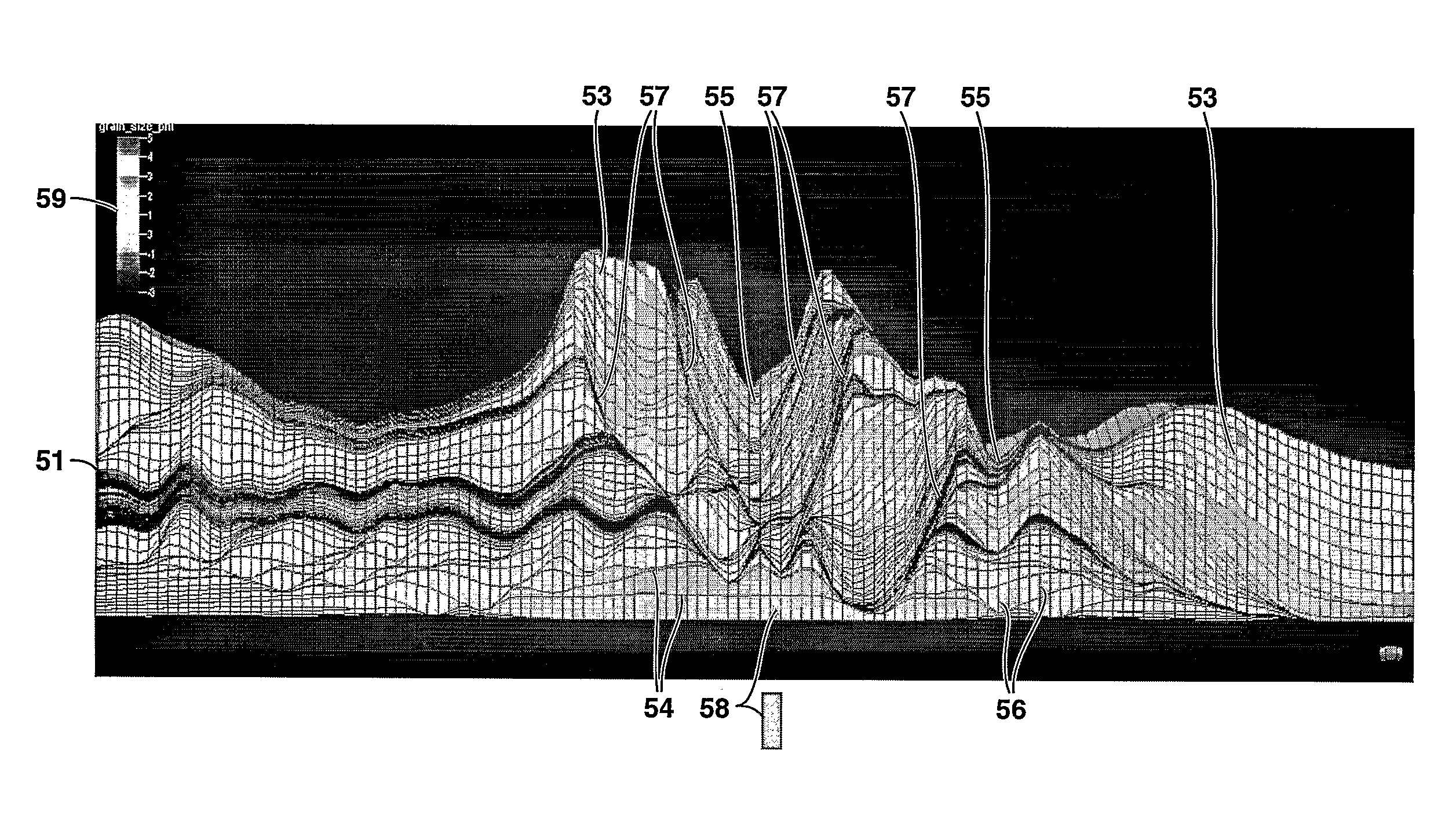
[0064]FIG. 7 shows a cross-section of a complex avulsive sand body 51 composed of several sand body lobes 53 and channels 55 simulated by using a physics-based sedimentary process simulator. FIG. 7 shows that in complex sand body 51 lobes 53 and channels 55 are maintained accurately in the Hydro-Grids 58 utilizing lateral grid lines or surfaces 54 in connection with vertical grid line or surface 56. The erosion (or truncation surfaces) 57 that are important to reservoir performance simulation are preserved. The color-scale 59 in FIG. 7 represents average grain size in the phi scale (from 5 to −3).

[0065] The Hydro-Grids idea can also be used in many commercially available sedimentary process simulators. FIGS. 8(a) and 8(b) illustrate example simulation results from a sedimentary process simulator, which populates sand bodies 61 of different size and shape to form a complex clastic deposit 63. FIG. 8(a) illustrates sand body locations 61 and sizes within an example fan delta 65, and ...


PUM


Abstract

The present invention is a method of hydrodynamics-based gridding (Hydro-Grids) for creating geologic models of subsurface volumes, such as reservoirs. Vertical grid surfaces may be chosen in an unstructured fashion to provide lateral resolution where needed. Lateral grid surfaces are created to represent surfaces of constant geologic time based on simulation of the depositional processes that created the subsurface volume. The values of geologic properties are then specified within each cell created by the intersections of the vertical and lateral surfaces. The geologic data may include, for example, seismic data, outcrop studies, well log data, core data, numerical modeling data, and interpreted stratigraphic surfaces based on seismic data. The modeled geologic properties of the subsurface volume may include, for example, grain size distribution, connectivity, net-to-gross, porosity, permeability and pore pressure.

Description

[0001] This application claims the benefit of U.S. Provisional Application No. 60 / 584,617 filed on Jul. 1, 2004.FIELD OF THE INVENTION [0002] This invention relates generally to the fields of geophysical prospecting and reservoir characterization. More specifically, the invention is a method for creating geologic models permitting enhanced representation of the properties of a subsurface volume, such as a reservoir or basin. BACKGROUND OF THE INVENTION [0003] A geologic model is a computer-based representation of a subsurface earth volume, such as a petroleum reservoir or a depositional basin. In the oil and gas industry, geologic models are commonly used in activities such as determining the locations of wells, estimating hydrocarbon reserves, or planning reservoir-development strategies. Geologic models are also input to fluid flow simulations to test development and production scenarios in order to optimize return on investment. A key parameter in flow simulation is the spatial d...

Claims


Application Information

Patent Timeline
IPC IPC(8): G01V1/28G06F19/00
CPCG01V1/282G01V2210/661G01V1/306
Inventor LI, DACHANGSUN, TAOHUH, CHUNDONOFRIO, CHRIS J.VAN WAGONER, JOHN C.DEFFENBAUGH, MAX
Owner EXXONMOBIL UPSTREAM RES CO
Learn More