Efficient use of expected user altitude data to aid in determining a position of a mobile station

a mobile station and expected user technology, applied in the field of position determination systems, can solve the problems of insufficient satellites to accurately determine an altitude, poor geometry of those satellites, inability to determine an altitude for a first positioning attempt or when the mobile station has moved, etc., to achieve faster time to fix, less memory, and higher yield

Active Publication Date: 2009-08-20
QUALCOMM INC
View PDF15 Cites 21 Cited by
  • Summary
  • Abstract
  • Description
  • Claims
  • Application Information

AI Technical Summary

Benefits of technology

[0007]Methods and apparatuses are disclosed herein that use defined terrain databases for altitude aiding for determining a position of a mobile station. The defined database contains expected user altitudes, based on terrain altitude data only for areas with dense user populations, and thus the database uses considerably less memory and is more efficient than systems that include the entire world or even a countrywide database. By using the disclosed aspects, GPS positioning occurs faster (faster time to fix) upon startup, and is more available (higher yield) within a given time frame. The disclosed aspects improve GPS yield and time to fix accuracy. In addition, they provide a predetermined expected user altitude database comprised of selected populated areas of the world or a selected country for use in altitude aiding in a mobile station and require less memory and is more efficient than a conventional terrain database, making it practical for use directly on a mobile device.

Problems solved by technology

However, in certain situations, there may not be enough satellites to accurately determine an altitude.
Even in some cases when four (4) GPS satellites are available, the geometry of those satellites is poor, or the solution is otherwise not high enough quality to be usable, and the use of altitude aiding can provide an additional measurement to improve the accuracy and reliability of that solution.
Also, mobile stations sometimes remember a previously calculated altitude, and use that for altitude aiding; however, obvious problems with this technique include the inability to determine an altitude for a first positioning attempt or when the mobile station has moved significantly since the previous altitude was calculated.
The fixed altitude technique, while useful in some situations, cannot address the general problem of determining position over uneven and / or unknown terrain.
However, these devices are impractical and require substantial resources due to the volume of terrain elevation data for the entire earth.

Method used


Image

  • Efficient use of expected user altitude data to aid in determining a position of a mobile station
  • Efficient use of expected user altitude data to aid in determining a position of a mobile station
  • Efficient use of expected user altitude data to aid in determining a position of a mobile station

Examples


Embodiment Construction

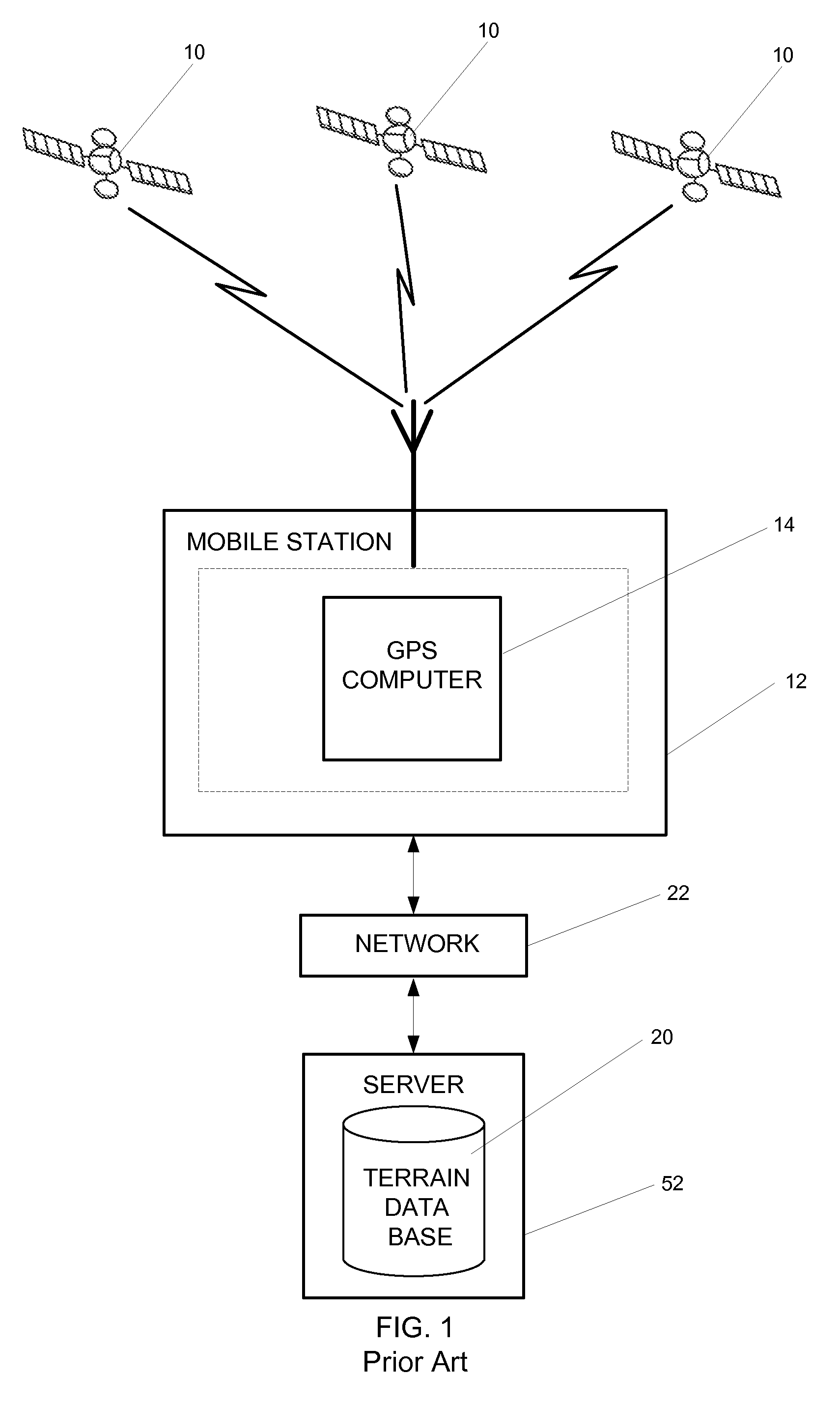
[0014]FIG. 1 shows a prior art system using the entire world terrain database for altitude aiding. In FIG. 1, satellites 10 send signal to a mobile station 12. A terrain database 20, inside a server or other external source 52, sends an altitude over communication network 22 to mobile station 12. The GPS signals and the localized altitude aiding are used by GPS computer 14 to determine the position of mobile station 12. In these prior art systems, terrain database 20 contains terrain maps of the entire earth, thus the need for an external server 52 or a very large memory source. The present system operates in a similar fashion; however the expected user altitude database is made up of selected portions of the worldwide terrain database, as modified for building heights.

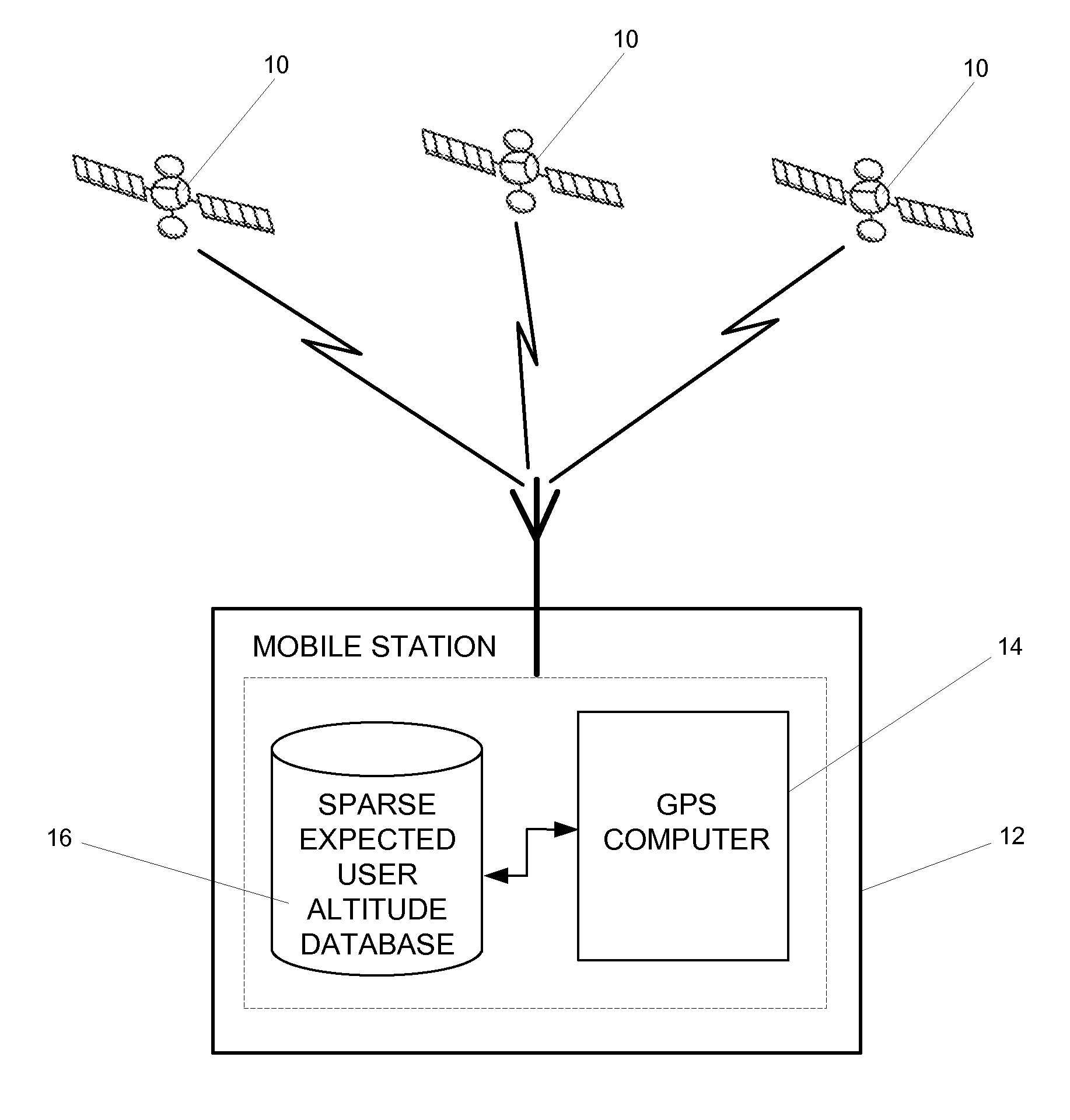
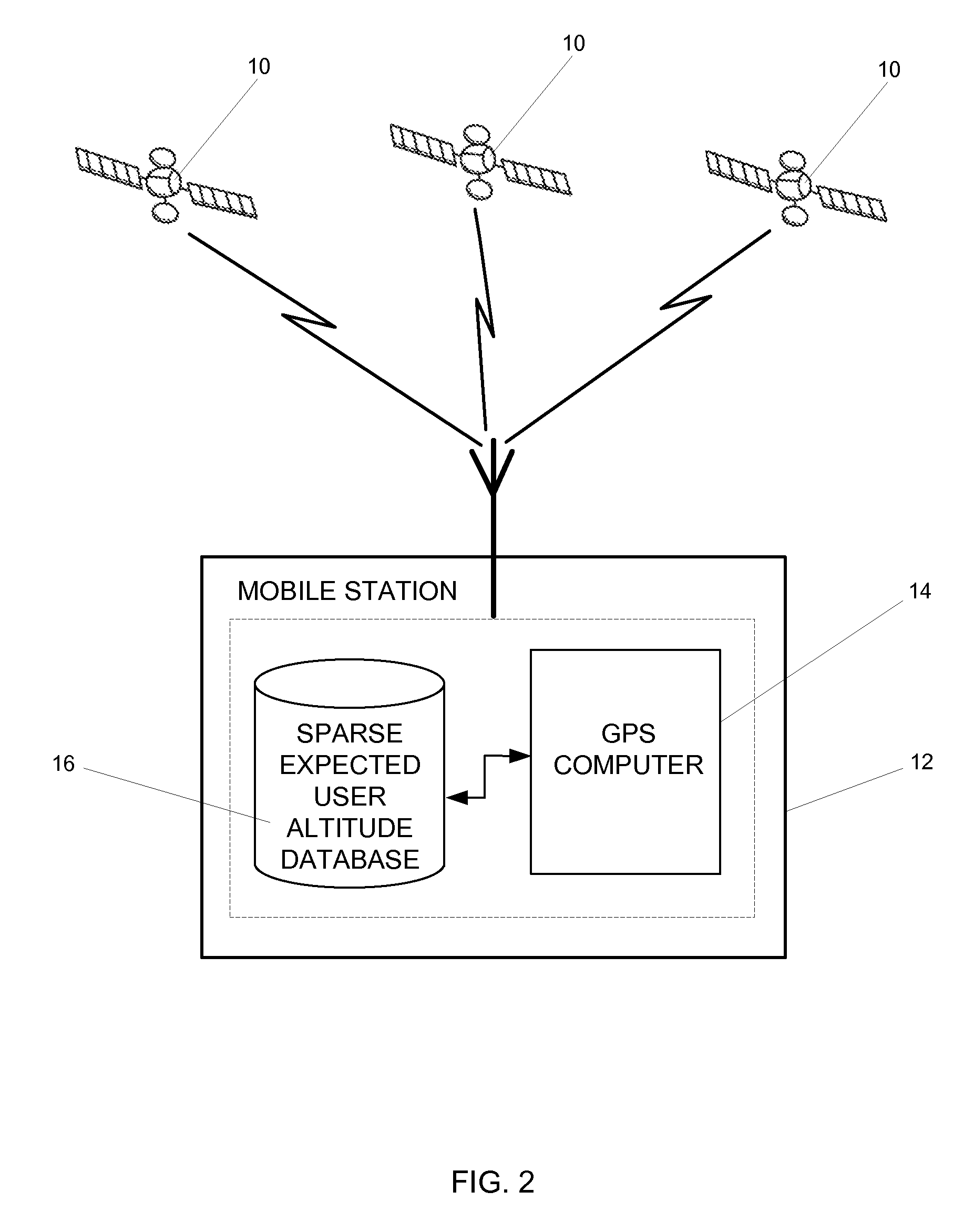
[0015]FIG. 2 shows an example of the current invention, using a sparse expected user altitude database for altitude aiding. As shown in FIG. 2, satellites 10 send signal to mobile station 12. A sparse expected user al...


PUM


Abstract

A method and apparatus for using a predetermined portion of terrain elevation maps in a database for aiding in computing a three-dimensional position of a wireless station. Instead of using the entire terrain model of the earth or an entire country, the database consists of an incomplete model, which includes only the most populous areas or specific regions. This reduces the size of the information in the database, which in turn reduces the amount of time to compute the positions of the wireless device.

Description

BACKGROUND OF THE INVENTION[0001]1. Field of the Invention[0002]The features of the present invention relate to position determination systems and more particularly to a method and apparatus for determining a position of a mobile device or mobile station using global positioning system (GPS) data and expected user altitude on data.[0003]2. Background Art[0004]To determine a position of a mobile device a Global Positioning System (GPS) uses measurements from several satellites to compute position in three (3) dimensions (i.e., latitude, longitude, and altitude). For the ideal situation, four (4) or more satellites are required for these measurements. However, in certain situations, there may not be enough satellites to accurately determine an altitude. For example, in some cases only three (3) GPS satellites are available. In these cases, a measurement is sometimes available in the form of an altitude estimate, and in this case four (4) measurements (3 GPS+1 altitude) can be used. Th...

Claims


Application Information

Patent Timeline
Patent Type & Authority Applications(United States)
IPC IPC(8): G01C21/00G01C5/00G01S5/14
CPCG01S19/05G01S19/22G01S19/50G01S5/14H04W64/00
Inventor RILEY, WYATT THOMASHESHMATI, ARDALAN
Owner QUALCOMM INC
Why Eureka
Try Eureka