Positioning using a reference station

Active Publication Date: 2010-04-15
NOKIA TECHNOLOGLES OY
View PDF9 Cites 24 Cited by
  • Summary
  • Abstract
  • Description
  • Claims
  • Application Information

AI Technical Summary

Benefits of technology

[0019]The invention proceeds from the consideration that using a short baseline between a rover and a reference station improves the reliability and speed of a basel

Problems solved by technology

The equipment required for such applications is expensive and meant, therefore, only for professional use.
However, such an approach has the disadvantage that the rover must have a real-time or near real-time feedback loop to a server providing the measurement data for the virtual reference station in or

Method used


Image

  • Positioning using a reference station
  • Positioning using a reference station
  • Positioning using a reference station

Examples


Embodiment Construction

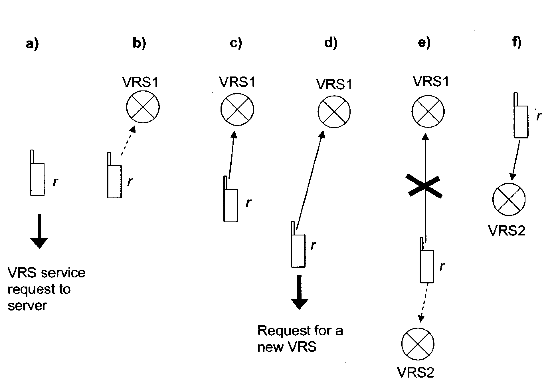
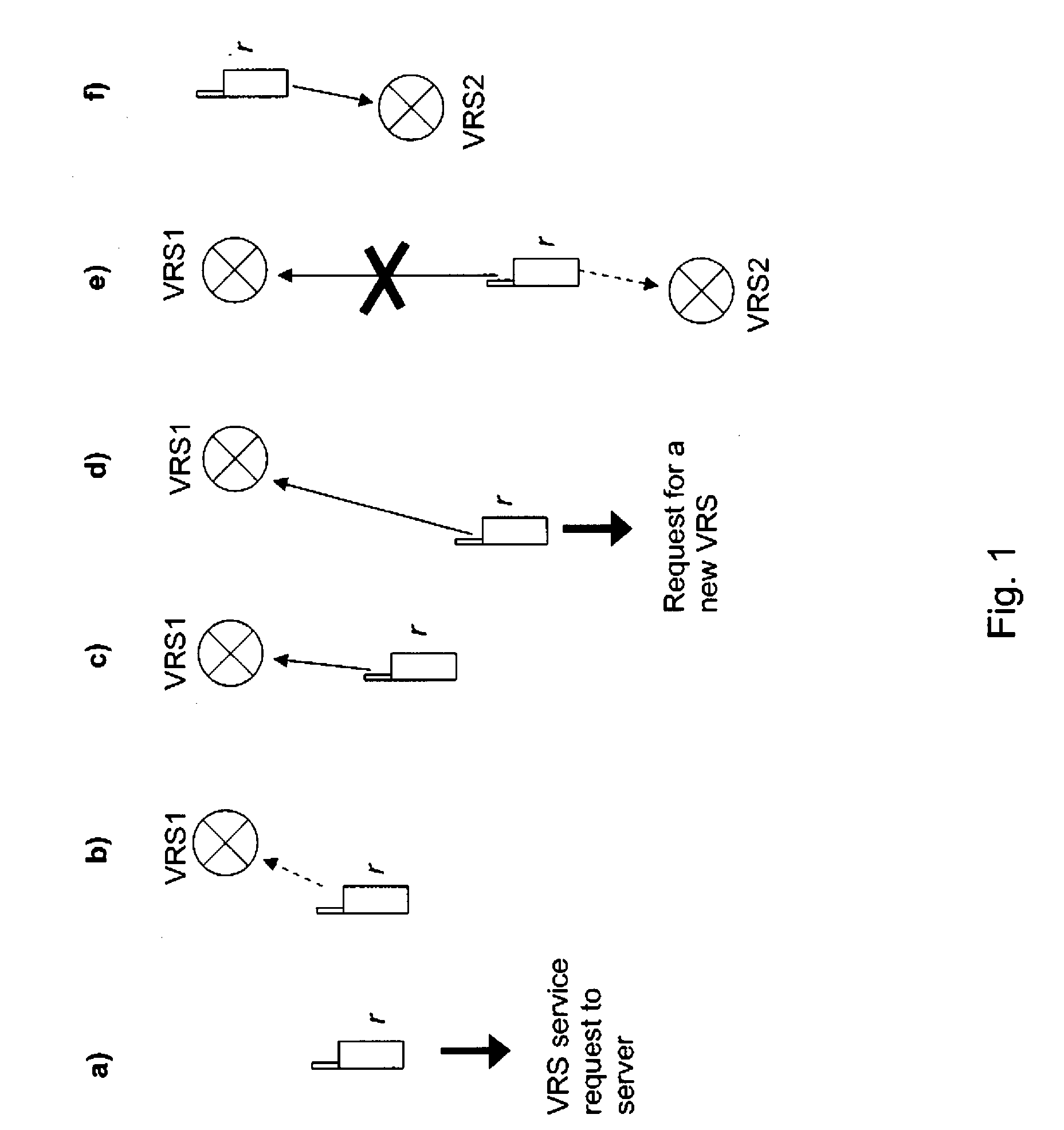
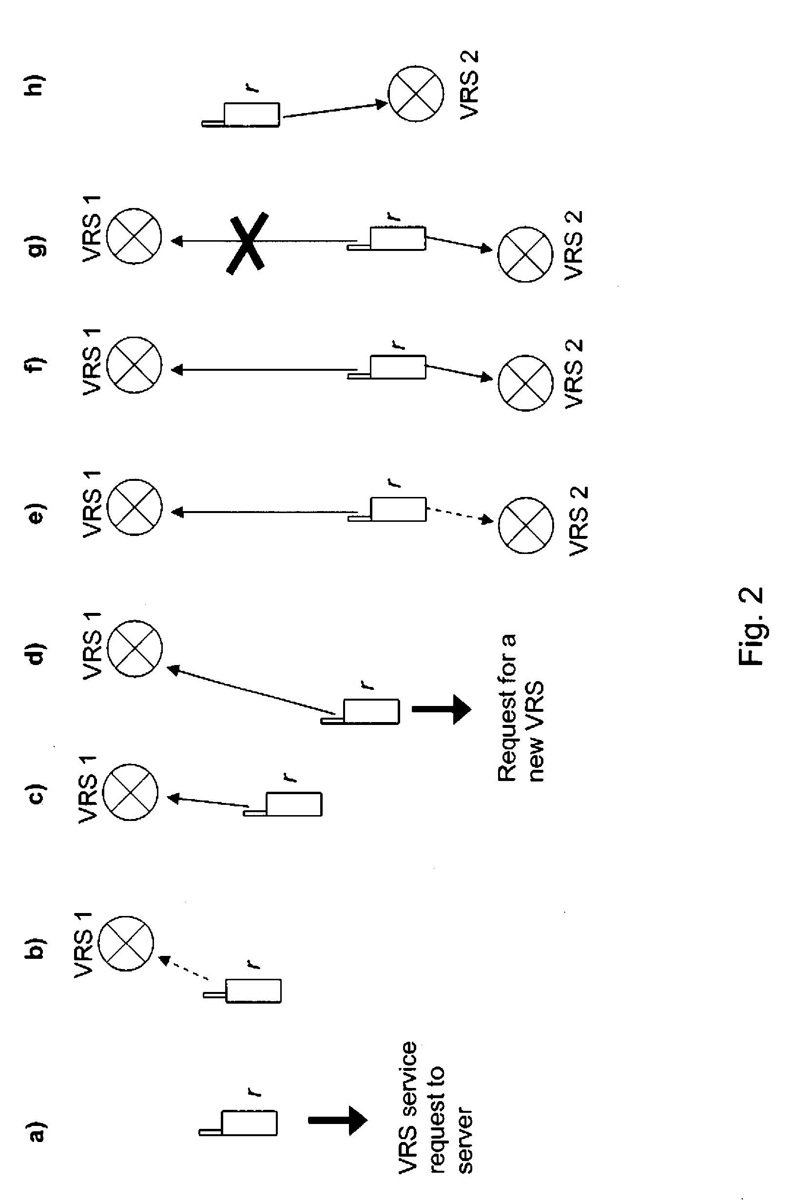
[0054]FIGS. 1 and 2 schematically illustrate the difference between intermittent high accuracy navigation and continuous high-accuracy navigation in accordance with an embodiment of the invention.

[0055]In both cases, an assisted GNSS (AGNSS) enabled rover r wants to perform a high-precision navigation using carrier-phase measurements from a virtual reference station. The distance to the virtual reference station should be as short as possible to improve the reliability and speed of the baseline determination. If the distance increases significantly, a new virtual reference station should be generated and used. Baselines are indicated in both Figures as arrows pointing from a rover r to a virtual reference station.

[0056]FIG. 1 presents steps a) to f) of a first possible approach for changing from one virtual reference station to another.

[0057]For beginning a navigation session, the rover r sends a request for virtual reference station measurements to a server (step a). The request co...


PUM


Abstract

For supporting a change of a reference station, first data that is valid for a first reference station is provided for transmission to a device, then data that is valid for the first reference station and data that is valid for a second reference station is provided for transmission to the device in parallel for a limited time, and finally data that is valid for the second reference station is provided for transmission to the device. The data for the first reference station and the data for the second reference station include measurements on satellite signals. At a receiving end, the respectively received data can be provided for a positioning of a device comprising a satellite signal receiver.

Description

FIELD OF THE INVENTION[0001]The invention relates to the field of positioning a device comprising a satellite signal receiver, and more specifically to a positioning based on measurements on satellite signals that are provided for a reference station.BACKGROUND OF THE INVENTION[0002]An absolute positioning of a device is supported by various Global Navigation Satellite Systems (GNSS). These include for example the American Global Positioning System (GPS), the Russian Global Navigation Satellite System (GLONASS), the future European system Galileo, the Space Based Augmentation Systems (SBAS), the Japanese GPS augmentation Quasi-Zenith Satellite System (QZSS), the Locals Area Augmentation Systems (LAAS), and hybrid systems. The satellites of these systems are also referred to as space vehicles (SV).[0003]The constellation in GPS, for example, consists of more than 20 satellites that orbit the earth. Each of the satellites transmits two carrier signals L1 and L2. One of these carrier s...

Claims


Application Information

Patent Timeline
IPC IPC(8): G01S19/44G01S19/29G01S5/14G01S19/04
CPCG01S19/44G01S19/04
Inventor WIROLA, LAURISYRJARINNE, JARI
Owner NOKIA TECHNOLOGLES OY
Why Eureka
Try Eureka