Distributed Distance Measurement System for Locating a Geostationary Satellite

a technology of distribution distance and satellite positioning, which is applied in the direction of instruments, using reradiation, transportation and packaging, etc., can solve the problems of system cost and the inability to use the solution of telecommunications operators, broadcasters and/or satellite packagers, and achieve the effect of increasing the accuracy of satellite positioning

Active Publication Date: 2011-11-03
THALES SA
View PDF2 Cites 27 Cited by
  • Summary
  • Abstract
  • Description
  • Claims
  • Application Information

AI Technical Summary

Benefits of technology

[0022]Furthermore, it is thus possible to make distance measurements and therefore to locate the satellite automatically (without human intervention) and repetitively, every second for example, to increase the accuracy of location of the satellite and of the restoration of the orbit and to access the position variations such as drifts and drift vel

Problems solved by technology

Such a system is costly.
This solution cannot be used with the telecommu

Method used


Image

  • Distributed Distance Measurement System for Locating a Geostationary Satellite
  • Distributed Distance Measurement System for Locating a Geostationary Satellite
  • Distributed Distance Measurement System for Locating a Geostationary Satellite

Examples


Embodiment Construction

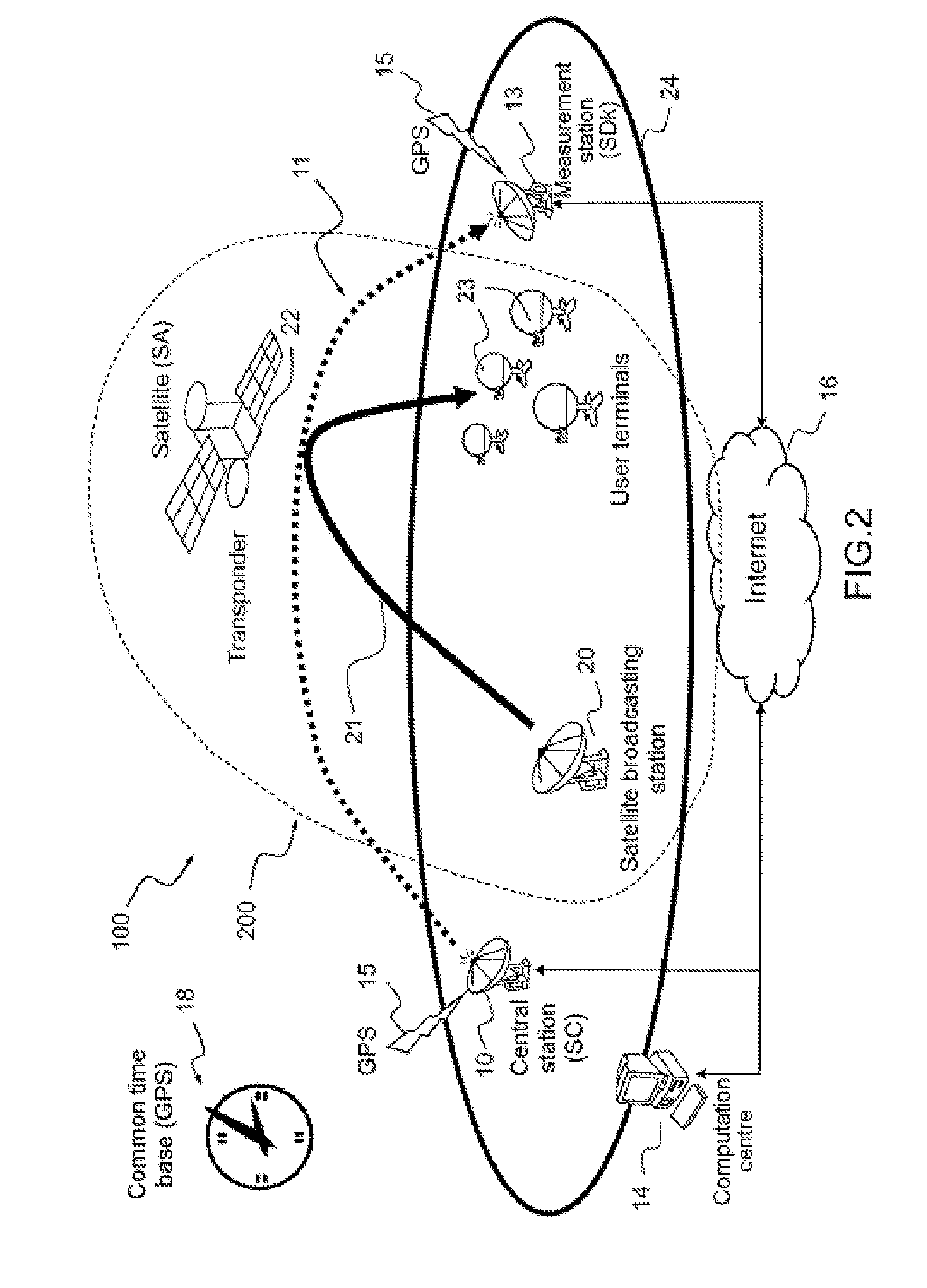
[0051]The distance measurement system 100 according to the invention, according to a first embodiment, is described in relation to FIG. 2.

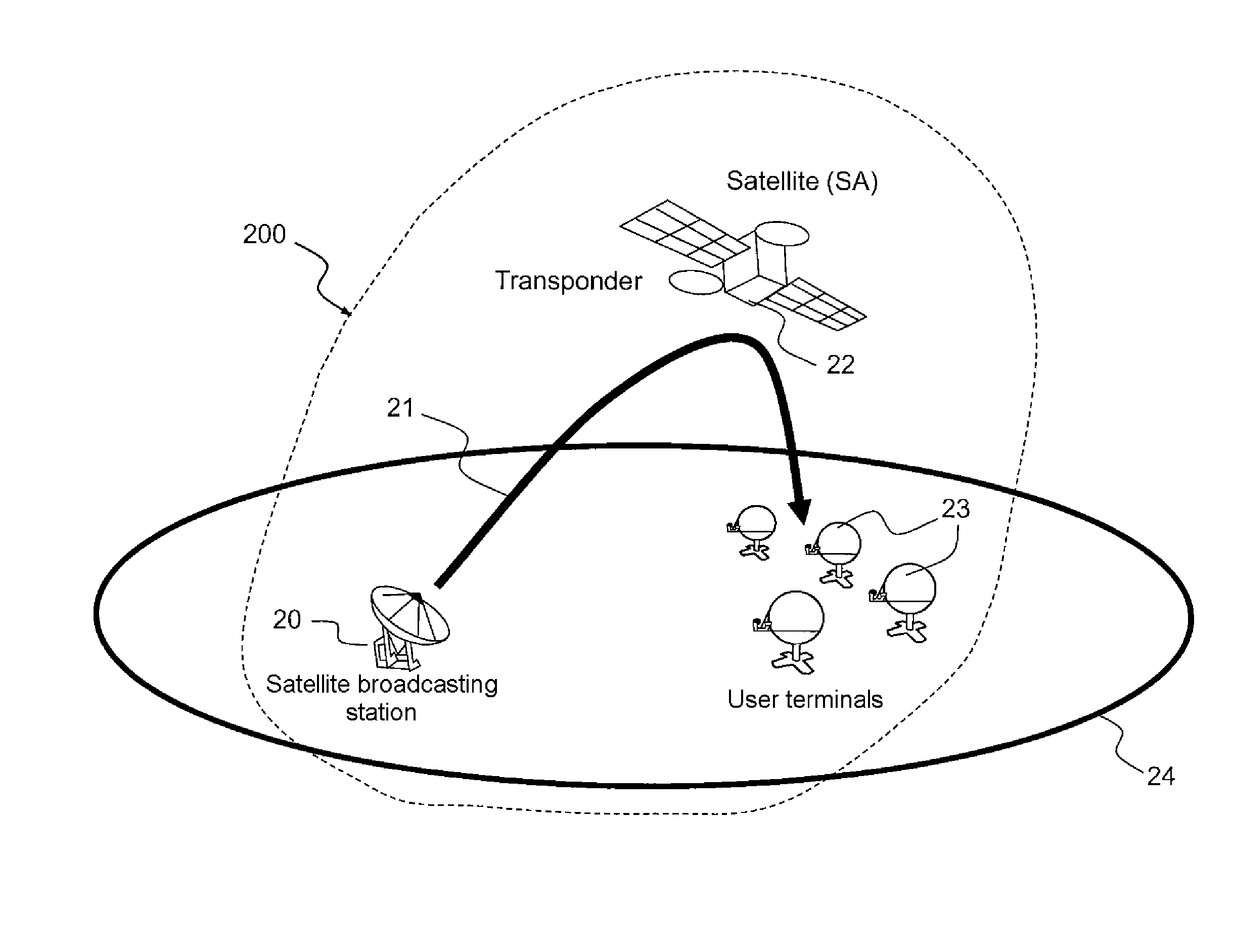
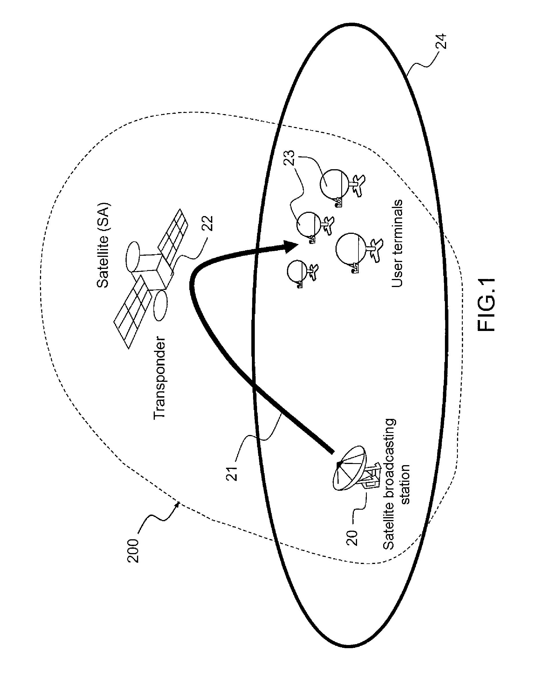
[0052]It comprises an emitting central station 10 which emits, to receiving remote measurement stations 13 (a single measurement station is represented in the figure in order to keep the figure simple), a distance measurement signal 11 with periodic events and with spread spectrum via the transponder 22 of a satellite SA of a telecommunications system 200, called telecommunications transponder. The system 100 according to the invention uses the transponder of another system, in this case that of a satellite telecommunications system 200. The emitting central station 10 is distinct from that 20 of the telecommunications system in that the signal 11 emitted by the station 10 is distinct from the telecommunications signal 21 emitted by the station 20. The two emitting stations 10 and 20 may, possibly, be located in the same place.

[0053]The distance m...


PUM


Abstract

A distance measurement system for locating a geostationary satellite equipped with a transponder includes: a central station emitting a distance measurement signal; and at least one measurement station receiving the emitted signal, including means for measuring the time of arrival of the emitted signal, and transmitted via the transponder of the satellite. The central and measurement stations, of known positions, include synchronization means with a common time base. The transponder is that of a satellite telecommunications system, and has a bandwidth B. The central station includes means for emitting a specific distance measurement signal, distinct from the telecommunications signals transmitted via the transponder, with periodic events and with spread spectrum, the bandwidth of which is included in B.

Description

CROSS-REFERENCE TO RELATED APPLICATION[0001]This application claims priority to foreign French patent application No. FR 1001867, filed on Apr. 30, 2010, the disclosure of which is incorporated by reference in its entirety.FIELD OF THE INVENTION[0002]The field of the invention is that of locating geostationary satellites.BACKGROUND[0003]It is known to determine the position of a geostationary satellite by using a system comprising a dedicated station for measuring distance between this station and the satellite, such as a large emitting and receiving TCR (acronym standing for Telemetry Command and Ranging) station, and a specific transponder on board the satellite, included in the TCR subsystem. The distance measurement, obtained by measuring the phase shift induced by the propagation time and the passage through the TCR transponder of the satellite on a sinusoidal or tone ranging radiofrequency carrier and associated with an elimination of ambiguity, is done periodically (weekly, f...

Claims


Application Information

Patent Timeline
IPC IPC(8): G01S19/48
CPCG01S13/878H04B7/18519G01S2013/466G01S13/46B64G3/00
Inventor GAYRARD, JEAN-DIDIERDERVIN, MATHIEUCELERIER, BRUNO
Owner THALES SA
Why Eureka
Try Eureka