Locating electromagnetic signal sources

a technology of electromagnetic signal and location, applied in the direction of navigation instruments, instruments, wireless commuication services, etc., can solve the problems of limited accuracy of position estimation, inability to detect other waps, and significant inaccuracy of wap location estimates, so as to and improve the accuracy of estimation

Active Publication Date: 2014-01-21
HUAWEI TECH CO LTD
View PDF17 Cites 15 Cited by
  • Summary
  • Abstract
  • Description
  • Claims
  • Application Information

AI Technical Summary

Benefits of technology

[0014]The location information data can improve the estimation of at least one of the second plurality of positions. In one example the user can input a correction to an approximate GPS (if available) or other positioning system reading if it appears that the reading is incorrect. The user can also (or alternatively) input additional reference data such as a height, which can for example overcome the relative inaccuracy of height readings in GPS and similar systems. The height may most easily be inputted in the form of the story number of a building in which the user is located; the story number can be converted into a height relatively approximately by multiplying an average / universal story height (such as 5 meters, 10 meters or somewhere inbetween) with the story number and adding to a height datum for the location, for example, or using more detailed information about the building in question or the location to obtain a more accurate result.
[0015]Processing the signal source position data may additionally or alternatively further comprise processing the signal detection data in accordance with an environmental model representing environmental factors applying to the signal sources. This can allow various environmental factors (such as the density of population of a building, presence or absence of various structural features, thickness of walls, reflectiveness of surfaces, and so on) to be taken into account to improve the accuracy of the estimation. In this case, the method preferably further comprises receiving at least one of environmental model selection data representing a choice of environmental model and environmental model parameter data representing a choice of at least one parameter of the environmental model, and processing the signal detection data in accordance with said at least one of the environmental model selection data and the environmental model parameter data.
[0022]The scanning at the first plurality of locations preferably comprises: scanning at the first plurality of locations to generate initial signal detection data, the initial signal detection data relating to signals received at the first plurality of locations from the signal sources; processing the initial signal detection data in dependence on first scanning position data, the first scanning position data representing the position of each of the first plurality of locations, in order to generate the position estimate data. Accordingly the signal sources can be used in both phases to facilitate the estimation of the position of the sources.
[0028]In a further embodiment a second (or further) signal detection system can be used at the first or second (or further) plurality of scanning locations, to complement the (first) signal detecting system and further to improve the accuracy of the location estimates. The first, second and (optionally) further phases of scanning need not be carried out at substantially the same time (on the same day, or on the same week, and so on).
[0031]At least one of the signal detection data, the signal source position data and the processed signal source position data may be transmitted via the wireless access point. This can facilitate the distribution of processing of the data between, for example, a hand-held device with limited computing power and storage, and a remote server and database. Alternatively all processing and scanning functionality may be carried out using the same device.

Problems solved by technology

War-driving suffers from limitations in the accuracy with which the position of WAPs and other signal sources can be determined.
The necessary distance between vehicles on a road and WAP base stations (typically installed inside buildings away from the road) can lead to significant inaccuracies in the WAP location estimates, and other WAPs may not be detected at all at that distance.
These factors can reduce the accuracy of a location service that uses data derived from the war-driving.
War-walking can allow detection equipment to be brought nearer to the WAPs and even inside buildings, but once inside the building the GPS receiver will typically fail, due to the loss of line-of-sight with the GPS satellites.
Therefore both war-driving and war-walking suffer from limitations in the accuracy in the estimate of the location of the WAPs and in some cases do not allow a location to be determined at all due to the failure of the GPS or similar positioning system.

Method used


Image

  • Locating electromagnetic signal sources
  • Locating electromagnetic signal sources
  • Locating electromagnetic signal sources

Examples


Embodiment Construction

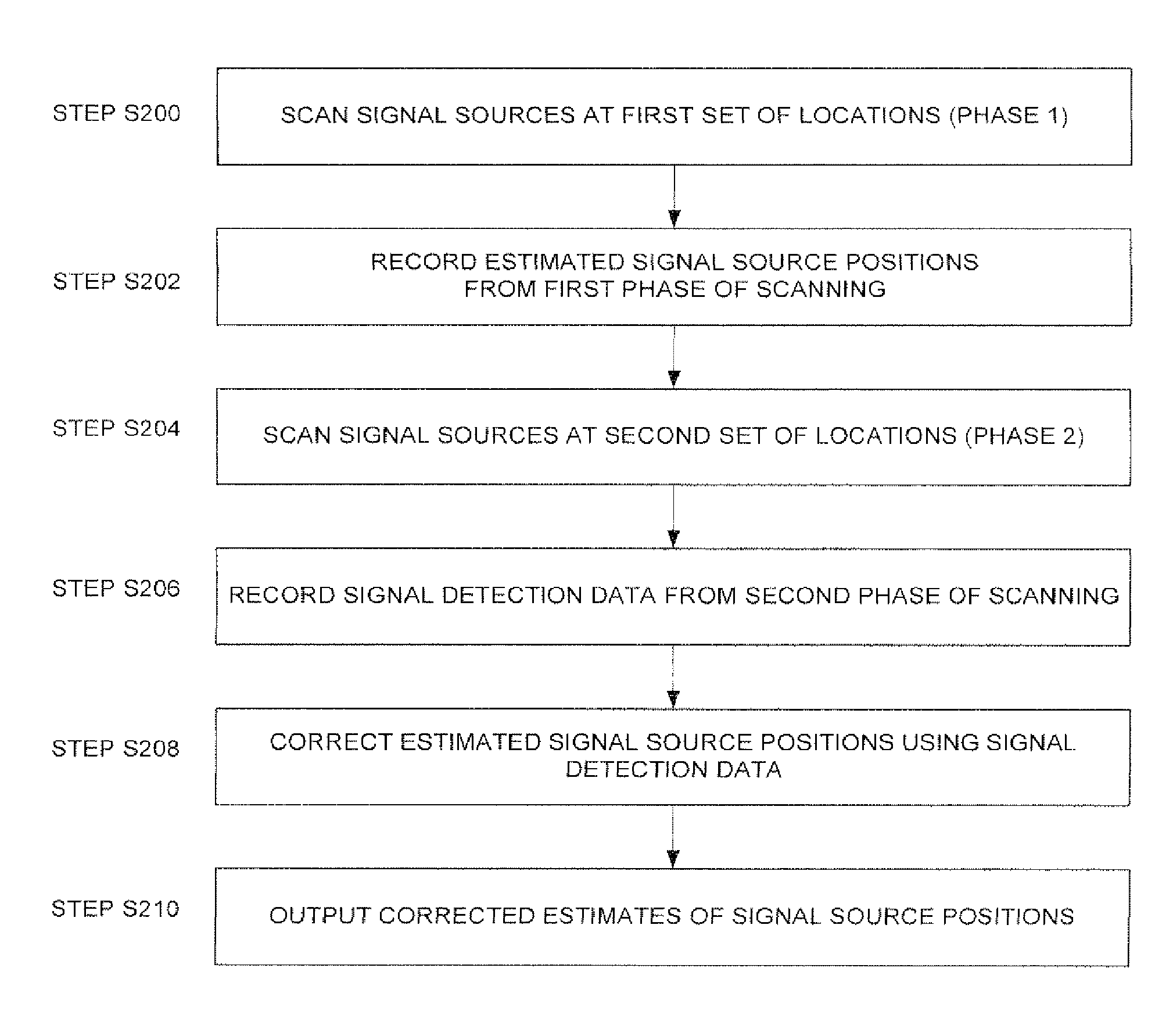
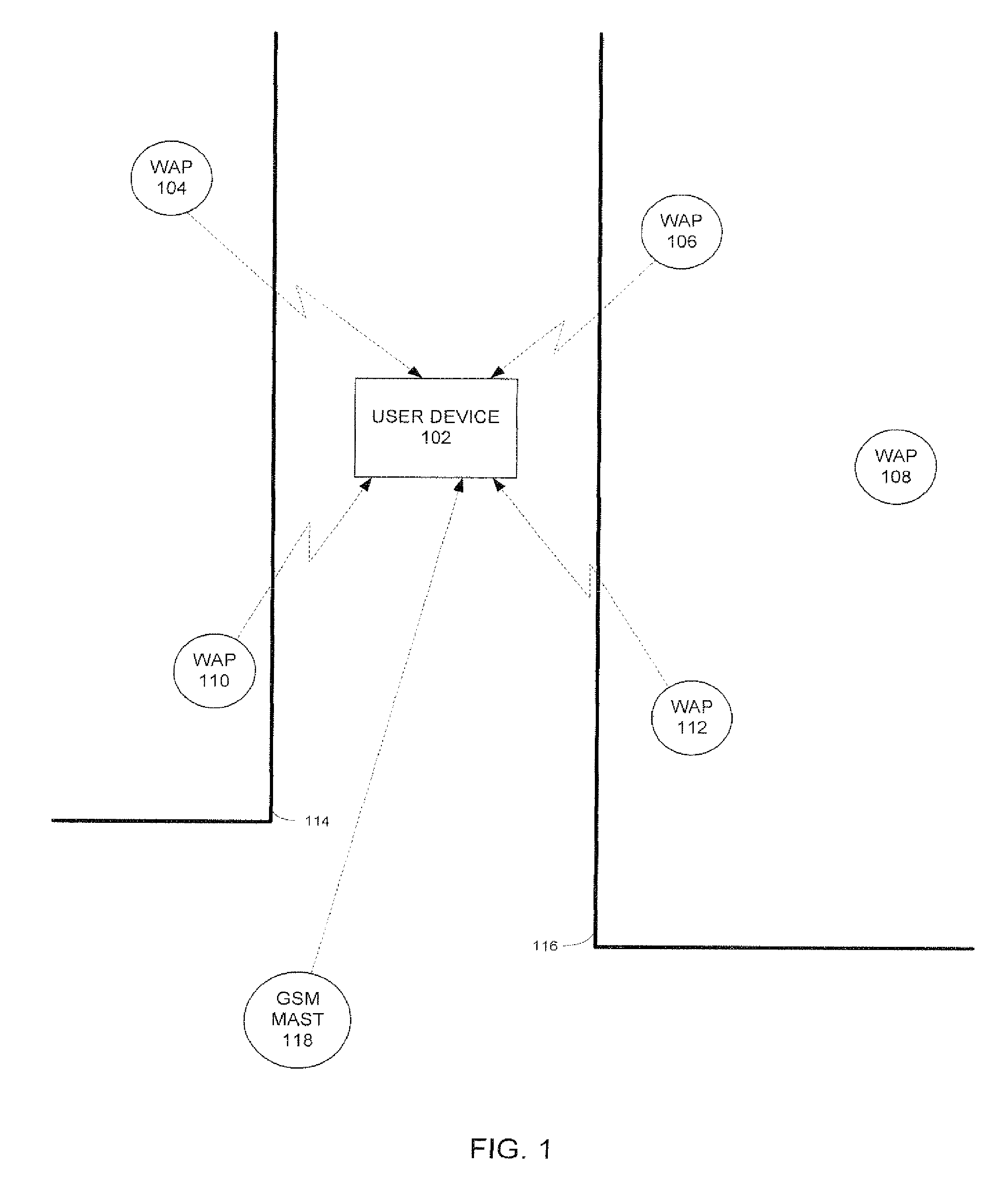
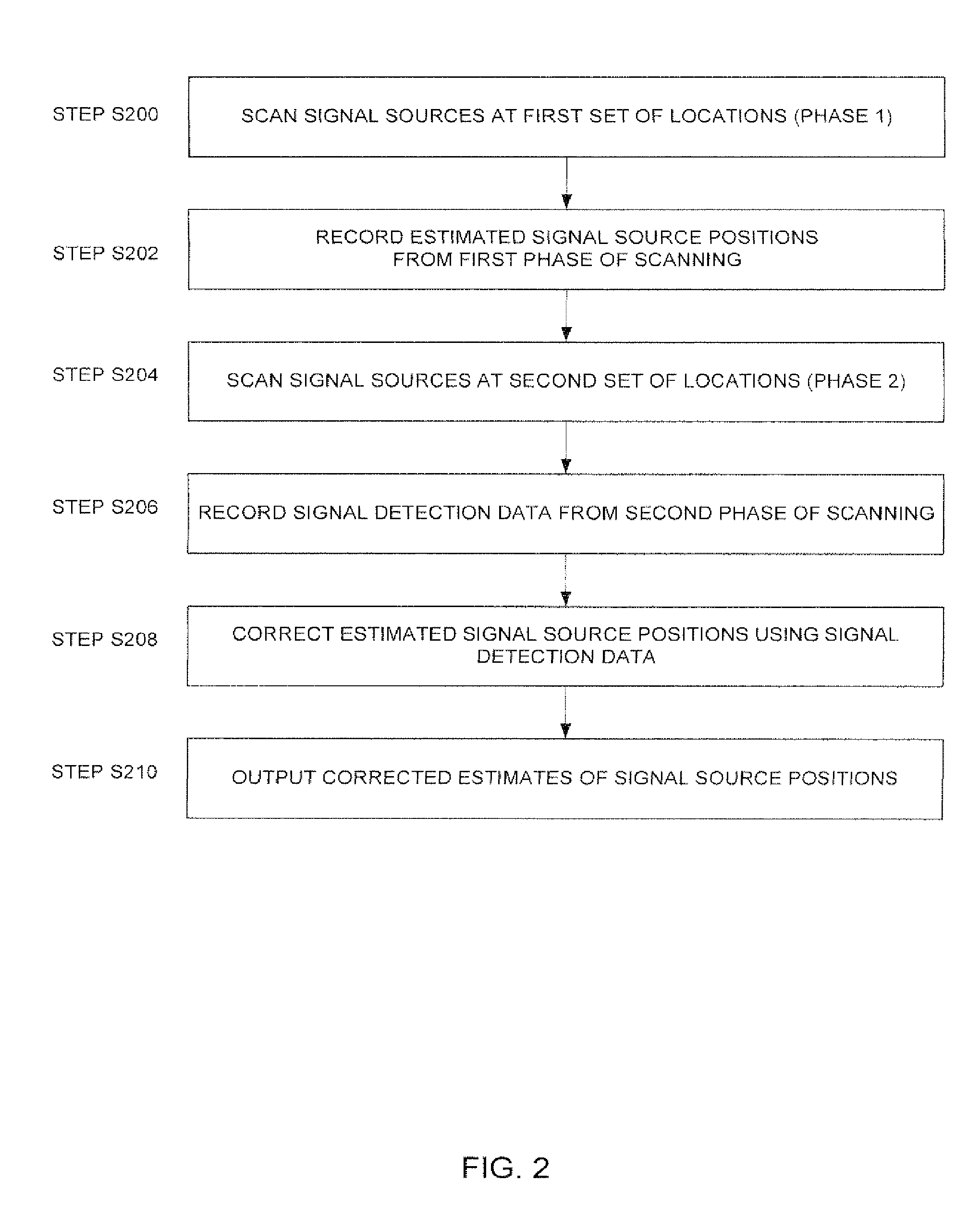
[0055]A method and system will be described for locating electromagnetic signal sources, with a particular (but not exclusive) application to a system for locating a user device by cross-referencing signals received at the user device with data previously gathered using the abovementioned method and system.

[0056]In one particular embodiment a method is described in relation to dynamically determining the location (such as position co-ordinates) of Wireless Access Points (WAPs) or Wireless Beacons in wireless technology-based positioning systems. Predominantly the wireless standard described in this document is Wi-Fi and the positioning system is a Wi-Fi-based system, but this method can equally be applied to other related standards such as Bluetooth and radio-frequency (RF) and other systems. Furthermore this method can also be applied in determining the location of base stations in other communication technologies such as mobile communication (such as GSM and CDMA for example), Wi-...


PUM


Abstract

There is disclosed a method of estimating the location of a plurality of electromagnetic signal sources, comprising: scanning at a first plurality of locations to generate signal source position data, the signal source position data representing estimates of the position of at least one of said signal sources; scanning at a second plurality of locations using a signal detection system to generate signal detection data, the signal detection data relating to signals received at the second plurality of locations from the signal sources; processing the signal source position data in dependence on the signal detection data to correct estimation errors in the signal source position data; and outputting the processed signal source position data.

Description

FIELD OF THE INVENTION[0001]The present invention relates to a method of and system for estimating the location of a plurality of electromagnetic signal sources.BACKGROUND TO THE INVENTION[0002]One example of an electromagnetic signal source is a wireless access point, such as a Wi-Fi base station (Wireless Access Point), which is used to communicate wirelessly with a device by the transmission and reception of electromagnetic radiation in the form of radio waves. Other electromagnetic signal sources may for example include optical (infra-red) communication devices and electromagnetic / wireless beacons of various sorts.[0003]It is sometimes desired to estimate the location of electromagnetic signal sources. In one example, details of the location and other properties of wireless access points (WAPs), cellular telephone masts, and other electromagnetic signal sources are determined. A device operated by a user can then measure properties of electromagnetic signals (such as WAP radio f...

Claims


Application Information

Patent Timeline
Patent Type & Authority Patents(United States)
IPC IPC(8): H04W4/00
CPCG01S19/14G01S5/0252G01S5/0242H04W64/003G01S5/021G01S5/0236G01S5/04G01S5/06G01S5/12G01S5/14G01S5/02521
Inventor ARSLAN, TUGHRUL SATISEVAK, ZANKAR UPENDRAKUMARALSEHLY, FIRAS
Owner HUAWEI TECH CO LTD
Why Eureka
Try Eureka