Public transport bus exact stop method based on standard line matching

An accurate positioning and standard technology, applied in satellite radio beacon positioning system, road vehicle traffic control system, positioning, etc., can solve the problems of lack of high-density shape point information and accurate site information, difficult to correct the basis, etc.

Inactive Publication Date: 2008-12-31
BEIJING UNIV OF TECH
View PDF0 Cites 81 Cited by
  • Summary
  • Abstract
  • Description
  • Claims
  • Application Information

AI Technical Summary

Problems solved by technology

However, ordinary GIS bus route map data is difficult to use as a basis for deviation correction due to the lack of high-density shape point information and accurate station information

Method used


Image

  • Public transport bus exact stop method based on standard line matching
  • Public transport bus exact stop method based on standard line matching
  • Public transport bus exact stop method based on standard line matching

Examples


Embodiment Construction

[0064] Specific embodiments of the present invention will be described below in conjunction with the accompanying drawings:

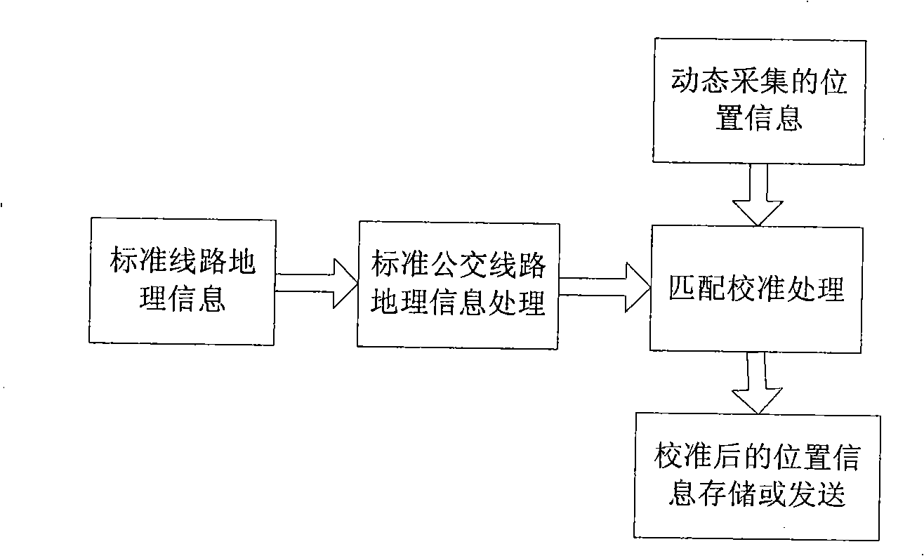
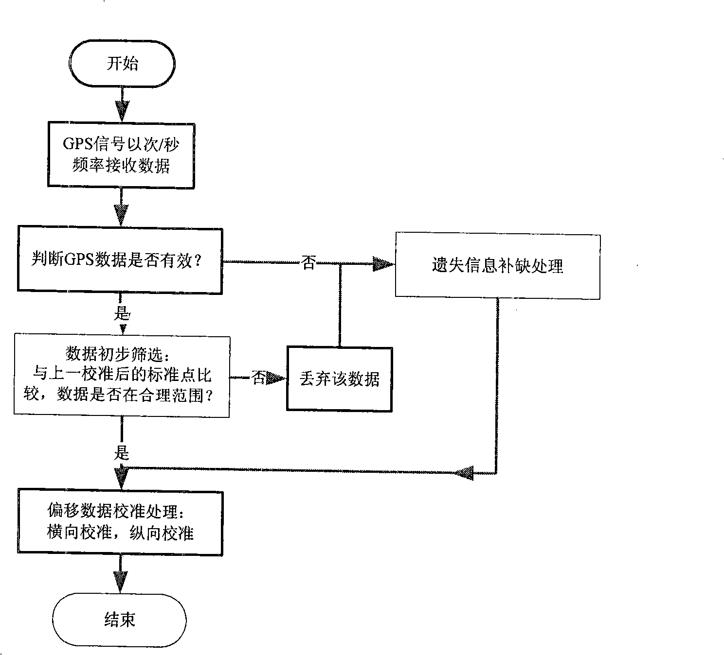
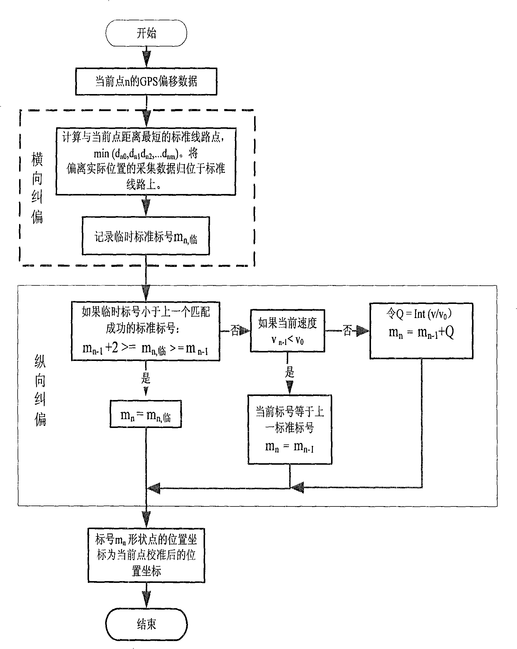
[0065] according to figure 1 The overall frame diagram of the system shown is to build a platform for implementing the method of the present invention, combined with figure 2 The given dynamic positioning information calibration of the present invention and the general flow chart of the present invention for the processing flow of filling the defect, image 3 The given deviation correction flow chart of the present invention carries out a detailed description of the specific embodiments of the present invention:

[0066] The overall implementation framework of the present invention is to first generate standard bus route map information with high-density shape points and accurate station locations in an ideal state, and then use this as a reference as the basis for deviation correction and missing data filling, and match the real-time collected data w...


PUM


Abstract

The invention discloses an accurate public traffic positioning method based on standard line matching, which pertains to the filed of dynamic public traffic information collection and is applied to dynamic information release and dynamic scheduling. The traditional method adopts the method of difference, inertial navigation or adding road test equipment to improve the positioning precision, and the equipment cost is increased due to the adding of additional hardware modules. According to the deviation or loss rule of the urban public traffic vehicle-bone GPS collected data, by being combined with the public traffic operation characters and on the basis of not increasing the equipment cost, the invention effectively improves the accuracy of the GPS positioning by being matched with the GIS public traffic line map data with the shape points of high density. The method firstly generates the GIS public traffic line map data with the shape points of high density and accurate stop positions so that the map data is taken as a reference to be used as the foundation for correcting the deviation and filling up the lost data, and matches the real-time collected data with the map data to obtain the precise position information, thus meeting the requirement of public traffic positioning. The method can also be applied to the problem of correcting other positioning information with fixed lines.

Description

technical field [0001] The invention belongs to the field of bus dynamic information collection and is used for dynamic information release and dynamic scheduling. Background technique [0002] The dynamic data collection of bus operation based on GPS positioning system is the basis of dynamic information release and dynamic dispatch. However, on urban roads, the collected GPS data is often deviated from the actual position or lost due to the occlusion of trees, buildings, overpasses, etc. The traditional method is to use differential, inertial navigation or adding drive test equipment to improve the positioning accuracy, these methods all need to add additional hardware modules, thus increasing the cost of equipment. [0003] In fact, the bus runs along a fixed route, and the GPS position drift collected on urban roads usually occurs around the actual position, and it is often an overall offset with certain regularity. These laws make it possible to find a new positioning...

Claims


Application Information

Patent Timeline
Patent Type & Authority Applications(China)
IPC IPC(8): G01C21/26G01S5/02G01S1/02G08G1/123G01S19/39G01S19/42
Inventor 陈艳艳王东柱
Owner BEIJING UNIV OF TECH
Why Eureka
Try Eureka