GIS (geographic information system) layer point data stacking method

A superposition method and point data technology, applied in the fields of electrical digital data processing, special data processing applications, instruments, etc., can solve problems such as great technical difficulty, and achieve the effect of enhancing flexibility and improving superposition efficiency.

Inactive Publication Date: 2012-07-25
SHANGHAI TONGYAN CIVIL ENGINEERING TECHNOLOGY CORP LTD +1
View PDF2 Cites 13 Cited by
  • Summary
  • Abstract
  • Description
  • Claims
  • Application Information

AI Technical Summary

Problems solved by technology
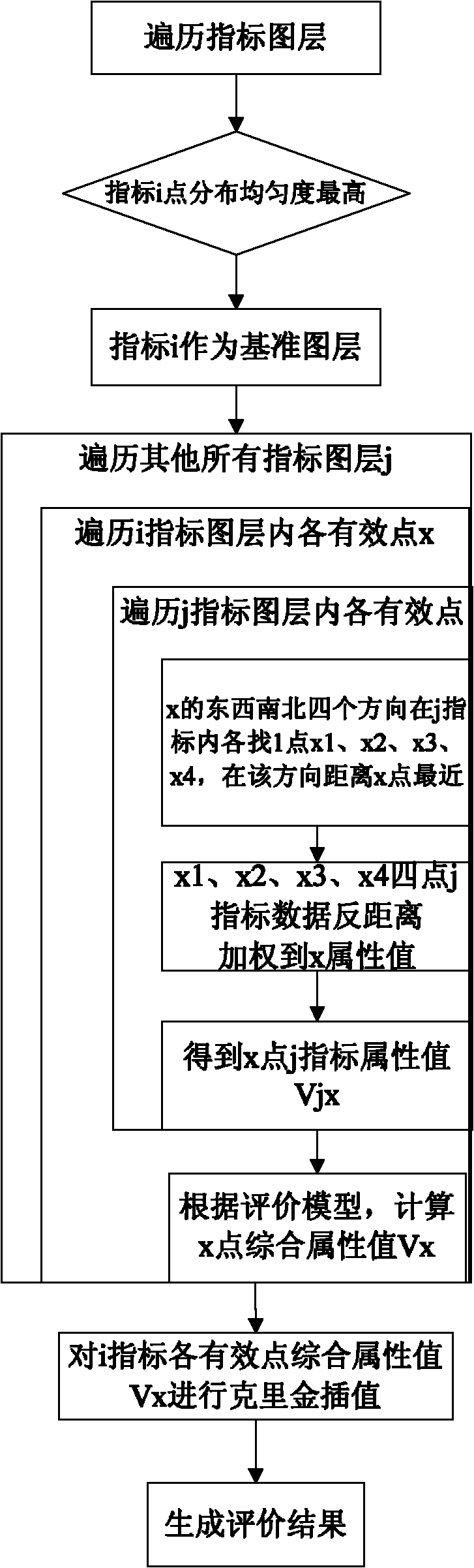
[0012] In the existing overlay analysis methods, point-surface, line-surface, and surface-surface overlays are vector overlays, but there is no mathematical transformation or algebraic operation for attribute data. The use of map algebra is flexible, but it is limited to raster layers. Layers are also technically difficult to calculate as variables in algebraic formulas

Method used


Image

  • GIS (geographic information system) layer point data stacking method
  • GIS (geographic information system) layer point data stacking method
  • GIS (geographic information system) layer point data stacking method

Examples


Embodiment 2

[0055] Take the application of multi-index engineering geological division as an example. In the multi-index engineering geological division, the analysis is composed of six basic indicators including basic seismic intensity, groundwater burial depth, water and soil-corrosion, groundwater quality, rock and soil type, and foundation bearing capacity. Take the constant, and the data of other basic analysis indicators come from the data of exploratory holes.

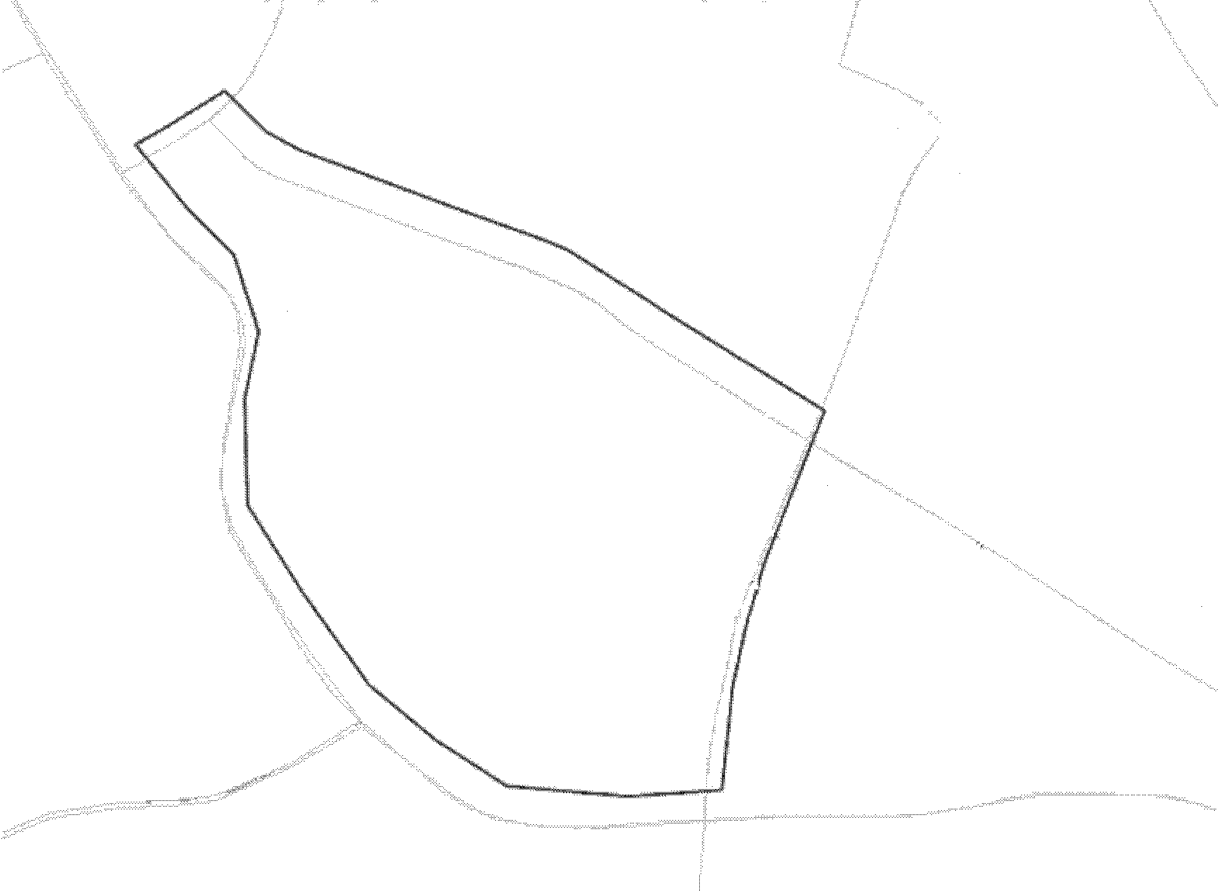
[0056] 1) if figure 2 As shown, enter a polygonal area where analysis is required;

[0057] 2) Since the exploration points with groundwater depth data are the densest and have the best distribution uniformity, the groundwater depth is selected as the reference layer.

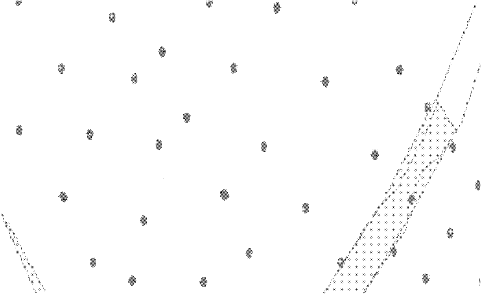
[0058] 3) Query all the exploration holes {a} with groundwater depth data in the polygon area;

[0059] 4) For a constant basic seismic intensity, each exploratory hole is assigned the constant value;

[0060] 5) if image 3 As shown, for the water and...


PUM


Abstract

The invention relates to a GIS (geographic information system) layer point data stacking method, which includes the steps: 1) selecting a layer with the highest stacking object point distribution uniformity as a reference layer; 2) reading data of another to-be-stacked layer c, and mapping the data onto stacking objects of the reference layer; 3) mapping point data of stacking objects on the layer c onto points of the reference layer according to the proximity effect principle; 4) traversing all the points on the reference layer until all the points on the reference layer have data mapping of the layer c; 5) traversing all the layers needing to be stacked until the data of the layers needing to be stacked are mapped onto the reference layer; 6) performing stacking computation according to a given stacking algorithm, so as to obtain a stacking result Up: Up=f(v, v', v'',......) of the points P; and 7) performing Kriging interpolation for the area on the reference layer according to the stacking result Up of all the points, so as to obtain a final result. Compared with the prior art, the GIS layer point data stacking method has the advantage that stacking efficiency is improved.

Description

technical field [0001] The invention relates to a data overlay method, in particular to a GIS layer point data overlay method. Background technique [0002] GIS geographic information system is a technical system that comprehensively processes and analyzes geospatial data. Based on the geospatial database, with the support of computer software and hardware, it uses the theories of system engineering and information science to scientifically manage and comprehensively analyze geographic data with spatial connotations, so as to provide technical systems for information required for management and decision-making. Generally, it has the functions of data collection, management, analysis, and display. Among them, spatial analysis is an advanced function of GIS. Through spatial query and spatial analysis, it is the starting point and destination of GIS to draw decision-making conclusions. Spatial analysis is used to mine the location-related laws or connections behind the data. I...

Claims


Application Information

Patent Timeline
Patent Type & Authority Applications(China)
IPC IPC(8): G06F17/30
Inventor 刘学增朱伟佳朱爱玺章哲颜朱合华
Owner SHANGHAI TONGYAN CIVIL ENGINEERING TECHNOLOGY CORP LTD
Why Eureka
Try Eureka