Geocoding points of interest and service route delivery and audit field performance and sales method and apparatus

A technology of geocoding and points of interest, applied in the field of service route delivery optimization, to achieve the effect of optimizing credit allocation and cash flow management, and optimizing logistics goods and service delivery

Inactive Publication Date: 2014-08-20
MAPAS INTELIGENTES +1
View PDF13 Cites 5 Cited by
  • Summary
  • Abstract
  • Description
  • Claims
  • Application Information

AI Technical Summary

Problems solved by technology

[0003] These geocoding systems emphasize logistics improvement, business location services, fleet management, routing design, but none include an integrated cloud-based computer approach to centralized auditing and control of: field sales, advertising and promotional efforts, routing engineering, continuous upgrades collections tailored to the client's specific needs and location, and real-time assessment of operator performance along its path

Method used


Image

  • Geocoding points of interest and service route delivery and audit field performance and sales method and apparatus
  • Geocoding points of interest and service route delivery and audit field performance and sales method and apparatus
  • Geocoding points of interest and service route delivery and audit field performance and sales method and apparatus

Examples


Embodiment Construction

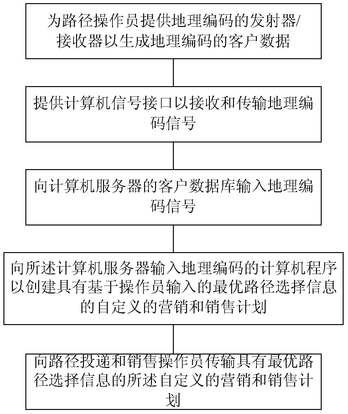
[0043] figure 1 is a flowchart of one embodiment of the method of the present invention showing a typical process sequence. Such as figure 1 As shown, this method provides routing operators with a geocoded transmitter / receiver to generate and import geocoded customer data. The geocoded customer data is transmitted to the customer database of the computer server via a computer signal interface, such as Bluetooth, WIFI, GPRS, mobile phone network, etc. A geocoding computer program (not shown) is imported into the computer server to create a customized marketing and sales plan with optimal routing information based on operator entries in the customer database. Then, this customized marketing and sales plan with optimal routing information is transmitted to routing and sales operators via the network cloud.

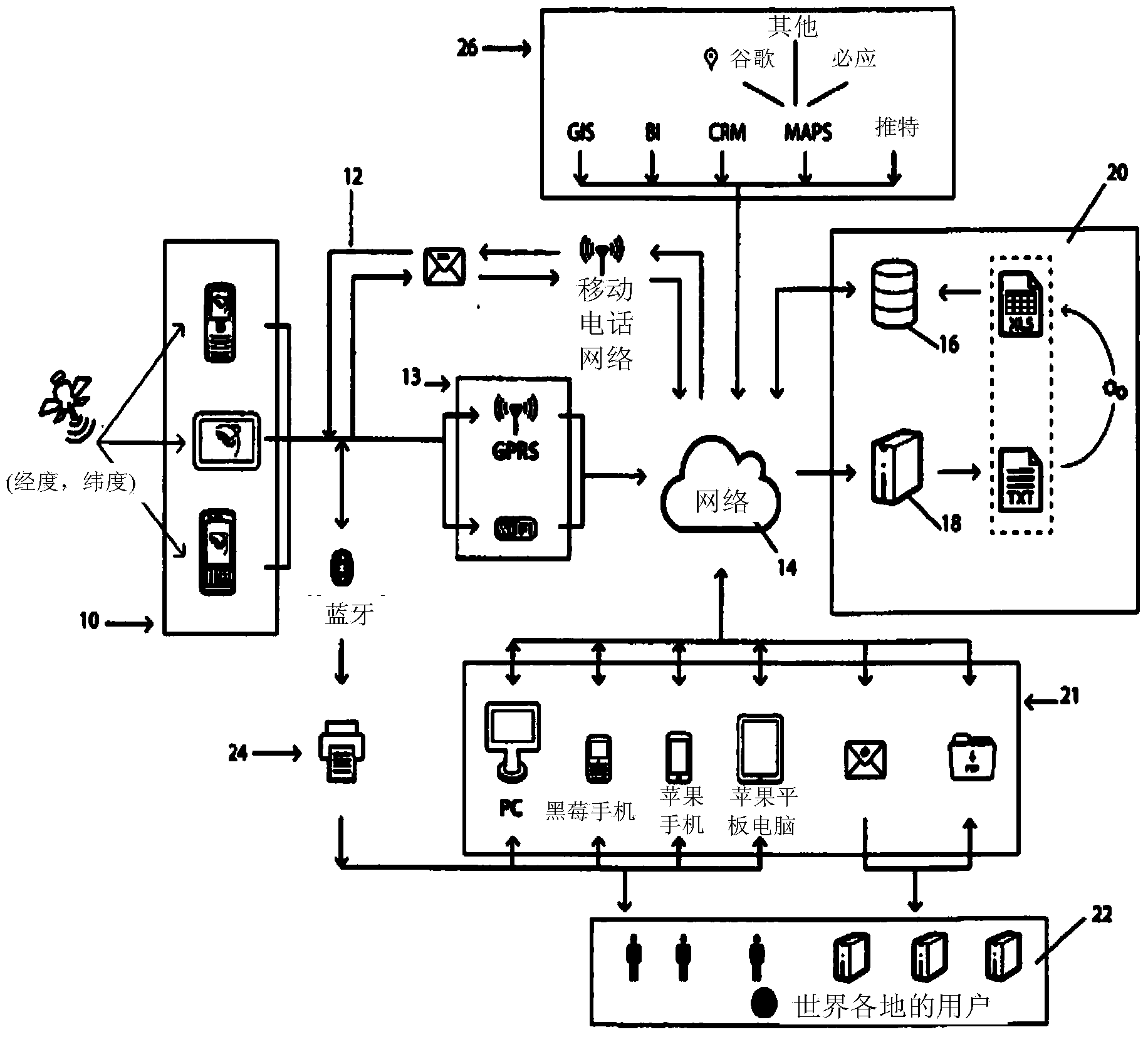
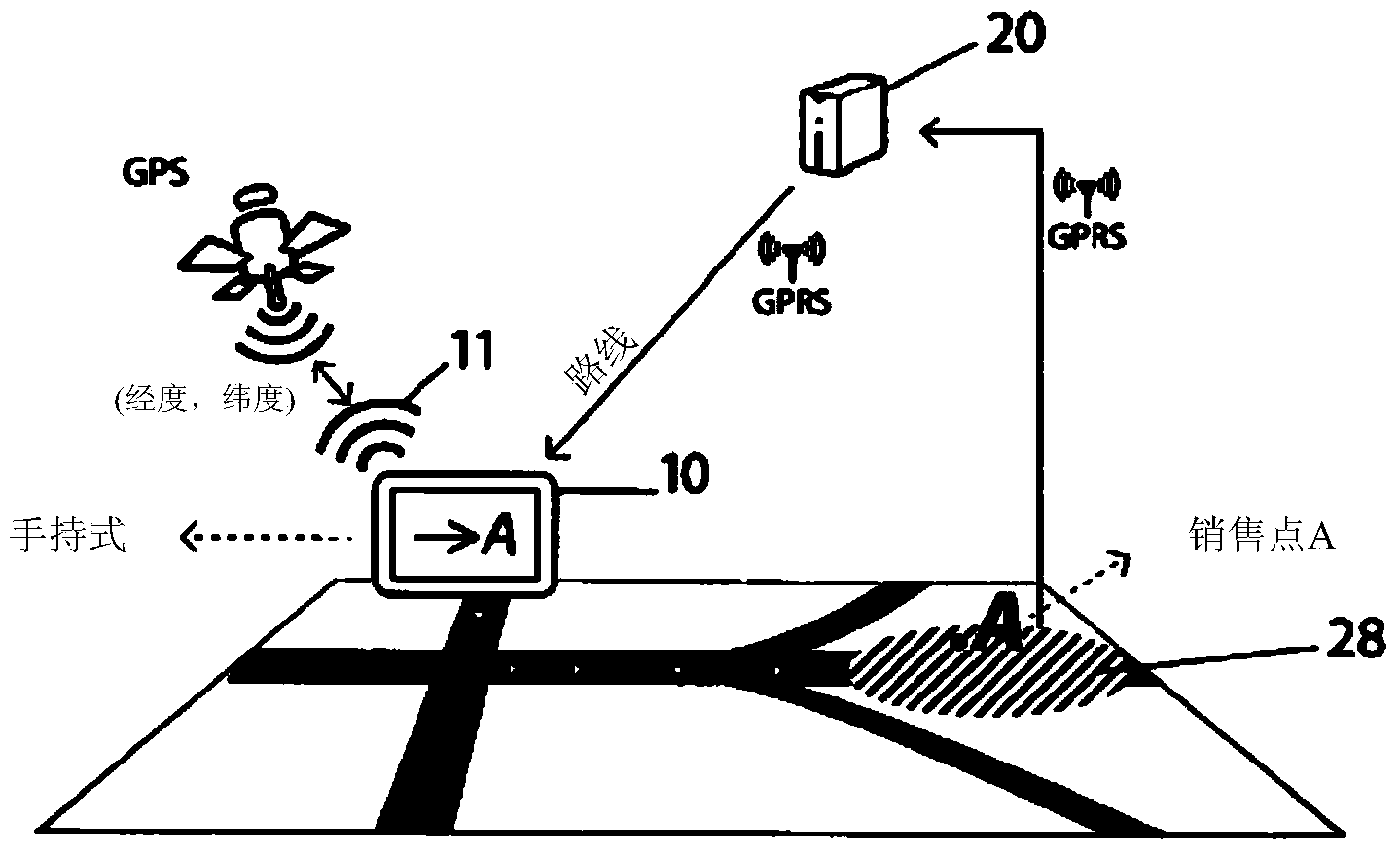
[0044] figure 2 is a schematic diagram of a typical embodiment of an apparatus for carrying out the method of the invention. Multiple computer-interactive data transmit...


PUM


Abstract

A computer guided geo-coded route service sales and deliveries method and apparatus optimizing geo-marketing, financial and sales, and improved logistics along delivery routes using operator transmitters / receivers inputs of route information in one mode, which receive and display to the operator in another mode computer generated pricing, sales, financial and marketing information, optimal routes, and other related information concerning each customer and distribution point of interest along a route, which are displayed or not, to the operator as he / she reaches the particular latitude and longitude of a point of interest enforcing the operator to act as it is indicated.

Description

technical field [0001] The invention relates to a service path delivery optimization method. In particular, the present invention relates to a cloud computing method that enhances market definition and market segmentation methods in some business processes, using "geographical information technology" also known as geographic information technology or surveying and mapping engineering, (collecting, storing , guidelines for processing and delivering geographic or spatially referenced information), integrating these results for route delivery and optimization, above business processes such as auditing the delivery, sales and payment processes, which are cashless and electronic cash transfer processes, Geocoding, routing, tracking, advertising and promotional efforts, security and insurance concerns create the foundation, and establish basic capabilities for cash receipts, credit distribution, and electronic cash transfers. Background technique [0002] Various geocoding method...

Claims


Application Information

Patent Timeline
Patent Type & Authority Applications(China)
IPC IPC(8): G01C21/34
CPCG06Q10/047G06Q10/08G06Q30/02
Inventor 阿尔弗雷多·委拉斯凯兹
Owner MAPAS INTELIGENTES
Why Eureka
Try Eureka