A Method of Determining Geographical Latitude Using Fiber Optic Gyroscope
A fiber optic gyro and geographic latitude technology, which is applied in the fields of inertial navigation technology, astrometry and celestial mechanics, geodynamics, and geodesy. Effects of interference, short data processing time, and simple solution method
- Summary
- Abstract
- Description
- Claims
- Application Information
AI Technical Summary
Problems solved by technology
Method used
Image
Examples
Embodiment 1
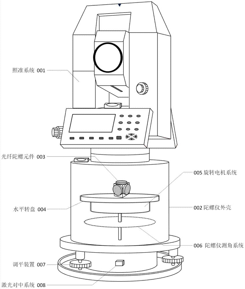
[0102] This embodiment provides a working program flow of a fiber optic gyro earth rotation parameter measuring instrument, such as Figure 6 shown, including the following basic steps:
[0103] 1. Set up the instrument:
[0104] Place the instrument at one of the stations of a known survey line, and place a reflective prism at the other station; connect the power supply of the gyroscope, turn on the switch of the laser transmitter 24, and move the instrument until the laser beam of the laser transmitter 24 shoots to the station. Logo; adjust the foot screw 22 to center the air bubble in the gyroscope vial 5. The operation of centering and adjusting the foot screw 22 is repeated repeatedly until the instrument is accurately centered and leveled. Insert the gyroscope cable into the power cable interface 19, turn on the external power switch to provide power for the instrument; start the gyroscope, at this time the gyroscope angle measuring system 006 will automatically judge ...
PUM
 Abstract
Description
Claims
Application Information
 - R&D
- Intellectual Property
- Life Sciences
- Materials
- Tech Scout
- Unparalleled Data Quality
- Higher Quality Content
- 60% Fewer Hallucinations
Browse by: Latest US Patents, China's latest patents, Technical Efficacy Thesaurus, Application Domain, Technology Topic, Popular Technical Reports.
© 2025 PatSnap. All rights reserved.Legal|Privacy policy|Modern Slavery Act Transparency Statement|Sitemap|About US| Contact US: help@patsnap.com


