Inversion method for soil water content of vegetation coverage land surface based on multi-polarization RADARSAT-2 and Landsat8 data

A soil water content and vegetation coverage technology, which is applied in the field of information extraction of vegetation coverage surface soil moisture content, can solve problems such as low accuracy, insufficient research on vegetation coverage surface soil moisture content inversion methods, and single area.

Active Publication Date: 2016-04-27
INST OF REMOTE SENSING & DIGITAL EARTH CHINESE ACADEMY OF SCI
View PDF4 Cites 8 Cited by
  • Summary
  • Abstract
  • Description
  • Claims
  • Application Information

AI Technical Summary

Problems solved by technology

[0008] Aiming at the problems of single data source, single area, and single model of vegetation-covered surface soil water content inversion methods, insufficient research and low precision, the present invention combines multiple data sources, multiple areas, and multiple models to establish a multi-polarization-based RADARSAT Retrieval Method of Vegetation Covered Surface Soil Moisture Content Based on -2 and Landsat8 Data

Method used


Image

  • Inversion method for soil water content of vegetation coverage land surface based on multi-polarization RADARSAT-2 and Landsat8 data
  • Inversion method for soil water content of vegetation coverage land surface based on multi-polarization RADARSAT-2 and Landsat8 data
  • Inversion method for soil water content of vegetation coverage land surface based on multi-polarization RADARSAT-2 and Landsat8 data

Examples


Embodiment Construction

[0029] The present invention "a method for retrieving moisture content of vegetation-covered surface soil based on multi-polarization RADARSAT-2 and Landsat8 data" will be further elaborated below in conjunction with the accompanying drawings.

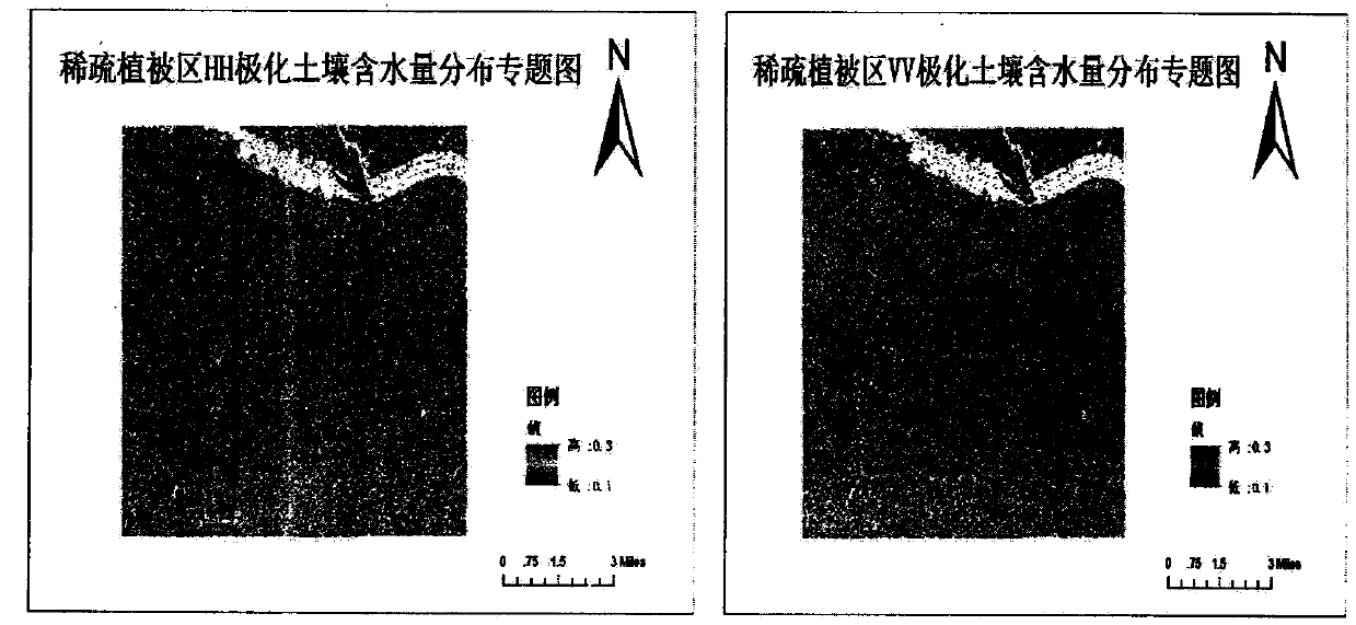
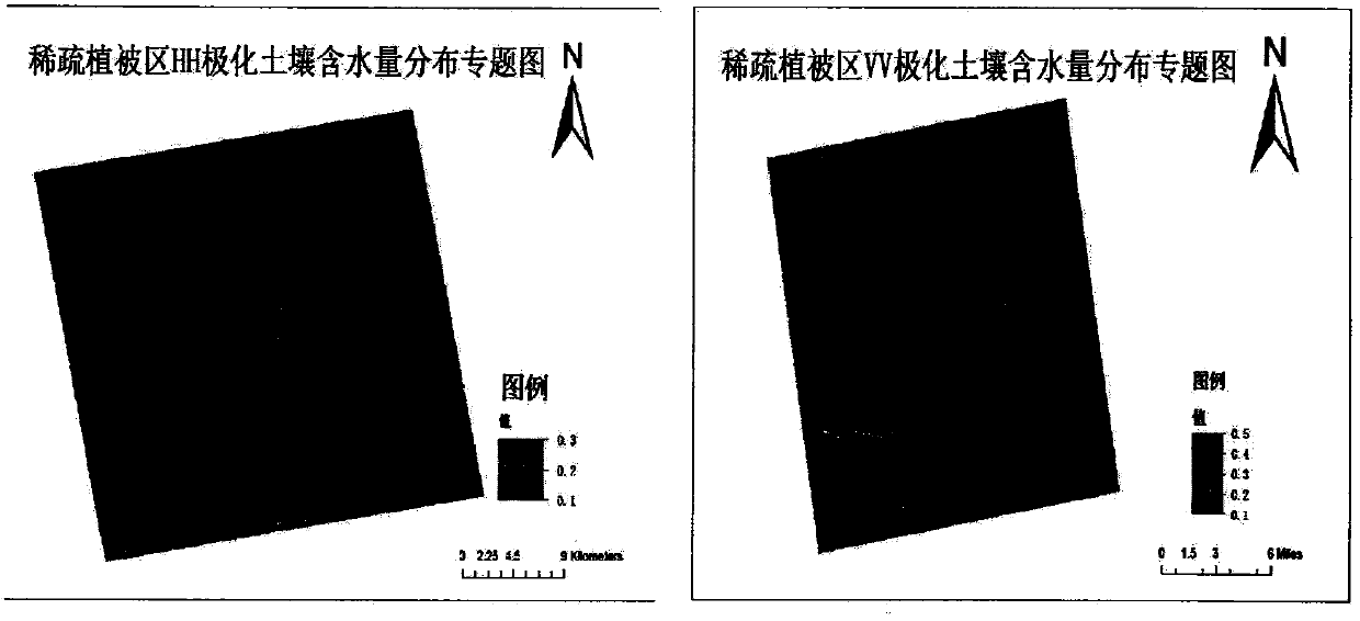
[0030] "Bare soil area soil water content inversion method based on RADARSAT-2 image", "optimal water index canopy water content inversion method based on Landsat8 image" and "multi-polarization RADARSAT-2 The Inversion Method of Vegetation Covered Surface Soil Water Content with Landsat8 Data" is an important method innovation of soil water content. Among them, "Bare soil area soil water content inversion method based on RADARSAT-2 image", combined the IEM theoretical model with the Dubois empirical model, established a soil water content inversion method for bare soil areas, and applied it to demonstration areas in Hebei and Anhui, This method achieves the effect of multi-model combination and multi-region experiment, and at the same...


PUM


Abstract

The invention discloses an inversion method for the soil water content of a vegetation coverage land surface based on multi-polarization RADARSAT-2 and Landsat8 data. The method comprises the following steps that 1) a relation model among the backward scattering coefficient co-polarization difference, the backward scattering coefficient co-polarization sum, the land surface roughness and the soil water content is established based on an IEM model; 2) a relation model between backward scattering coefficient co-polarization data and the soil water content of a bare earth area is established based on a Dubois model and the step 1); 3) based on a PROSAIL radiation transfer model, a relation model between NDVI, NDWI1, NDWI2 and MSI and the vegetation canopy in the whole growth period (including the initial stage, the mid stage and the last stage) of corns and the initial stage of winter wheat is established, and a striograph of the vegetation water content is drawn; and 4) the inversion method for the soil water content of the vegetation coverage land surface is established by combining a soil water content semi-empirical model of the bare earth area with the vegetation water content model. The method can be used to further improve the inversion precision of the soil water content via multi-source data cooperation, multi-model fusion and multi-area test.

Description

technical field [0001] The invention relates to a method for extracting vegetation-covered surface soil water content information based on multi-polarization RADARSAT-2 and Landsat8 data, in particular to a method for large-area detection of soil water content using radar and multispectral satellite data. Background technique [0002] Surface soil moisture is an important factor in the process of energy exchange between land and the atmosphere. It is the link between surface water and groundwater. It is also an important indicator for drought monitoring and crop yield estimation. Excessive surface soil moisture will have a serious impact on agriculture. It is the most concerned issue in people's life. [0003] As a new type of earth observation technology, remote sensing has the advantages of large-area synchronous coverage, real-time continuous, cost-effective and so on. Multi-source remote sensing data such as radar satellite sensors (such as RADARSAT-2) and optical senso...

Claims


Application Information

Patent Timeline
Patent Type & Authority Applications(China)
IPC IPC(8): G01S7/41
CPCG01S7/41
Inventor 孟庆岩谢秋霞马建新王春梅
Owner INST OF REMOTE SENSING & DIGITAL EARTH CHINESE ACADEMY OF SCI
Why Eureka
Try Eureka