3D Geological Modeling Method for Linear Engineering
A three-dimensional geological and modeling method technology, applied in the field of geological modeling, can solve the problems of large manual interaction workload, unable to meet the needs of large-scale engineering applications, etc., and achieves small human-computer interaction workload, rapid reconstruction, Targeted effect
- Summary
- Abstract
- Description
- Claims
- Application Information
AI Technical Summary
Problems solved by technology
Method used
Image
Examples
Embodiment Construction
[0028] In order to further understand the invention content, characteristics and effects of the present invention, the following examples are given, and detailed descriptions are as follows in conjunction with the accompanying drawings:
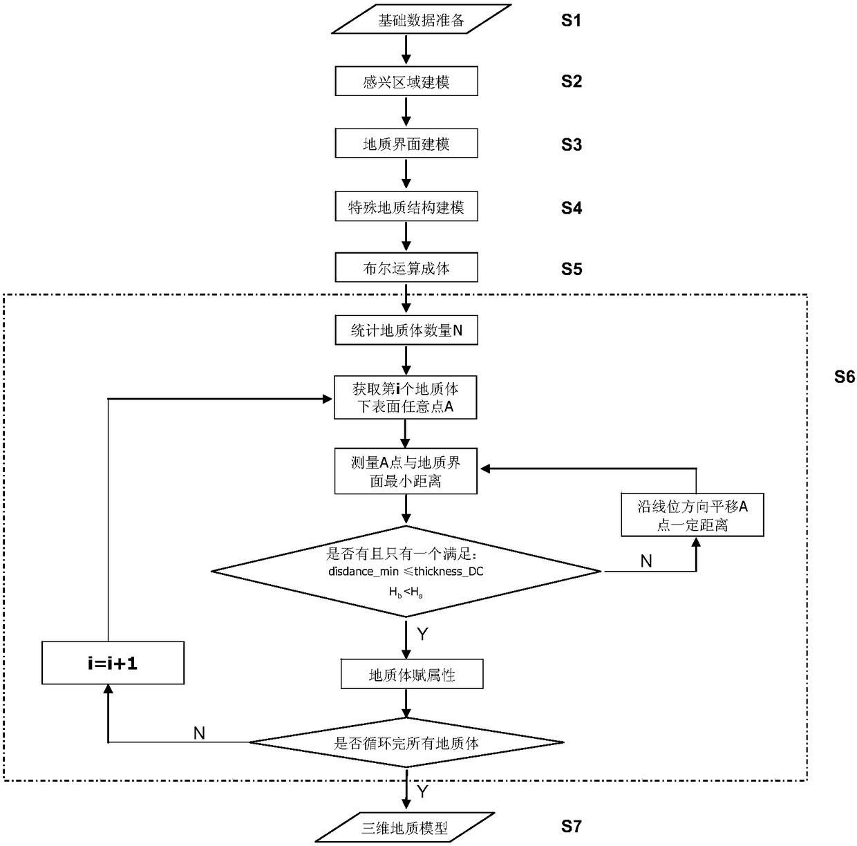
[0029] see figure 1 with figure 2 , a linear engineering three-dimensional geological modeling method, comprising the following steps:
[0030] S1: basic data preparation;
[0031] The boundary lines of each stratum can be obtained through electronic longitudinal (transverse) sections, engineering geological plans, engineering geological data backup databases, digital paper sections, etc. Each stratum boundary line is composed of data points, including the three-dimensional coordinates (x, y, z) of the data points, and the topological attribute information of the data line (stratum attribute information: layer number, geological age, geological origin, stratum name, weathering degree, etc.).
[0032] In addition, the topographic surface a...
PUM
 Abstract
Description
Claims
Application Information
 - R&D
- Intellectual Property
- Life Sciences
- Materials
- Tech Scout
- Unparalleled Data Quality
- Higher Quality Content
- 60% Fewer Hallucinations
Browse by: Latest US Patents, China's latest patents, Technical Efficacy Thesaurus, Application Domain, Technology Topic, Popular Technical Reports.
© 2025 PatSnap. All rights reserved.Legal|Privacy policy|Modern Slavery Act Transparency Statement|Sitemap|About US| Contact US: help@patsnap.com


