Fusion method and device of multisource sea surface wind field

A technology of sea surface wind field and fusion method, applied in special data processing applications, instruments, electrical digital data processing, etc. Problems such as uneven distribution of unit space

Active Publication Date: 2016-09-28
NAT SATELLITE OCEAN APPL SERVICE +1
View PDF4 Cites 32 Cited by
  • Summary
  • Abstract
  • Description
  • Claims
  • Application Information

AI Technical Summary

Problems solved by technology

[0004] Based on the above-mentioned satellite remote sensing method, at present, a single satellite is used to observe the sea surface wind vector (or sea surface wind speed), and with the continuous advancement of science and technology, it is necessary to further understand the atmospheric coupling system and develop numerical weather prediction and ocean forecasting for the sea surface wind field. Observational accuracy and spatial-temporal resolution of observational data put forward higher and higher requirements. Some applications require temporal resolution and spatial resolution to reach 6h and 50km respectively.
Taking the HY-2 satellite scatterometer data product as an example, although its L2B-level wind field product can provide fine-grained features of the ocean and atmosphere in small and medium scales, the sea surface wind field data product is stored according to orbit, and the spatial distribution of wind vector units is uneven, The observation area is not fixed every day, and the number of transits in the middle and low latitude regions is usually twice a day, and it takes about 3 days to cover the whole world once. Its single-satellite data cannot meet the needs of sea surface wind field observation with high temporal and spatial resolution
[0005] The inventor found in the research that relying on the observation data of a single satellite in the prior art can no longer meet the high requirements of high observation accuracy and high temporal and spatial resolution

Method used


Image

  • Fusion method and device of multisource sea surface wind field
  • Fusion method and device of multisource sea surface wind field
  • Fusion method and device of multisource sea surface wind field

Examples


Embodiment Construction

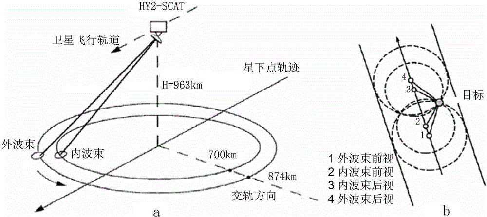
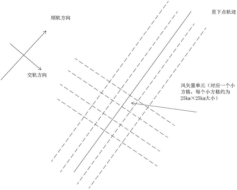
[0055] In order to make the purpose, technical solutions and advantages of the embodiments of the present invention clearer, the technical solutions in the embodiments of the present invention will be clearly and completely described below in conjunction with the drawings in the embodiments of the present invention. Obviously, the described embodiments are only It is a part of embodiments of the present invention, but not all embodiments. The components of the embodiments of the invention generally described and illustrated in the figures herein may be arranged and designed in a variety of different configurations. Accordingly, the following detailed description of the embodiments of the invention provided in the accompanying drawings is not intended to limit the scope of the claimed invention, but merely represents selected embodiments of the invention. Based on the embodiments of the present invention, all other embodiments obtained by those skilled in the art without making...


PUM


Abstract

The invention provides a fusion method and device of a multisource sea surface wind field. The fusion method comprises the following steps: obtaining multisource sea surface wind field data which comprises sea surface wind field data and/ or multiple pieces of reanalysis meteorological sea surface wind field data collected by a plurality of satellite borne microwave remote sensors; according to a preset temporal-spatial resolution, independently carrying out meshing processing on the sea surface wind field data obtained by each satellite borne microwave remote sensor to obtain multiple pieces of corresponding sea surface wind field data with the equal longitude and latitude; and utilizing a temporal-spatial interpolation algorithm to carry out interpolation calculation on all sea surface wind field data with the equal longitude and latitude to obtain fusion sea surface wind field data. The fusion method can perform the advantage of the cooperative observation of a multisource satellite, can effectively improve the coverage range and the temporal-spatial resolution of the sea surface wind field data through the fusion sea surface wind field data constructed by the fusion of satellite remote sensing wind field data and/ or reanalysis meteorological sea surface wind field data on a premise that meso-and micro-scale characteristic information can be kept, and can better meet the requirements of numerical weather prediction, marine forecasting research and marine meso-and micro-scale system research.

Description

technical field [0001] The invention relates to the technical field of marine microwave remote sensing, in particular to a fusion method and device for multi-source sea surface wind fields. Background technique [0002] The ocean surface wind vector is an active factor affecting ocean waves, ocean currents, and water masses, and a basic parameter of ocean dynamics. It is of great value in improving the accuracy of global atmospheric and ocean dynamics forecast models. At the same time, the sea surface wind vector is also the main factor affecting navigation, sea operations, fishery production, etc. Mastering the sea surface wind field is the key to optimizing routes, ensuring routes, avoiding typhoons, and searching and rescue work. Therefore, the observation of sea surface wind vectors is of great significance . [0003] Satellite remote sensing has become the main means of global wind vector observation due to the advantages of large-area synchronous measurement, fast acq...

Claims


Application Information

Patent Timeline
Patent Type & Authority Applications(China)
IPC IPC(8): G06F19/00
CPCG16Z99/00
Inventor 邹巨洪林明森邹斌吴志峰郭茂华崔松雪
Owner NAT SATELLITE OCEAN APPL SERVICE
Why Eureka
Try Eureka