
Method and system for realizing robot row identification and guiding based on laser radar detection

A technology of laser radar and robot, which is applied in the direction of control/adjustment system, instrument, two-dimensional position/channel control, etc. It can solve the problems of inability to provide obstacle distance information, no identification signs, complex unstructured road environment, etc.

Inactive Publication Date: 2016-12-21
UNIV OF JINAN
View PDF3 Cites 14 Cited by
  • Summary
  • Abstract
  • Description
  • Claims
  • Application Information

AI Technical Summary

Problems solved by technology

However, the unstructured road environment is relatively complex, and there is no specific identification mark, and it is impossible to provide accurate distance information of obstacles
Therefore, machine vision becomes powerless to detect obstacles and identify paths in unstructured roads

Method used


Image

  • Method and system for realizing robot row identification and guiding based on laser radar detection
  • Method and system for realizing robot row identification and guiding based on laser radar detection
  • Method and system for realizing robot row identification and guiding based on laser radar detection

Examples


Embodiment Construction

[0070] The present invention will be further described below in conjunction with the accompanying drawings and embodiments.

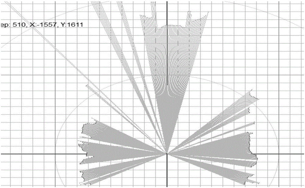
[0071] As a prerequisite for environmental perception, lidar ranging detects a distance value at a certain angle, and the collected environmental information is expressed in polar coordinates. The collected ridgeline environmental information is represented in the Cartesian coordinate system as figure 1 shown. With the help of lidar sensors for local path planning, based on lidar data acquisition and processing flow chart as shown in figure 2 shown.

[0072] The invention adopts the laser radar to collect the surrounding environment information. After the hardware is connected and the power is turned on, the lidar first completes the initialization process, and then the controller periodically sends instructions to the lidar to obtain the data collected by the lidar; in order to improve the efficiency of data transmission, a transmission protocol is...


PUM


Abstract

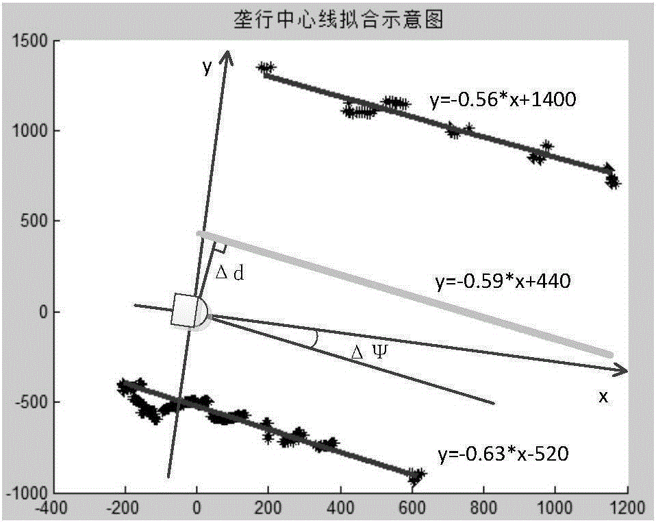
The invention discloses a method and system for realizing robot row identification and guidance based on laser radar detection. The steps are: the laser radar carried by the robot collects the distance and polar angle from the left and right sides of the row to the plant protection robot; sets a critical value and uses extreme value filtering method to remove the interference information in the collected distance; carry out coordinate transformation, and transform the polar coordinates into rectangular coordinates; The classification data is used to fit straight lines to the envelopes on the left and right sides of the row, and the equations of the straight lines on both sides of the row are obtained; the center line fitting of the borders on both sides: according to the acquired straight line equations on both sides of the row, the equations of the two sides of the row are fitted. The linear equation of the row center line; using the row center line as the navigation line, calculate the course deviation and trajectory deviation of the robot; realize the guidance of the robot row recognition through the course deviation and trajectory deviation. The path identification method of the present invention is relatively simple and efficient.

Description

technical field [0001] The invention relates to a method and system for realizing robot row recognition and guidance based on laser radar detection. Background technique [0002] The traditional and more classic way of path recognition is to use machine vision, and the recognition of obstacles by machine vision is based on the feature recognition method. However, the unstructured road environment is relatively complex, and there is no specific identification mark, so it cannot provide accurate distance information of obstacles. Therefore, machine vision becomes powerless to detect obstacles and identify paths in unstructured roads. Contents of the invention [0003] The object of the present invention is to solve the above-mentioned problems, and provide a method and system for realizing robot row recognition and guidance based on laser radar detection. It uses laser radar to collect row environment information, and after decoding, filtering, coordinate transformation, bo...

Claims


Application Information

Patent Timeline
IPC IPC(8): G05D1/02
CPCG05D1/0257G05D1/0231
Inventor 艾长胜张永泽武德林杨林浩张尉
Owner UNIV OF JINAN
Learn More