Airborne SAR real-time imaging method

A real-time imaging and azimuth technology, applied in radio wave reflection/re-radiation, using re-radiation, measurement devices, etc., can solve the problem of image defocusing in imaging processing, and achieve low processor delay and high imaging processing quality Effect

Active Publication Date: 2017-05-31
INST OF ELECTRONICS CHINESE ACAD OF SCI
View PDF6 Cites 16 Cited by
  • Summary
  • Abstract
  • Description
  • Claims
  • Application Information

AI Technical Summary

Problems solved by technology

Due to the disturbance of the atmosphere, the actual flight of the airborne SAR platform often has a certain deviation from the ideal route, which causes the image defocus of the imaging process. The aircraft motion error is the main source of the phase error of the echo data.

Method used


Image

  • Airborne SAR real-time imaging method
  • Airborne SAR real-time imaging method
  • Airborne SAR real-time imaging method

Examples


Embodiment Construction

[0049] In order to make the object, technical solution and advantages of the present invention clearer, the present invention will be further described in detail below in conjunction with specific embodiments and with reference to the accompanying drawings.

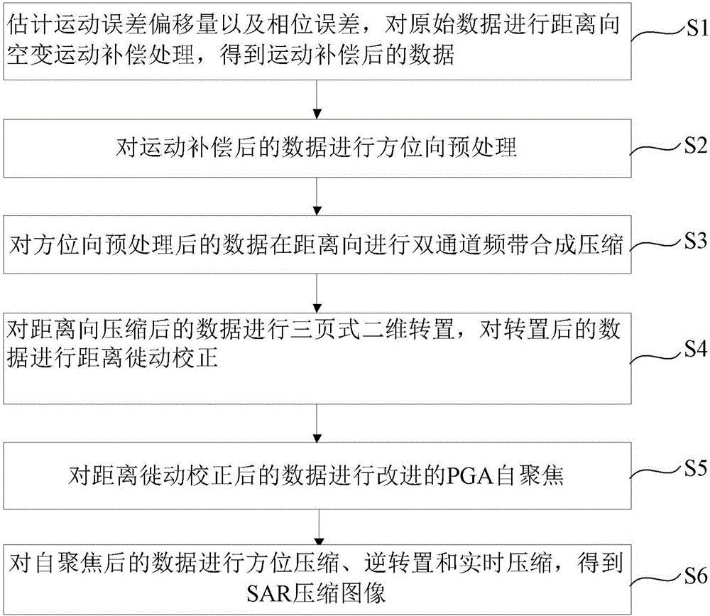
[0050] An embodiment of the present invention provides an airborne SAR real-time imaging method, see figure 1 , the method includes:

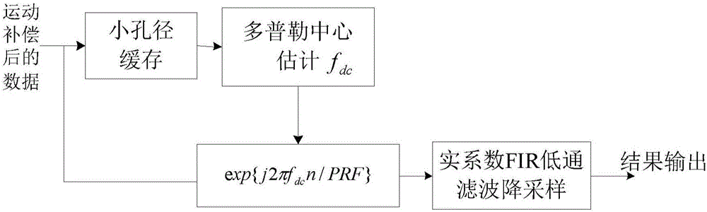
[0051] Step S1: Estimate the motion error offset and phase error, perform range-space-varying motion compensation processing on the original data, and obtain motion-compensated data.

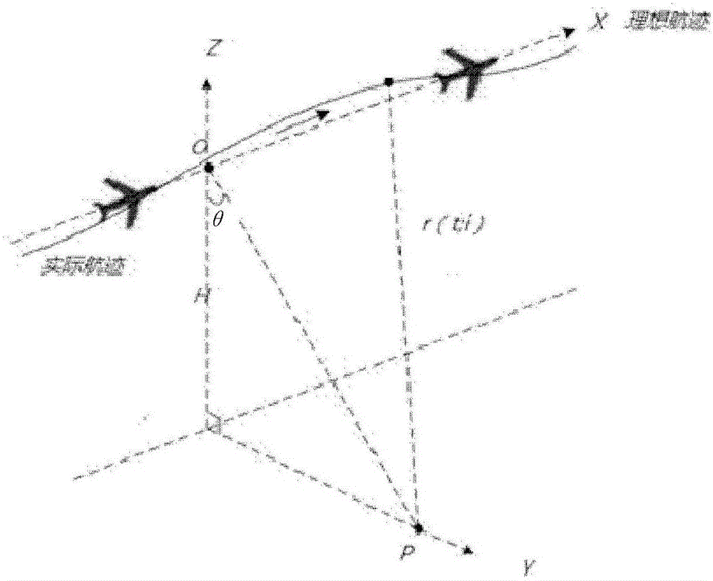
[0052] In this step, firstly, according to the inertial navigation parameters measured by the airborne inertial navigation system, the pulse repetition frequency and the downward viewing angle of different distance units, the motion error offset of the actual track relative to the ideal track is obtained, and the motion error offset The phase error of the echo signal is obtained by measuring the phase error...


PUM


Abstract

The invention discloses an airborne SAR real-time imaging method. The airborne SAR real-time imaging method comprises the following steps: estimating kinematic error offset and phase error, and executing the range direction space-variant motion compensation processing to the original data so as to obtain the data after the motion compensation; executing the orientation direction pre-processing to the data after the motion compensation; executing the two-channel frequency band synthesis compressing to the data after the orientation direction pre-processing in the range direction; executing the three-page two-dimensional transposition to the data after the range direction compressing, and executing the range migration correction to the data after the transposition; and executing the improved PGA self-focusing to the data after the range migration correction; and executing the orientation compressing, reverse transposition and real-time compressing to the data after the self-focusing, to obtain the SAR compressing image. The method is suitable for an airborne SAR range direction two-channel frequency band synthesized real-time imaging processor, and has the higher image processing quality and lower processor time delay.

Description

technical field [0001] The invention relates to the technical field of airborne radar imaging, in particular to an airborne synthetic aperture radar (Synthetic Aperture Radar, SAR for short) real-time imaging method. Background technique [0002] SAR is a microwave imaging system that can work all-weather and all-day, and can provide large-scale and high-resolution radar images of the target observation area. Widely used in land and resources survey, crop monitoring, flood, earthquake and other disaster monitoring, as well as national defense and many other fields. Due to the disturbance of the atmosphere, the actual flight of the airborne SAR platform often has a certain deviation from the ideal route, resulting in defocusing of the image processed by the imaging process. The aircraft motion error is the main source of the phase error of the echo data. How to obtain high-quality images quickly is an important problem that needs to be solved urgently in real-time airborne S...

Claims


Application Information

Patent Timeline
Patent Type & Authority Applications(China)
IPC IPC(8): G01S13/90
CPCG01S13/90G01S13/9019
Inventor 刘碧丹刘畅王岩飞王超王琦詹学丽
Owner INST OF ELECTRONICS CHINESE ACAD OF SCI
Why Eureka
Try Eureka