Indoor positioning and navigation method based on MPU6050 and smart phone

A smart phone, indoor positioning technology, applied in the directions of surveying and mapping, navigation, navigation, ground navigation, etc., can solve the problems of decreased positioning accuracy and large cumulative error, and achieve the effects of simple structure, strong anti-interference, and short algorithm execution time.

Active Publication Date: 2017-12-19
BEIJING UNIV OF TECH
View PDF4 Cites 13 Cited by
  • Summary
  • Abstract
  • Description
  • Claims
  • Application Information

AI Technical Summary

Problems solved by technology

The advantage of this technology is that the positioning method is simple, easy to implement and cheap, but there is a cumulative error and with the increase of the pedestrian's moving distance and heading angle, the cumulative error becomes larger and leads to a decrease in positioning accuracy.

Method used


Image

  • Indoor positioning and navigation method based on MPU6050 and smart phone
  • Indoor positioning and navigation method based on MPU6050 and smart phone
  • Indoor positioning and navigation method based on MPU6050 and smart phone

Examples


Embodiment Construction

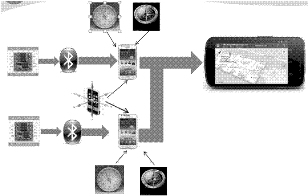
[0037] Further description will be made below in conjunction with the accompanying drawings. The overall block diagram of the navigation system of the present invention is shown in figure 1 .

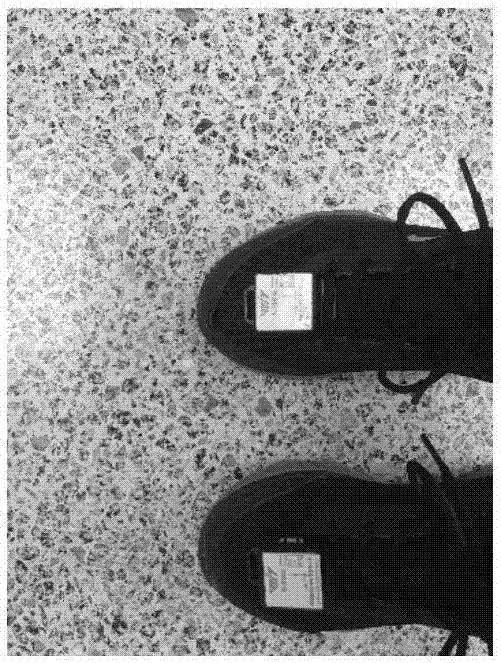
[0038] The present invention is based on the research of the indoor positioning and navigation method of the inertial device. The MPU6050 mainly transmits the data of the feet of the pedestrian and the air pressure of the pedestrian to the mobile phone through Bluetooth, and processes the data by using some algorithms to obtain the displacement of the pedestrian. information, combined with the built-in electronic compass of the mobile phone to obtain the pedestrian's heading information, and finally display the motion trajectory on the mobile phone, realizing the indoor positioning and navigation functions of pedestrians.

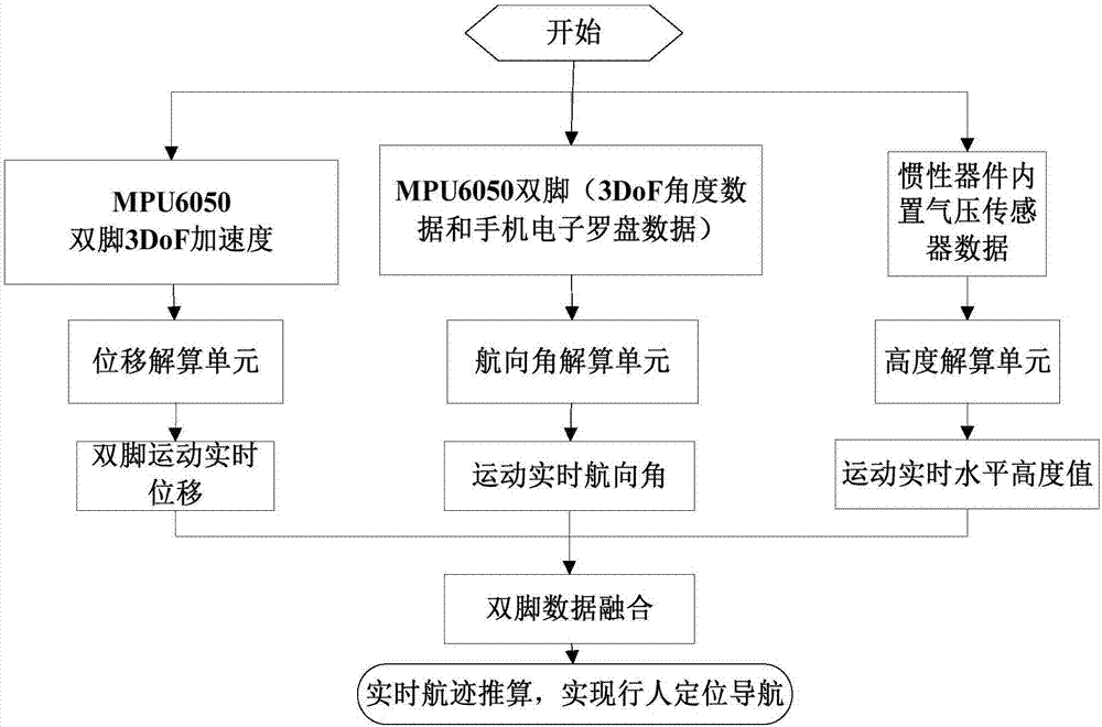
[0039] The overall flow chart of the system of the present invention is shown in figure 2. This system is mainly composed of MPU6050 data acquisition module, Blu...


PUM


Abstract

The invention provides an indoor positioning and navigation method based on a MPU6050 and a smart phone. The MPU6050 wirelessly transmits double-feet walking measurement data of a user to the smart phone through Bluetooth; the position error of an inertia device itself is reduced through a zero-bias correction algorithm, and with a modified zero velocity correction accumulated error reducing algorithm, a data collected by an acceleration sensor is subjected to time-domain integration for one time to acquire speed, and the speed is then corrected through a modified zero velocity detection method; then frequency domain integration is carried out for one time to calculate walking displacement information which is more accurate; in determination of pedestrian movement direction angle, on the basis of advantages and defects of electronic compass and gyroscope on the smart phone, sliding mean wave filtering and angle compensation aslgorithms are designed; through setting of a threshold value, a proper direction is selected, thus increasing the accuracy of the direction of a pedestrian. By fusing the data of both feet, the weight of left and right feet is obtained through training by neural network, thereby obtaining more accurate pedestrian track information and finally acquiring more accurate pedestrian position information.

Description

Technical field: [0001] The invention is an indoor positioning method for the fusion of MEMS inertial devices and Android smartphones realized by using sensor technology, bluetooth data transmission technology, computer technology, digital signal processing technology, android programming technology, etc. This method can reduce the cumulative error in the inertial navigation solution process, and obtain more accurate pedestrian displacement information and heading angle information. Background technique: [0002] Indoor is the place with the most intensive human activities, so the research on indoor location-based services is of great significance. Due to the characteristics of multipath, non-line-of-sight, and complex and changeable indoor environments, GPS and other widely used outdoor positioning technologies cannot be applied indoors. Indoor positioning and navigation technology based on MEMS inertial sensors has become the focus of indoor positioning technology researc...

Claims


Application Information

Patent Timeline
Patent Type & Authority Applications(China)
IPC IPC(8): G01C21/20G01C21/16G01C21/18G01C21/08G01C21/00G01C25/00
CPCG01C21/005G01C21/08G01C21/165G01C21/18G01C21/206G01C25/00G01C25/005
Inventor 张会清寇彩云王普
Owner BEIJING UNIV OF TECH
Why Eureka
Try Eureka