Simulated data generation method and system for distributed POS (Position and Orientation System) transfer alignment
A technology for transmitting alignment and simulation data, which is applied in the field of aviation remote sensing inertial navigation system, and can solve problems that do not conform to the actual situation, do not consider the influence of position and speed, do not consider, etc.
- Summary
- Abstract
- Description
- Claims
- Application Information
AI Technical Summary
Problems solved by technology
Method used
Image
Examples
Embodiment approach
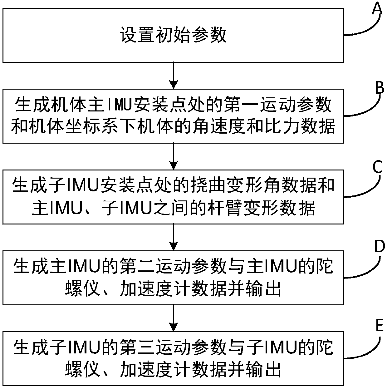
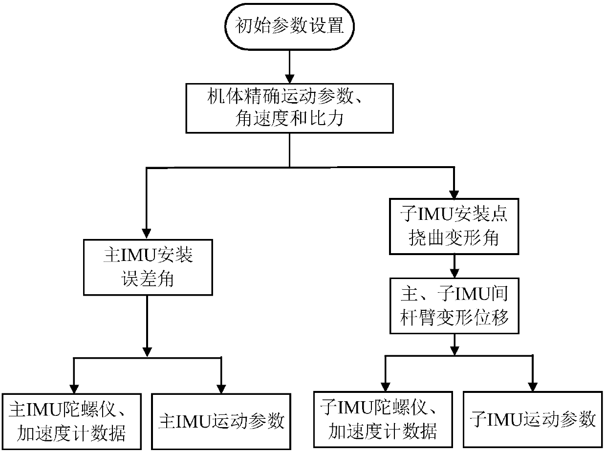
[0192] Preferably, as a preferred embodiment, the method may specifically include the steps of:
[0193] 1. Parameter settings, including distributed POS device parameter settings, trajectory parameter settings and deflection parameter settings; specific parameter settings are as follows:
[0194] 1) Device parameter setting
[0195] The coordinate system used is defined as follows:
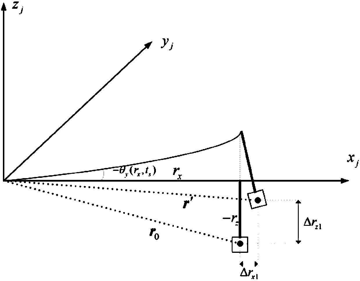
[0196] Note that i is the geocentric inertial coordinate system; e is the earth coordinate system; the navigation coordinate system is the northeast sky geographic coordinate system, n represents the real navigation coordinate system, n′ 主 Indicates the main IMU calculation navigation coordinate system; the origin of the carrier coordinate system is the center of gravity of the carrier, the x-axis is along the horizontal axis of the carrier to the right, the y-axis is forward along the longitudinal axis of the carrier, and the z-axis is upward along the vertical axis of the carrier. This coordin...
PUM
 Abstract
Description
Claims
Application Information
 - R&D
- Intellectual Property
- Life Sciences
- Materials
- Tech Scout
- Unparalleled Data Quality
- Higher Quality Content
- 60% Fewer Hallucinations
Browse by: Latest US Patents, China's latest patents, Technical Efficacy Thesaurus, Application Domain, Technology Topic, Popular Technical Reports.
© 2025 PatSnap. All rights reserved.Legal|Privacy policy|Modern Slavery Act Transparency Statement|Sitemap|About US| Contact US: help@patsnap.com


