Chlorophyll calculating method based on remote-sensing images and water ecological model
A technology of remote sensing images and calculation methods, applied in the field of chlorophyll calculation, can solve the problems of inability to timely and effectively predict the risk of water body algal blooms, lack of algae growth mechanism, etc.
- Summary
- Abstract
- Description
- Claims
- Application Information
AI Technical Summary
Problems solved by technology
Method used
Image
Examples
Embodiment Construction
[0087] The technical solutions of the present invention will be further described below in conjunction with the accompanying drawings and embodiments.
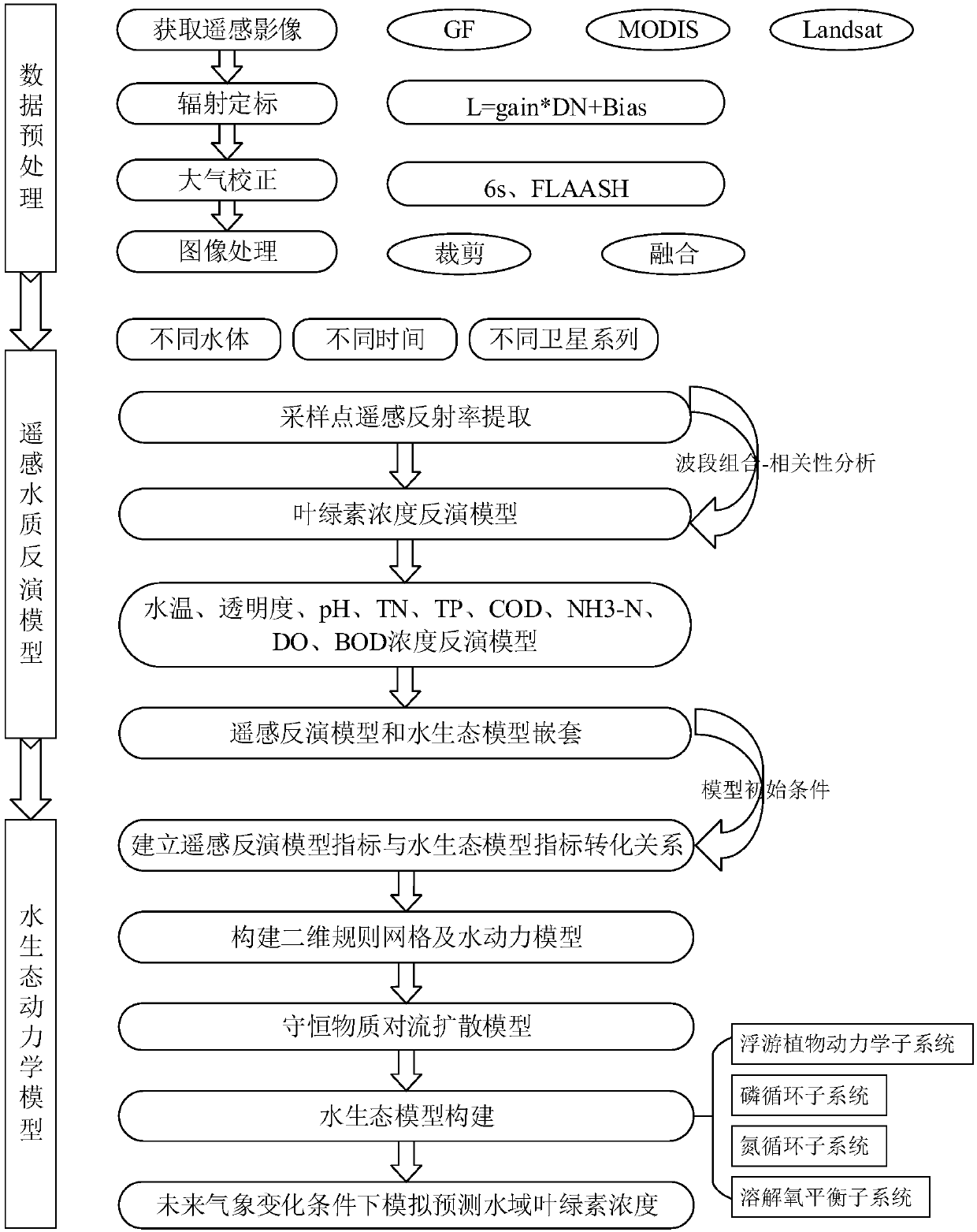
[0088] Such as figure 1 It is a flowchart of a method for calculating chlorophyll based on remote sensing images and water ecological models according to an embodiment of the present invention, and specifically includes the following steps:
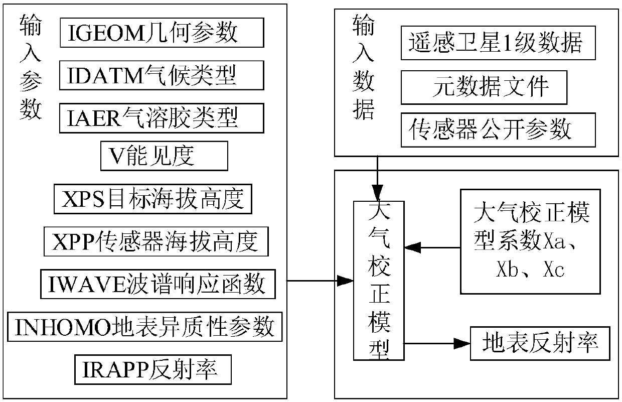
[0089] Step 1, remote sensing image data preprocessing, applicable to GF, Landsat, MODIS and other satellite image data: including radiometric calibration, atmospheric correction, image cropping and fusion and other processes.
[0090] Step 1-1, first perform radiation calibration: the purpose is to eliminate the error generated by the sensor itself, and convert the dimensionless DN value recorded by the sensor into the radiance or reflectance of the top layer of the atmosphere with actual physical meaning. The specific calculation formula is:
[0091] L=Gain*DN+Bias
[0092] Where: L i...
PUM
 Abstract
Description
Claims
Application Information
 - R&D
- Intellectual Property
- Life Sciences
- Materials
- Tech Scout
- Unparalleled Data Quality
- Higher Quality Content
- 60% Fewer Hallucinations
Browse by: Latest US Patents, China's latest patents, Technical Efficacy Thesaurus, Application Domain, Technology Topic, Popular Technical Reports.
© 2025 PatSnap. All rights reserved.Legal|Privacy policy|Modern Slavery Act Transparency Statement|Sitemap|About US| Contact US: help@patsnap.com


