
Method for inverting effective leaf area indexes of man-made forest by UAV lidar

A technology of lidar and area index, which is applied in the field of forest resource investigation, can solve the problems of unseen UAV lidar point cloud features and effective leaf area index extraction, etc., so as to facilitate mechanism explanation, easy method transplantation, and increase coefficient of determination Effect

Active Publication Date: 2018-12-11
NANJING FORESTRY UNIV
View PDF8 Cites 8 Cited by
  • Summary
  • Abstract
  • Description
  • Claims
  • Application Information

AI Technical Summary

Problems solved by technology

However, the above methods all use low-density man-machine lidar data and use a single characteristic variable to estimate the effective leaf area index. No high-density UAV lidar point cloud data is applied to the effective leaf area index inversion. At the same time, There is no comprehensive and in-depth calculation of UAV lidar point cloud features and effective leaf area index extraction method

Method used


Image

  • Method for inverting effective leaf area indexes of man-made forest by UAV lidar
  • Method for inverting effective leaf area indexes of man-made forest by UAV lidar
  • Method for inverting effective leaf area indexes of man-made forest by UAV lidar

Examples


Embodiment 1

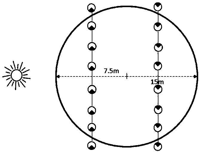
[0042] The implementation site of this embodiment is located in Tiefu Town, Pizhou City, northern Jiangsu Province. Its geographic location is 34°33′49″-34°34′23″ north latitude and 118°05′1″-118°06′06″ east longitude. It belongs to the semi-humid temperate zone monsoon climate, with an annual rainfall of about 903mm. The maximum rainfall is concentrated in the rainy season in July and August. The annual average temperature is about 13.9°C, and the frost-free period is 211 days. The main soil type is black clay soil, which is acidic. Large-scale planting of ginkgo in this area began in 1993, with a total area of ​​about 5400hm 2 .

[0043] The method for retrieving the effective leaf area index of a plantation by the unmanned aerial vehicle lidar of the present embodiment comprises the following steps:

[0044] (1) Data collection: Lidar data collection is carried out with the help of the Lidar sensor carried by the multi-rotor UAV. According to the survey data of historical f...


PUM


Abstract

The invention discloses a method for inverting an effective leaf area indexes of man-made forest by a UAV (Unmanned Aerial Vehicle) lidar, and belongs to the forest resource survey, forest site quality assessment and forest productivity estimation research field. The method for inverting the effective leaf area indexes of man-made forest by the UAV lidar normalizes the original point cloud data ofthe UAV lidar, extracts canopy structure characteristic variables from the normalized point cloud data, combines the ground actual measured data and the extracted characteristic variables, and estimates the effective leaf area index of the sample area scale in the study area based on the screened characteristic variables by means of a statistical model method. By obtaining the UAV lidar point cloud and extracting the canopy characteristic variables, by combining the ground actual measured data, the method for inverting effective leaf area indexes of man-made forest by the UAV lidar is relatively higher in efficiency and accuracy of the obtained continuously distributed effective leaf area indexes on the "face" of the specific range. Compared with other similar remote sensing methods, whenthe method for inverting effective leaf area indexes of man-made forest by the UAV lidar is used to extract the effective leaf area indexes of the man-made forest, the coefficient of determination isincreased by more than 5%.

Description

technical field [0001] The invention belongs to the research fields of forest resource investigation, forest site quality evaluation and forest productivity estimation, and more specifically relates to a method for retrieving the effective leaf area index of plantation forests by unmanned aerial vehicle laser radar. Background technique [0002] Accurate extraction of plantation effective leaf area index is of great significance for forest resources investigation, forest site quality evaluation and forest productivity estimation. Provide data support for the restoration and reconstruction of the ecological environment and the maintenance of carbon balance. The extraction of traditional plantation effective leaf area index mainly relies on direct methods and instrumental measurements. These ground measurements are time-consuming and laborious, and the efficiency is very low. The forest canopy has caused some damage, and only plot-scale information can be obtained, so it is d...

Claims


Application Information

Patent Timeline
Patent Type & Authority Applications(China)
IPC IPC(8): G01B11/28G01S13/88
CPCG01B11/28G01S13/88
Inventor 曹林吴项乾刘坤申鑫代劲松汪贵斌
Owner NANJING FORESTRY UNIV
Learn More