Method for compensating external measurement information based on SINS/DVL integrated navigation system
A technology of integrated navigation system and compensation method, which is applied in the field of external measurement information compensation based on SINS/DVL integrated navigation system, and can solve problems such as coordinate system errors
- Summary
- Abstract
- Description
- Claims
- Application Information
AI Technical Summary
Problems solved by technology
Method used
Image
Examples
Embodiment Construction
[0074] In order to make the above-mentioned purposes, features and advantages of the present invention more obvious and understandable, the present invention will be further described below in conjunction with the accompanying drawings:
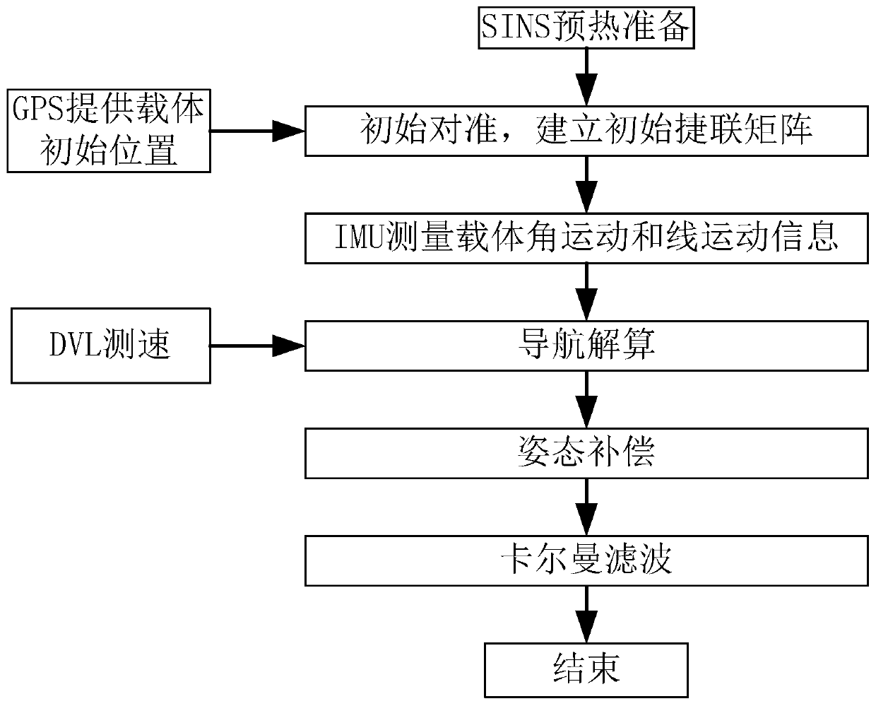
[0075] figure 1 It is a flow chart of a method for compensating external measurement information based on a SINS / DVL integrated navigation system;
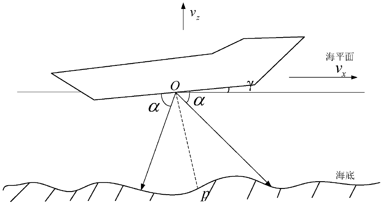
[0076] figure 2 is the schematic diagram of hull pitching;
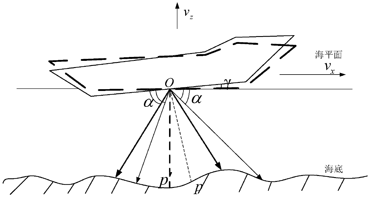
[0077] image 3 Schematic diagram of suppressing speed measurement error for attitude compensation;
[0078] Figure 4 For the Matlab simulation test of the present invention, the east direction misalignment angle error figure (simulation time 1h);
[0079] Figure 5 For the present invention's Matlab simulation test north direction misalignment angle error figure (simulation time 1h);
[0080] Figure 6 It is the Matlab simulation test direction misalignment angle error figure (simulation time 1h) of the present invention;
...
PUM
 Abstract
Description
Claims
Application Information
 - R&D
- Intellectual Property
- Life Sciences
- Materials
- Tech Scout
- Unparalleled Data Quality
- Higher Quality Content
- 60% Fewer Hallucinations
Browse by: Latest US Patents, China's latest patents, Technical Efficacy Thesaurus, Application Domain, Technology Topic, Popular Technical Reports.
© 2025 PatSnap. All rights reserved.Legal|Privacy policy|Modern Slavery Act Transparency Statement|Sitemap|About US| Contact US: help@patsnap.com


