

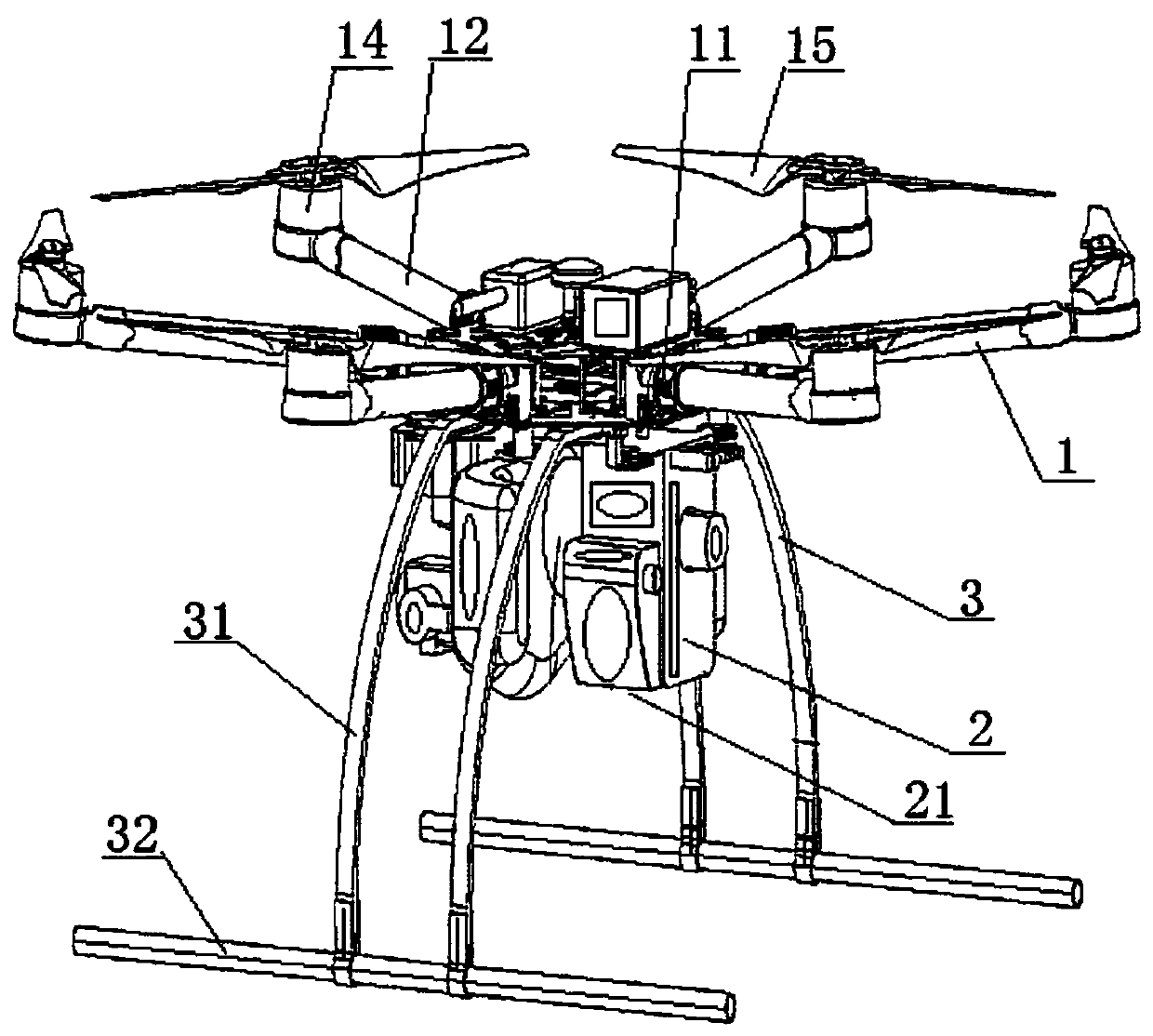
Unmanned aerial vehicle cruising and monitoring system for forest fire
A forest fire and monitoring system technology, which is applied to forest fire alarms, fire alarms, and fire alarms that rely on radiation, can solve the problems of cumbersome and difficult operation, and blindness of unmanned aerial vehicle fire monitoring path planning. Problems such as large size, old-fashioned and single cruise path design, etc.
- Summary
- Abstract
- Description
- Claims
- Application Information
AI Technical Summary
Problems solved by technology
Method used
Image

Examples
Embodiment 1
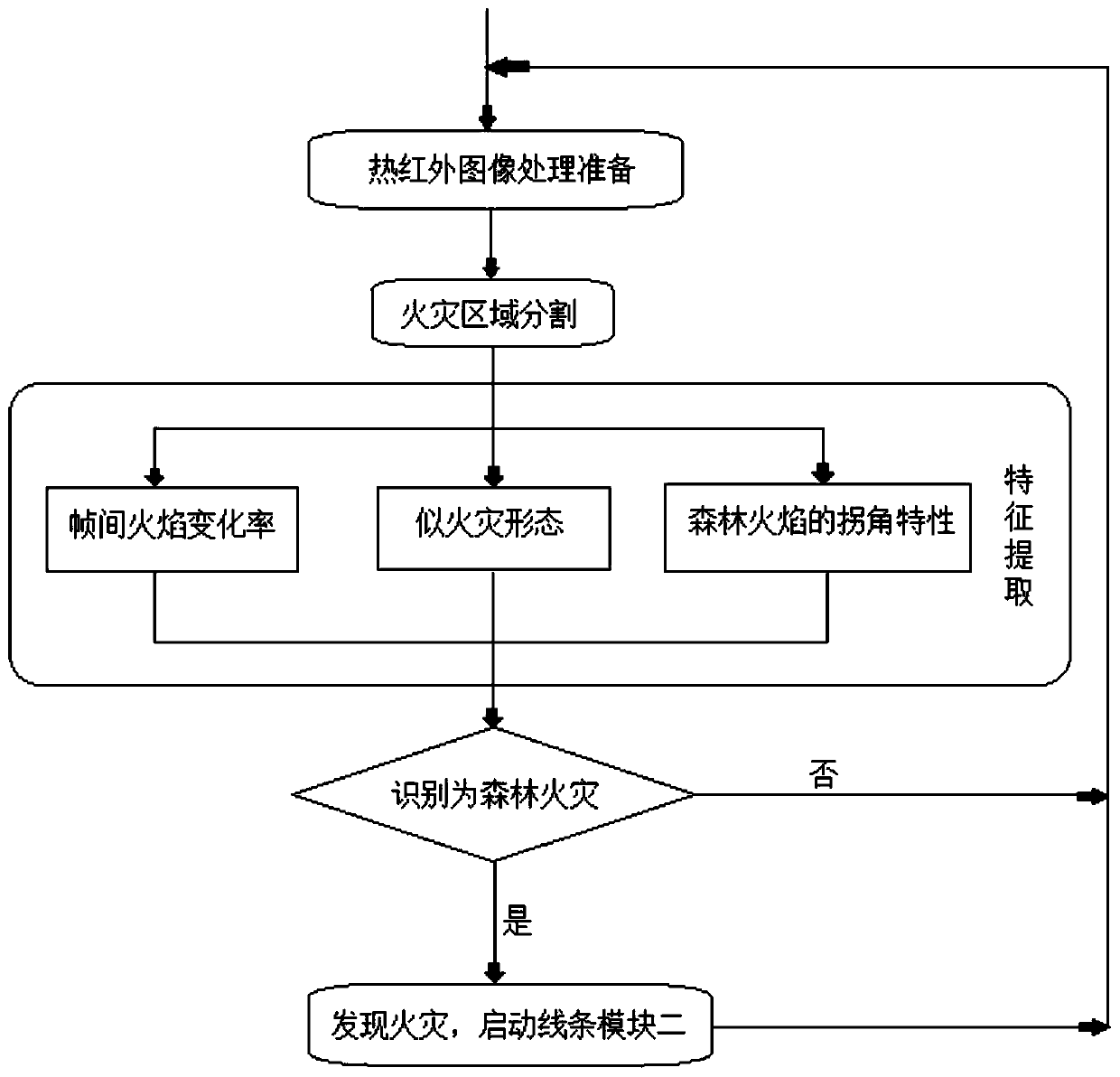
[0096] Embodiment 1: the median filtering method, the basic principle is to replace the value of a point in the digital image with the median value of each point value in a neighborhood of the point, so that the surrounding pixel values are close to the true value, and the isolated noise points are eliminated .
[0097] The median filter method is relatively mature, it is very simple to implement, the amount of calculation is small, it will not increase the burden on the airborne microcomputer system, and the image denoising effect after processing is good.
Embodiment 2
[0098] Embodiment 2: YBLFC filtering.
[0099] Firstly, Gaussian filtering is used to smooth the gray-scale converted image to overcome the sudden change caused by noise to edge detection.
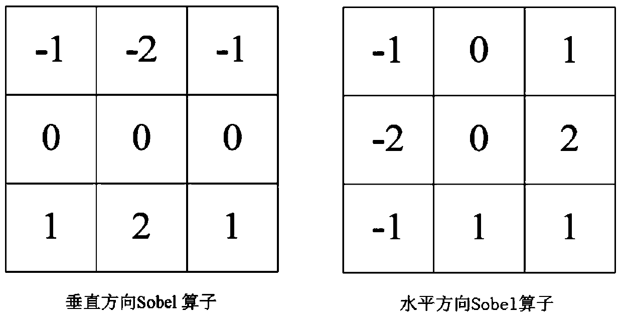
[0100] Then the Sobel operator is used to calculate the gradient of the image, and the Sobel operator used is as follows image 3 shown. image 3 It is the Sobel operator in the vertical direction and the horizontal direction, and the Sobel operator is used to obtain the vertical and horizontal direction gradient G of the image x and G y , and then perform absolute value accumulation to obtain the gradient magnitude image of the image pixel, as shown in the following formula:
[0101] Gg i,j =|Gx i,j |+|Gy i,j |
[0102] Select the corresponding image block in the gradient magnitude image for calculation, set two K×K image blocks x and y, and calculate the variance gσ of the gradient image x , gσ y and the covariance gσ xy , get the YBLFC filter equation with gradient information, ...
PUM
 Abstract
Description
Claims
Application Information