A method using an all-weather atmospheric coherence length measurement system
An atmospheric coherence length and measurement system technology, which is applied in the field of using an all-weather atmospheric coherence length measurement system to achieve the effects of small amount of transmitted data, fast centroid calculation, and simple use
- Summary
- Abstract
- Description
- Claims
- Application Information
AI Technical Summary
Problems solved by technology
Method used
Image
Examples
Embodiment 1
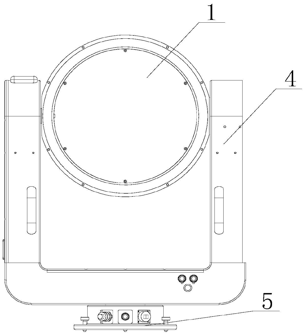
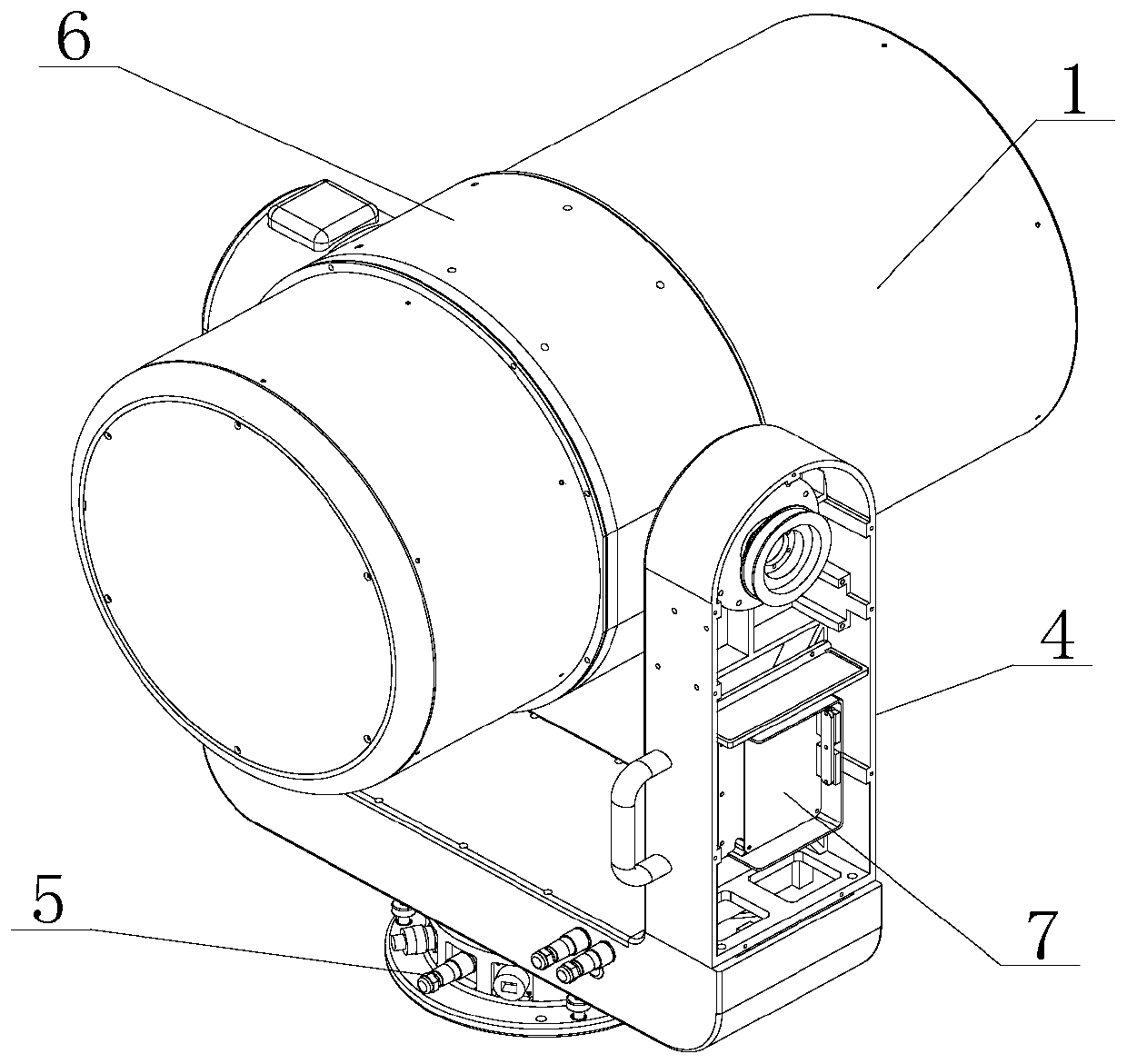
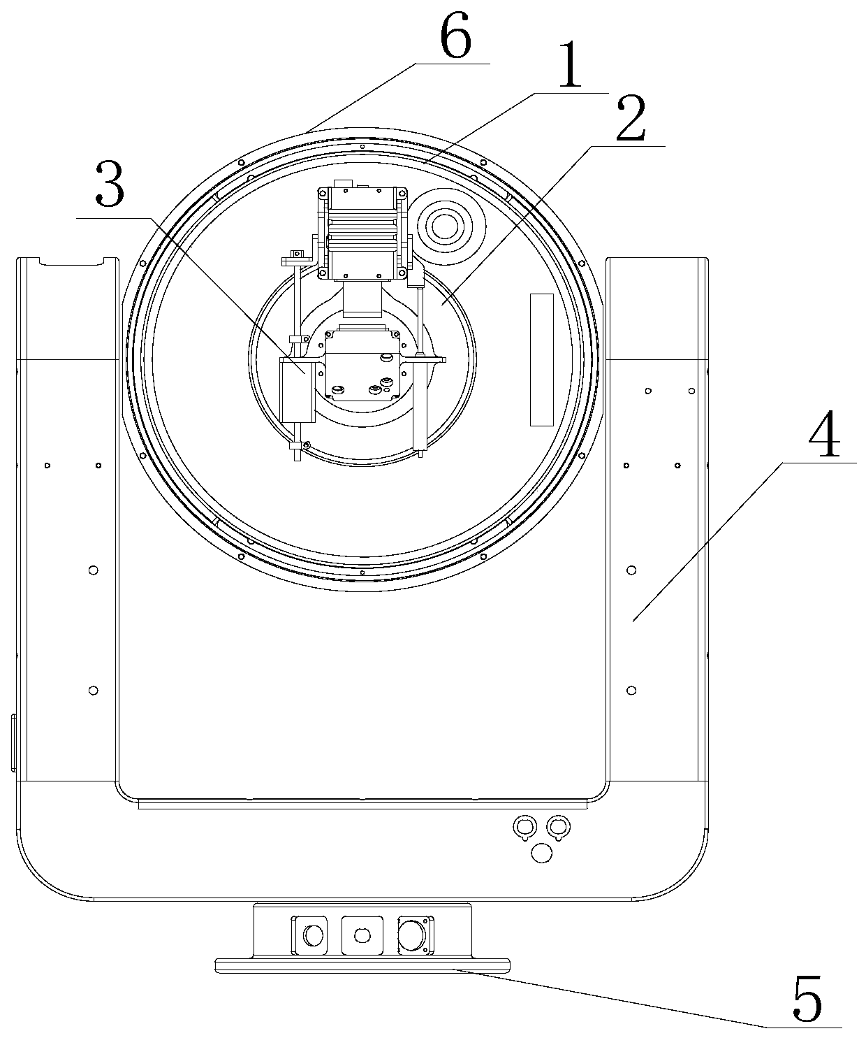
[0037] Such as Figure 1-3 As shown, an all-weather atmospheric coherence length measurement system includes an atmospheric coherence length meter, a base 5 for supporting the atmospheric coherence length meter, a drive assembly and a control module that enable the atmospheric coherence length meter to rotate horizontally and pitch relative to the base 5; The atmospheric coherence length meter includes a housing and a telescope 1, a camera 2, and a GPS measurement component arranged in the housing. The camera 2 is arranged at the imaging position of the telescope 1, and the position of the camera 2 is determined by the internal focusing mechanism 3 and the housing. Body connection; the control module is correspondingly connected with the controlled end of the drive assembly, the controlled end of the focusing mechanism 3, the data acquisition end and the data input end of the atmospheric coherence length meter. Camera 2 is a high-speed smart camera in this solution.
[0038] T...
Embodiment 2
[0040] Such as Figure 4 As shown, the method of using a kind of all-weather atmospheric coherence length measuring system described in embodiment 1 may further comprise the steps:
[0041] S1. The system is powered on, and the driving component drives the horizontal rotation angle and pitch angle of the atmospheric coherence length instrument to be 0 degrees; the control module configures the exposure parameters of camera 2 from the data input end of the atmospheric coherence length instrument to camera 2; The acquisition end obtains the GPS information of the system's location and the corresponding time information;
[0042] S2. The control module retrieves the star map information stored in the interior, and according to the GPS information and the corresponding time information, selects the star with the highest brightness within the pitch angle of the atmospheric coherence length meter from the star map information, and determines the position of the star ; To determine ...
PUM
 Abstract
Description
Claims
Application Information
 - R&D
- Intellectual Property
- Life Sciences
- Materials
- Tech Scout
- Unparalleled Data Quality
- Higher Quality Content
- 60% Fewer Hallucinations
Browse by: Latest US Patents, China's latest patents, Technical Efficacy Thesaurus, Application Domain, Technology Topic, Popular Technical Reports.
© 2025 PatSnap. All rights reserved.Legal|Privacy policy|Modern Slavery Act Transparency Statement|Sitemap|About US| Contact US: help@patsnap.com


