Mine underground positioning system and positioning method based on specific optical frequency
A positioning system and specific light technology, applied in beacon systems, measuring devices, instruments, etc. using electromagnetic waves, can solve the problems of difficult large-scale promotion and complex design algorithms, and improve user experience and human-computer interaction. Flexible, low power consumption
- Summary
- Abstract
- Description
- Claims
- Application Information
AI Technical Summary
Problems solved by technology
Method used
Image


Examples
Embodiment 1
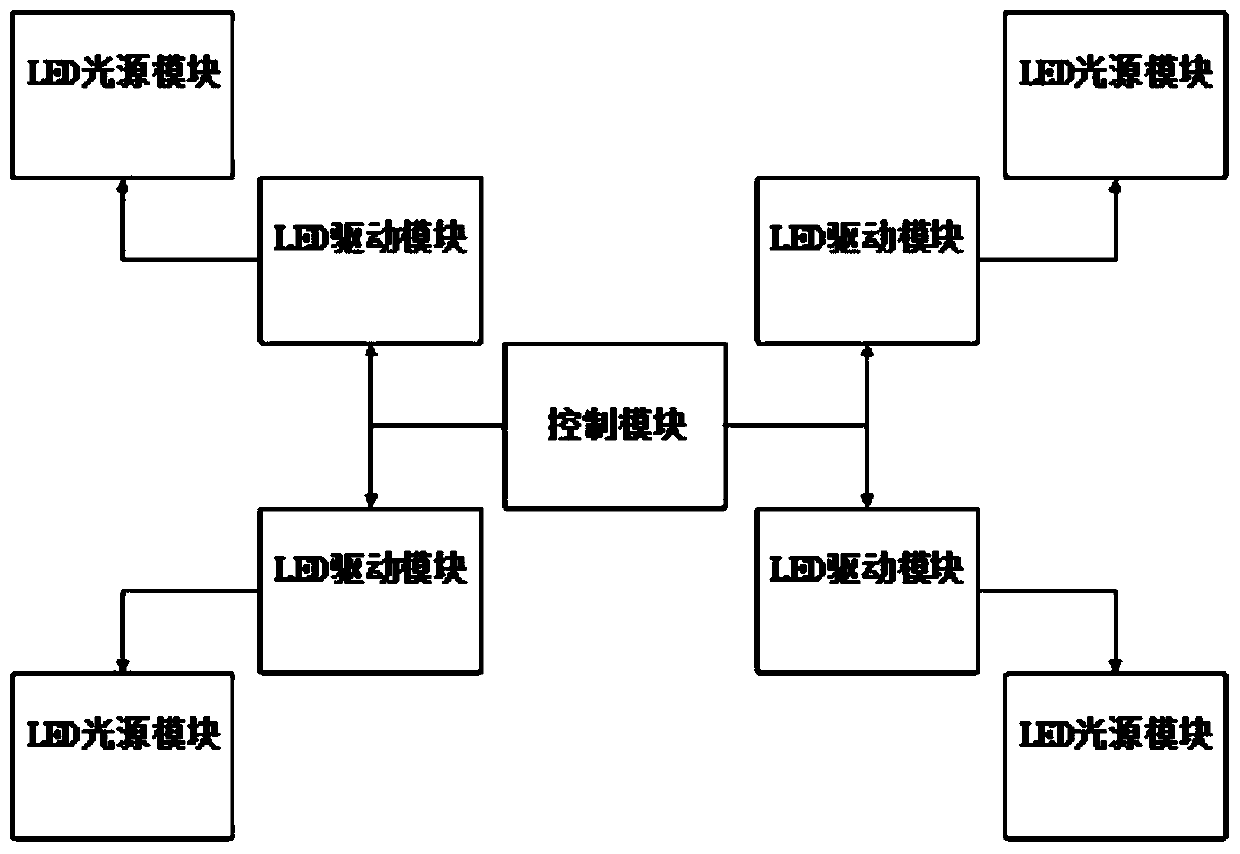
[0034] Example 1, such as figure 1 As shown, a mine positioning system based on a specific optical frequency of the present invention includes an LED light source module, a database, a mobile terminal, a server, a control module and an LED driver module;
[0035] The LED light source module is used to emit LED light source;
[0036] In an embodiment, the LED light source module adopts a 24V DC LED light source and is connected to the LED driver module.
[0037] The database is used to store the LED light source information of the LED light source module;
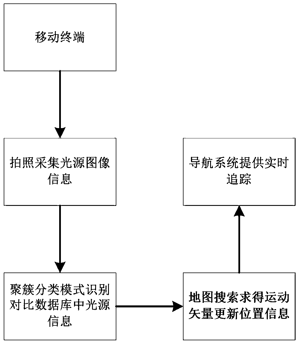
[0038] The mobile terminal includes a camera and an inertial navigation system, the camera is used to collect LED light source images and upload them to the server at the same time, and the inertial navigation system is used to realize the user's motion tracking and real-time navigation;
[0039] In an embodiment, the mobile terminal may be a mobile phone, and the inertial navigation system establishes a navigation coordin...
Embodiment 2
[0045] Embodiment 2, a mine positioning method based on a specific optical frequency, comprising the following steps:
[0046] On-line or off-line acquisition of specific optical frequency for LED light source;
[0047] For different collection frequencies, store the frequency and serial number information in the database;
[0048] Take the light source image of the LED light source and perform image processing to obtain the corresponding light frequency parameters;
[0049] Use the improved clustering method to compare the parameters with the information in the database to obtain the light frequency information of the light source at the position to be measured;
[0050] Compare the corresponding relationship between the optical frequency information and the map information in the database, and return the exact location information to the user.
[0051] In the embodiment, when the user moves, the image search method is used to obtain the motion vector estimation, and the mo...
Embodiment 3
[0052] Example 3, such as figure 2 As shown, the specific frequency data analyzed in the previous step is compared with a large amount of data in the database to obtain the optical frequency information. The specific steps include:
[0053] Multiple miners take pictures with mobile terminals in the area to be measured;
[0054] Using the classification clustering algorithm, first randomly select K samples in the database as the centroids of K clusters, and calculate the distance to the cluster centroid for each obtained optical frequency value, and the cluster with the closest distance is used as the class to which the sample point belongs;
[0055]Assign each sample point to a class in the database, recalculate the centroid for each cluster, and repeat the calculation until the change of the centroid reaches the preset value;
[0056] The light frequency information obtained by taking pictures is represented by the weighted mean of the cluster;
[0057] Finally, the miner'...
PUM
 Abstract
Description
Claims
Application Information
 - R&D
- Intellectual Property
- Life Sciences
- Materials
- Tech Scout
- Unparalleled Data Quality
- Higher Quality Content
- 60% Fewer Hallucinations
Browse by: Latest US Patents, China's latest patents, Technical Efficacy Thesaurus, Application Domain, Technology Topic, Popular Technical Reports.
© 2025 PatSnap. All rights reserved.Legal|Privacy policy|Modern Slavery Act Transparency Statement|Sitemap|About US| Contact US: help@patsnap.com