
An Integrated System Based on 3D Geological Structure Model and Groundwater Numerical Simulation

A structural model, three-dimensional geological technology, applied in groundwater detection/exploration, 3D modeling, water resource assessment, etc., can solve the problems of low detection accuracy, large amount of calculation, poor simulation effect, etc. The effect of high detection sensitivity

Active Publication Date: 2022-06-07
山东省地质调查院
View PDF3 Cites 0 Cited by
  • Summary
  • Abstract
  • Description
  • Claims
  • Application Information

AI Technical Summary

Problems solved by technology

Finally, the location and structure of the underground space can be determined through the acquisition, processing and analysis of the waveform. However, the detection accuracy of this method is not high, and the follow-up processing method is complicated and the amount of calculation is large.
[0008] Moreover, in the prior art, for the three-dimensional space simulation method of groundwater development channel, the algorithm is simple, and the simulation effect is not good, and it cannot be effectively presented and quickly simulated
[0009] In addition, in the prior art, underground detection needs to be equipped with above-ground detection equipment. Every time a borehole or a different location is detected, the entire detection equipment needs to be moved, which is time-consuming, laborious, and inefficient.

Method used

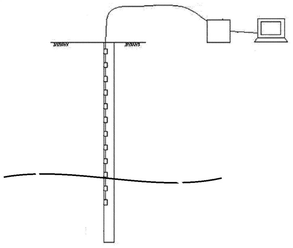

Image

  • An Integrated System Based on 3D Geological Structure Model and Groundwater Numerical Simulation
  • An Integrated System Based on 3D Geological Structure Model and Groundwater Numerical Simulation
  • An Integrated System Based on 3D Geological Structure Model and Groundwater Numerical Simulation

Examples


Embodiment Construction

[0037] The specific implementation of the present invention will be described in detail below. It is necessary to point out that the following implementation is only used for the further description of the present invention, and should not be construed as a limitation on the protection scope of the present invention. Some non-essential improvements and adjustments made still belong to the protection scope of the present invention.

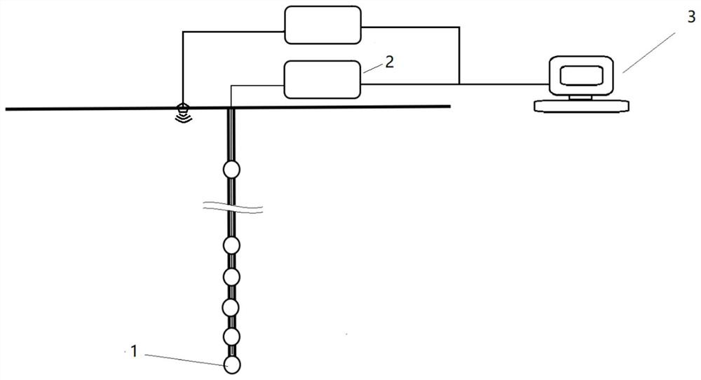
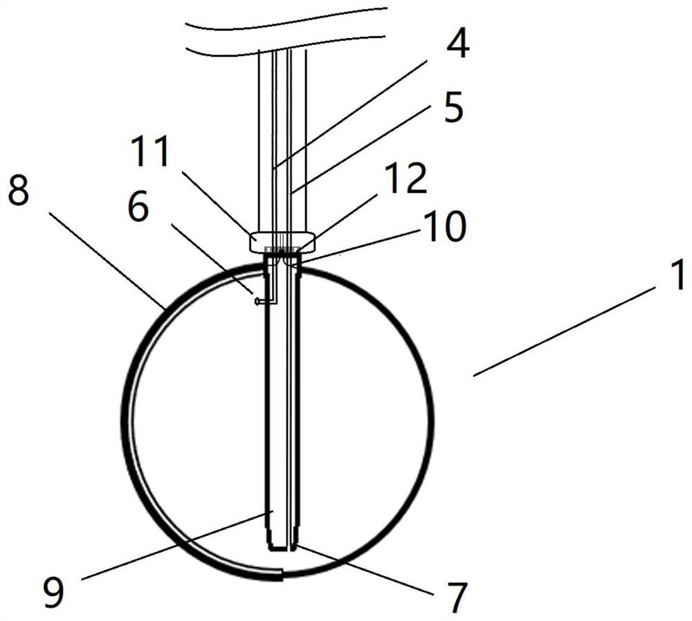
[0038] The invention provides an integrated system based on a three-dimensional geological structure model and groundwater numerical simulation, the structure of which is as follows figure 2 shown, in addition image 3 Schematic diagram of the structure of the underwater robot, Figure 4 It is a schematic diagram of the attraction structure of the dual underwater robot, Figure 5 It is a schematic diagram of the attraction structure of the dual underwater robot, which will be further described below.

[0039] The present invention also provides...


PUM


Abstract

An integrated system based on three-dimensional geological structure model and groundwater numerical simulation, including three-dimensional detection equipment, mobile equipment and simulation integration device; three-dimensional detection equipment includes geological detection module, ground detection module and processing module; mobile equipment includes remote computer, integrated control The processing device, multiple underwater robots, and the simulation integration device are used to respectively obtain the three-dimensional geological map of the three-dimensional geological structure model and the monitoring data of the groundwater value through the corresponding three-dimensional detection equipment and mobile equipment, and integrate the two to obtain the simulation integration As a result, it can improve the detection accuracy, and the detection sensitivity is high, and it can perform rapid monitoring in real time. It can realize underground movement without moving the above-ground equipment, with low cost and high efficiency. At the same time, it can quickly and efficiently simulate the three-dimensional space of the groundwater channel. Perform model building and present in a straightforward manner.

Description

technical field [0001] The invention relates to the field of real-time monitoring of groundwater level and water volume in underground space, in particular to an integrated system based on a three-dimensional geological structure model and groundwater numerical simulation. Background technique [0002] Groundwater is an important part of water resources. Because of its stable water quantity and good water quality, it is one of the important water sources for agricultural irrigation, industrial and mining and cities. Nowadays, the main methods of groundwater geology detection are remote sensing technology method, salinity method, radioactive element method, engineering physical exploration method and so on. The detection requires installation of many hardware facilities, which is expensive and time-consuming. [0003] Groundwater detection device refers to the process of detecting the presence or absence of water sources through the corresponding mechanical equipment to dete...

Claims


Application Information

Patent Timeline
Patent Type & Authority Patents(China)
IPC IPC(8): G06T17/05G01V9/02
CPCG06T17/05G01V9/02Y02A90/30
Inventor 朱恒华刘治政杨丽芝刘春华边农方周洋刘柏含彭莹张华平马丽新
Owner 山东省地质调查院
Learn More