Traffic demand estimation method based on GPS navigation data

A GPS navigation and traffic demand technology, applied in the field of transportation, can solve the problems of lack of uniform standards and basis, high randomness, and determination of the size of traffic grid cells, so as to achieve rich and easy-to-obtain data sources and high human and material costs. , the effect of reducing and optimizing data

Active Publication Date: 2019-12-10
GUANGDONG UNIV OF TECH
View PDF9 Cites 4 Cited by
  • Summary
  • Abstract
  • Description
  • Claims
  • Application Information

AI Technical Summary

Problems solved by technology

The taxi travel demand is estimated by the grid division method, the spatio-temporal distribution characteristics of the taxi travel demand in different functional areas are analyzed, and the Kalman filter model, the neural network model and the combined model are used to predict the taxi trav

Method used


Image

  • Traffic demand estimation method based on GPS navigation data
  • Traffic demand estimation method based on GPS navigation data
  • Traffic demand estimation method based on GPS navigation data

Examples


Embodiment Construction

[0062] The invention discloses a traffic demand estimation method based on GPS navigation data, which specifically includes the following steps:

[0063] Step 1: Collect GPS navigation data and preprocess it to establish a summary table of GPS navigation data entries

[0064] The GPS navigation data generated by different devices in one day is collected from the GPS navigation database in units of days. Each GPS navigation data includes date, time, device number, GPS positioning status, longitude, latitude, speed, and direction angle as GPS navigation data. data entry. The GPS navigation database refers to a database that aggregates and stores the uploaded GPS data after the navigation APP uploads the GPS navigation data, such as the server database of the navigation APP company. The device refers to a device with a built-in navigation module and capable of running a navigation APP, such as a mobile phone, a tablet computer, and the like.

[0065] Preprocess the GPS navigati...


PUM


Abstract

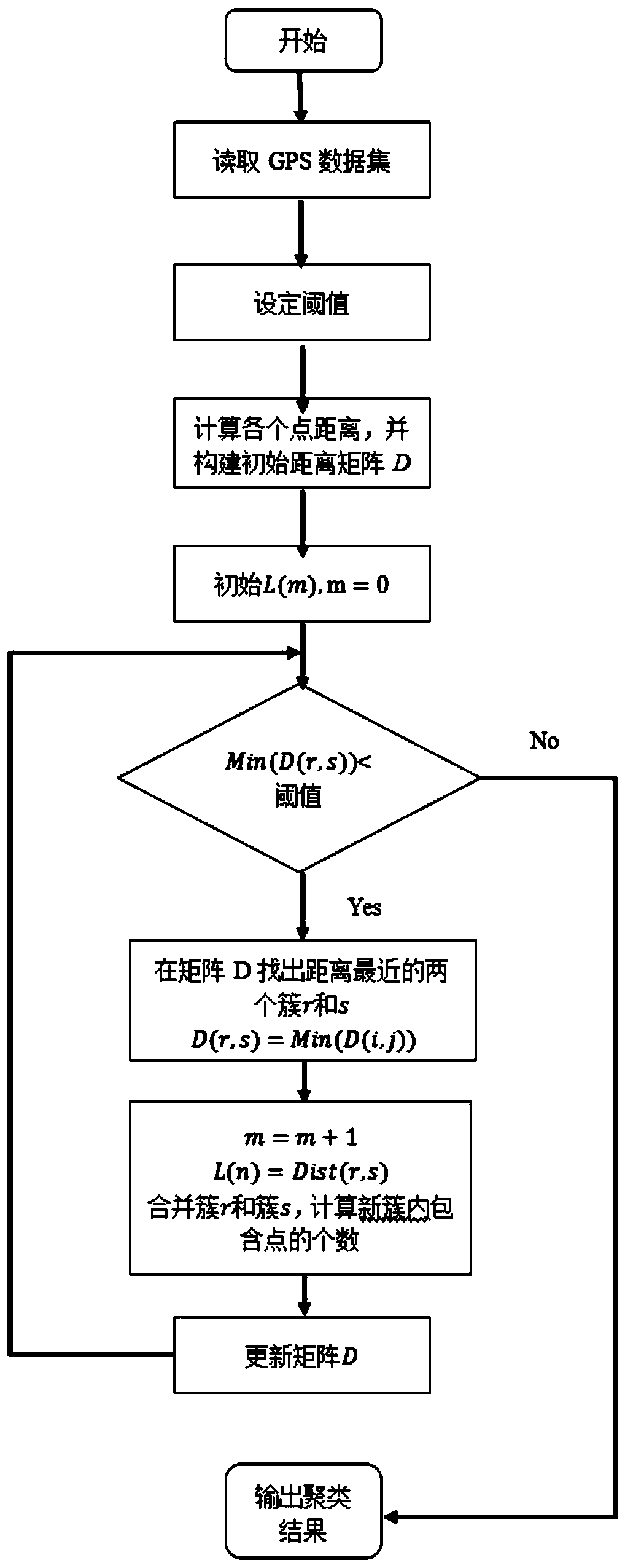
The invention discloses a traffic demand estimation method based on GPS navigation data, a big data technology and an artificial intelligence algorithm are increasingly mature, the traffic informationacquisition cost is lower than that at any time in the past, and resident travel characteristics, space-time distribution characteristics of traffic demands and the like can be more intuitively and clearly understood. According to macroscopic data characteristics presented by big data, a hierarchical clustering algorithm is utilized to divide hot spot areas required by resident travel. Scientificand reasonable clustering division can analyze the travel demand of current residents, and an effective basis is provided for relieving urban traffic congestion and maximizing the utilization of traffic resources. The accurate estimation of the traffic demand can better understand the characteristics of urban traffic behaviors, provides a theoretical basis for urban traffic planning, effectivelyreduces the travel cost of residents, and improves the dispersion capability of urban emergencies.

Description

technical field [0001] The invention relates to the field of transportation, in particular to a traffic demand estimation method based on GPS navigation data. Background technique [0002] With the acceleration of urbanization development in my country, urban traffic congestion and traffic pollution are becoming more and more serious, and traffic accidents frequently occur. Timely and accurate acquisition of traffic big data, visual analysis of data, and construction of traffic data processing models are the prerequisites for building intelligent transportation. GPS navigation data is one of the important sources of traffic big data. The mobile phone map APP records the user's GPS track, including time and latitude and longitude information. For example, Baidu Maps has 300 million monthly active users, 200 million kilometers of daily navigation services, covering 375 large and medium cities and 99% of national roads. Therefore, by analyzing the data of GPS navigation, a m...

Claims


Application Information

Patent Timeline
IPC IPC(8): G06Q10/04G06Q50/26G06F16/29G06F16/28G08G1/01
CPCG06Q10/04G06Q50/26G06F16/29G06F16/285G08G1/0125
Inventor 曾伟良陈仲武
Owner GUANGDONG UNIV OF TECH
Why Eureka
Try Eureka