Pavement three-dimensional disease measurement method based on unmanned aerial vehicle oblique photography

A measurement method and oblique photography technology, applied in image data processing, instruments, calculations, etc., can solve problems such as inability to visually display three-dimensional diseases, difficulty in ensuring detection efficiency, lack of consistent judgment standards, etc., to speed up data processing and information The effect of extraction speed, saving training cost, intelligent identification and information analysis

Active Publication Date: 2020-12-11
HEBEI UNIV OF TECH
View PDF6 Cites 6 Cited by
  • Summary
  • Abstract
  • Description
  • Claims
  • Application Information

AI Technical Summary

Problems solved by technology

[0004] Both inspection vehicles and manual inspections will affect the normal use of roads, especially on expressways. Manual inspections may even require road closures. At the same time, it will consume a lot of manpower, material and financial resources, and it is difficult to guarantee the inspection efficiency.
Manual detection is easily affected by subjective judgment and lacks consistent judgment standards
At the same time, it cannot visually display and track the three-dimensional disease characteristics, which makes it difficult for later maintenance

Method used


Image

  • Pavement three-dimensional disease measurement method based on unmanned aerial vehicle oblique photography
  • Pavement three-dimensional disease measurement method based on unmanned aerial vehicle oblique photography
  • Pavement three-dimensional disease measurement method based on unmanned aerial vehicle oblique photography

Examples


Embodiment

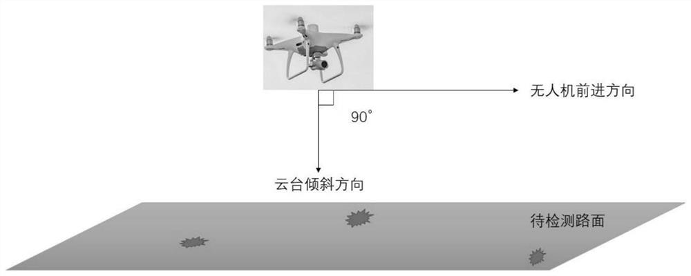
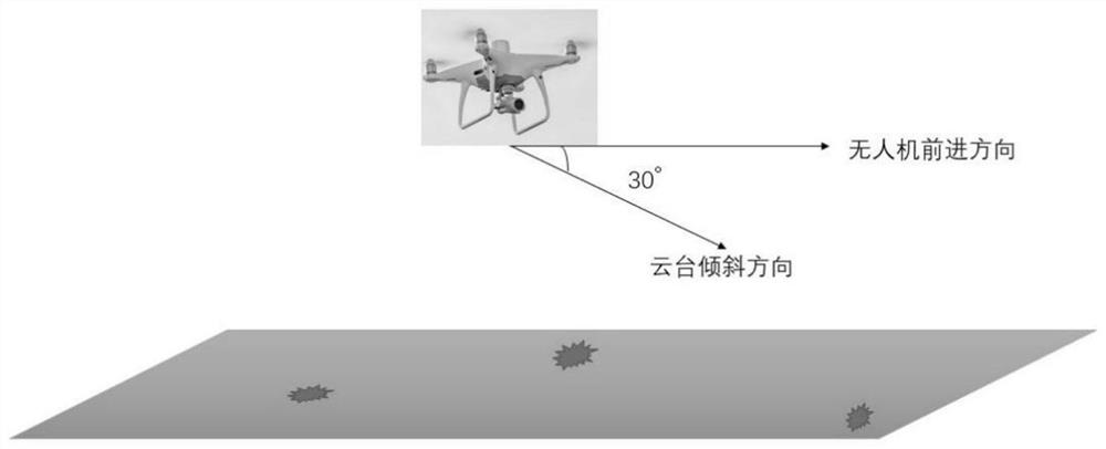
[0042] The present invention provides the use of DJI Phantom 4RTK UAV. The camera parameters carried are: lens FOV84°; 8.8mm / 24mm (equivalent to 35mm format); aperture f / 2.8-f / 11; -∞), ISO range video: 100-3200 (automatic), 100-6400 (manual); image resolution is 4864×3648 (4∶3); 5472×3648 (3∶2), the effective frame size of the photo is 5472×3648. DNSS positioning accuracy: multi-frequency and multi-system high-precision RTK GNSS vertical 1.5cm+1ppm (RMS); horizontal 1cm+1ppm (RMS). This type of UAV can use the carrier phase difference technology (RTK) to connect to the network, and it does not need to measure the phase control point, and the operation is simple. The mapping accuracy meets GB / T 7930-2008 1:500 topographic map aerial photogrammetry industry specification. The formula for calculating the ground sampling distance (GSD) is:

[0043] GSD=(H / 36.5)cm / pixel

[0044] Among them, H is the flight height of the drone, in meters, and the ground sampling distance (GSD) r...


PUM


Abstract

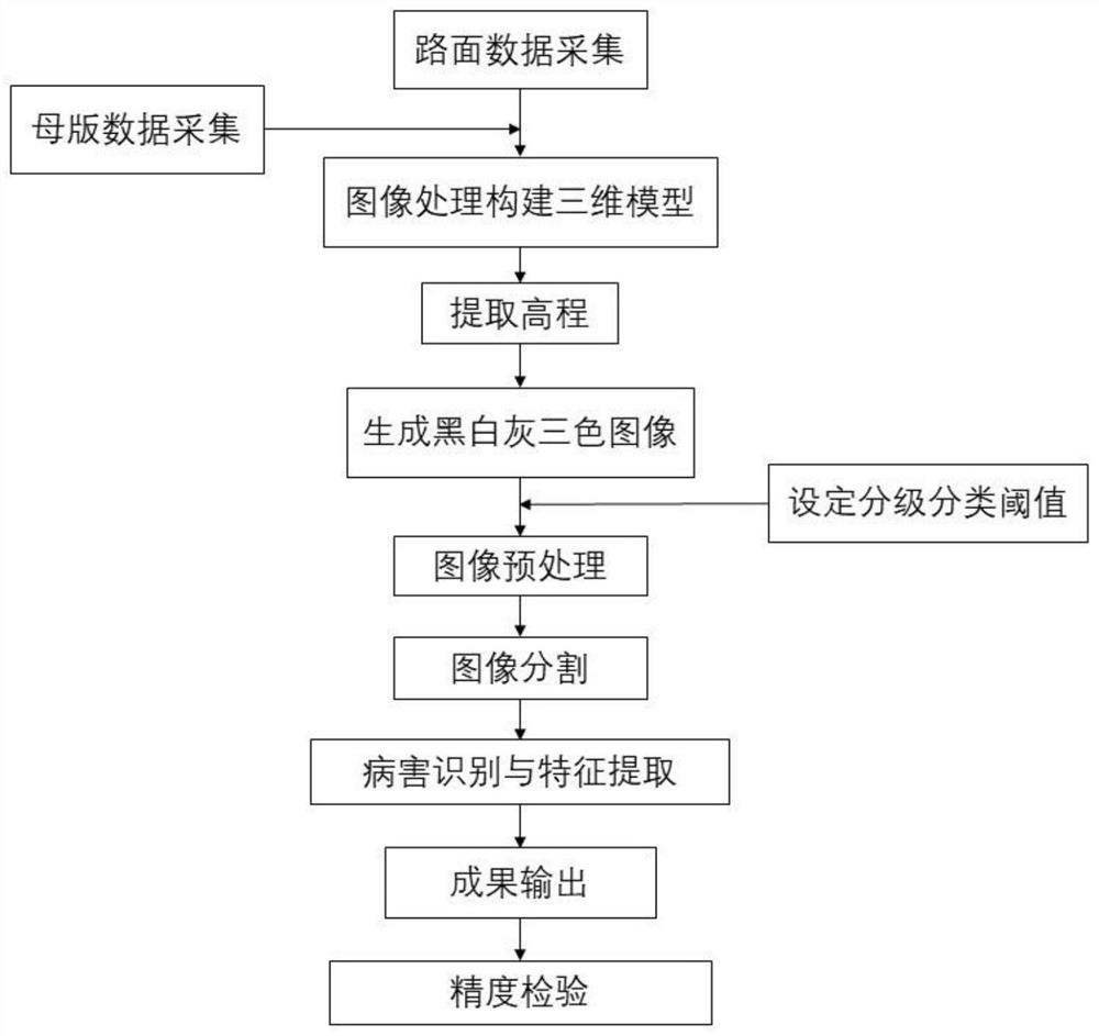
The invention relates to a pavement three-dimensional disease measurement method based on unmanned aerial vehicle oblique photography. The method comprises the following steps of: carrying out primarypavement detection on a pavement before traffic on the pavement without diseases, and calling pavement data acquired before traffic as master data; performing road surface detection again according to road maintenance requirements after traffic, collecting current road surface data, and performing oblique photography on the road surface by using an unmanned aerial vehicle during road surface detection to construct a digital surface model and a digital elevation model in corresponding periods respectively; performing superposition calculation on digital elevation models in different periods toobtain elevation changes of different positions of a pavement, mapping the elevation change of each position to a pixel value of each pixel point, and judging a pavement damage type, a damage grade,a disease characteristic and a disease position through unsupervised learning and image processing in combination with engineering specifications, and realizing intelligent identification of three-dimensional diseases. According to the method, identification grading and positioning of pavement three-dimensional diseases are realized, and the diseases are visually displayed.

Description

technical field [0001] The invention relates to the field of UAV oblique photography and road surface three-dimensional disease identification and maintenance, in particular to a road surface three-dimensional disease measurement method based on UAV oblique photography. Background technique [0002] In order to ensure the safe driving of vehicles on the road and prolong the service life of the road, it is necessary to regularly detect and maintain the road, and the detection and identification of the three-dimensional disease of the road surface is a necessary and basic work. The three-dimensional diseases of the pavement mainly include potholes, ruts, subsidence and wave wrapping. [0003] At present, the three-dimensional pavement disease detection methods mainly use road inspection vehicles and manual inspection. The road inspection vehicle is equipped with laser sensing equipment such as a laser deflection tester and a vehicle-mounted bump accumulator. The on-board equ...

Claims


Application Information

Patent Timeline
Patent Type & Authority Applications(China)
IPC IPC(8): G06T7/00G06T5/00G06T7/136G06T7/187
CPCG06T5/002G06T7/0004G06T2207/10021G06T2207/30132G06T7/136G06T7/187
Inventor 李家乐王雪菲刘涛马国伟奚文彬马立纲张大力
Owner HEBEI UNIV OF TECH
Why Eureka
Try Eureka