Ship course and area estimation method based on Beidou navigation and data driving
A data-driven, Beidou navigation technology, applied in the field of navigation and positioning, can solve problems such as difficulties in the transformation of ship equipment, reduced search and rescue success rate, limited experimental environment characteristics, etc. The effect of excessive envelope area
- Summary
- Abstract
- Description
- Claims
- Application Information
AI Technical Summary
Problems solved by technology
Method used
Image
Examples
Embodiment Construction
[0125] Embodiments of the present invention will be described below with reference to the accompanying drawings.
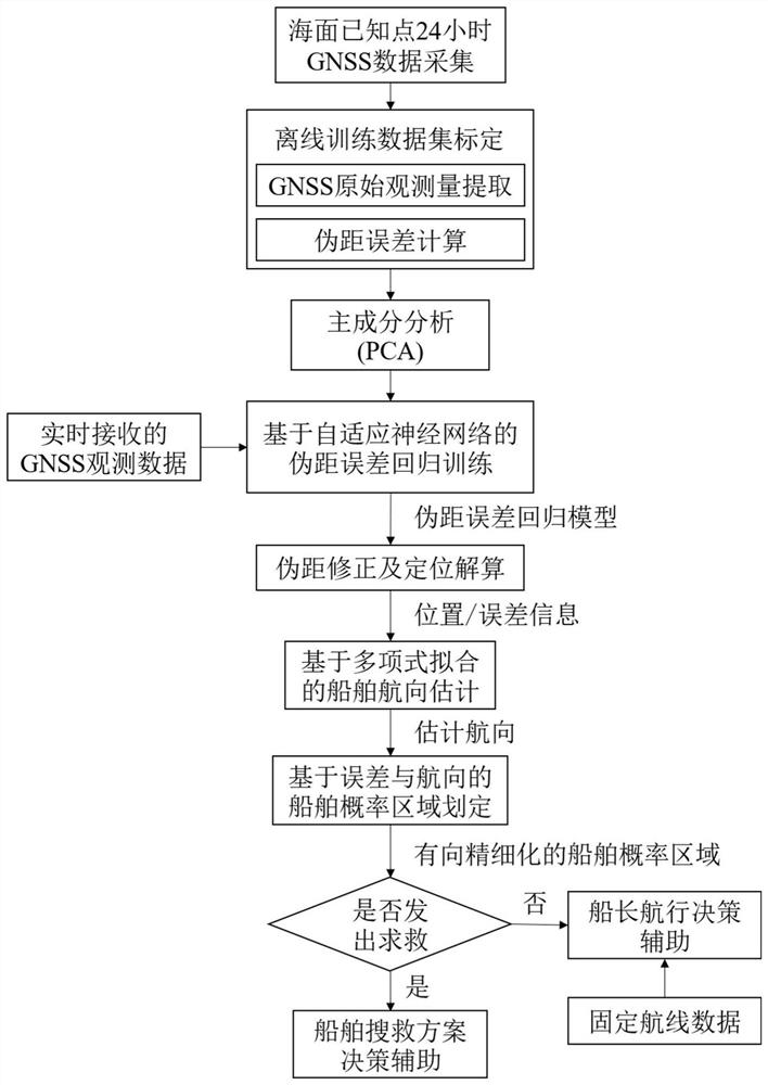
[0126] The embodiment of the present application provides a method for estimating the course of a ship and its area based on Beidou navigation and data drive, such as figure 1 shown, including the following steps:
[0127] Step 1, known points on the sea surface (X 0 ,Y 0 ,Z 0 ) to collect 24-hour GNSS observation data.
[0128] Step 2, obtain the offline calibration data set, the offline calibration data set includes the original observations and pseudorange errors extracted from the GNSS observation data:
[0129] Step 3, analyze and screen the original observations extracted from the GNSS observation data, and obtain the sample set Z after screening;
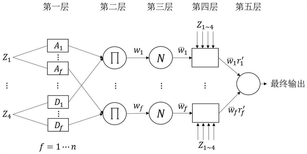
[0130] Step 4, input the sample set Z and the corresponding pseudorange error into the adaptive neural network ANFIS for training, extract the pseudorange error prediction rule, and obtain the pseudorange er...
PUM
 Abstract
Description
Claims
Application Information
 - R&D
- Intellectual Property
- Life Sciences
- Materials
- Tech Scout
- Unparalleled Data Quality
- Higher Quality Content
- 60% Fewer Hallucinations
Browse by: Latest US Patents, China's latest patents, Technical Efficacy Thesaurus, Application Domain, Technology Topic, Popular Technical Reports.
© 2025 PatSnap. All rights reserved.Legal|Privacy policy|Modern Slavery Act Transparency Statement|Sitemap|About US| Contact US: help@patsnap.com


