

Mariculture area classification method fusing multi-source high-resolution satellite remote sensing images
A satellite remote sensing image, high-resolution technology, applied in the field of image processing, can solve the problems of lack of animal-based aquaculture area research, lack of extraction methods, restriction of dynamic supervision and evaluation of marine aquaculture areas, etc., so as to improve the extraction accuracy and reduce workload. , the effect of automatic interpretation
- Summary
- Abstract
- Description
- Claims
- Application Information
AI Technical Summary
Problems solved by technology
Method used
Image


Examples
Embodiment Construction
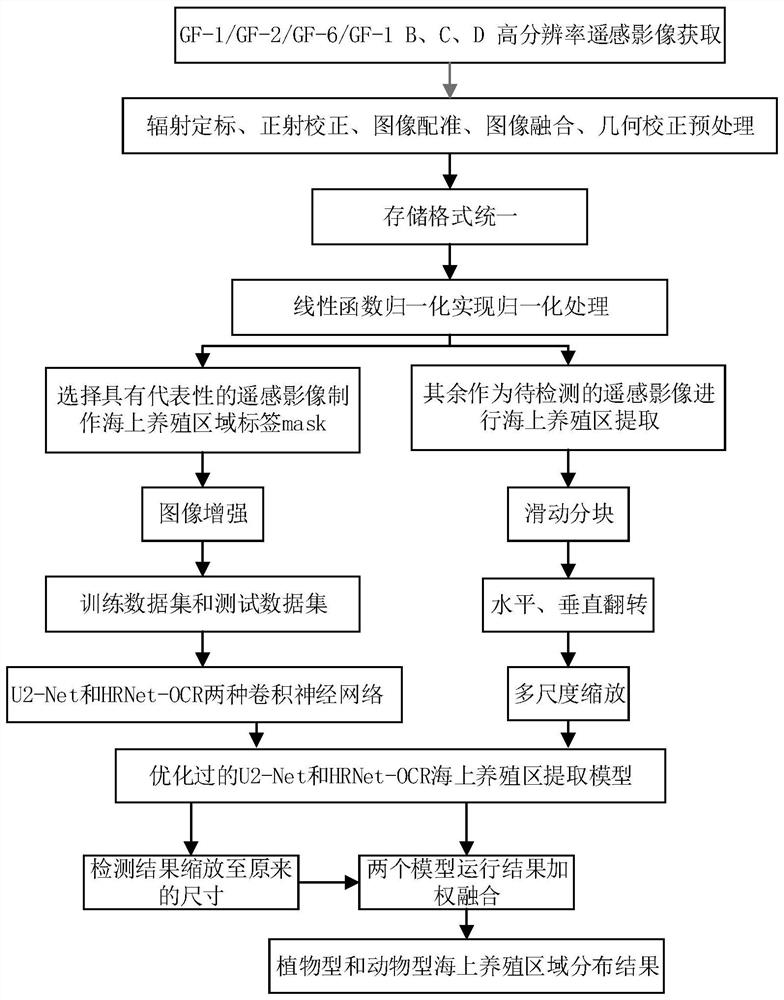
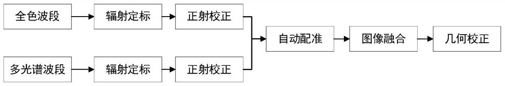
[0042]In order to make the object, technical solution and advantages of the present invention clearer, the present invention will be further described in detail below in combination with specific embodiments and with reference to the accompanying drawings. It should be understood that these descriptions are exemplary only, and are not intended to limit the scope of the present invention. Also, in the following description, descriptions of well-known structures and techniques are omitted to avoid unnecessarily obscuring the concept of the present invention.
[0043] A classification method for marine aquaculture areas by fusing multi-source high-resolution satellite remote sensing images, combining figure 1 ,Proceed as follows:
[0044] Step 1: Obtain a variety of satellite remote sensing images covering a range of 30km from my country's coastline within a set period of time.
[0045] Obtain GF-1 / GF-2 / GF-6 / GF-1 B, C, D 0.8-2m high-resolution remote sensing images covering 30k...
PUM
 Abstract
Description
Claims
Application Information