
Method for performing automatic cruise in selected range in three-dimensional map

An automatic cruise, three-dimensional map technology, applied in two-dimensional position/channel control, non-electric variable control, instruments and other directions, can solve the problem that the monitoring target cannot be achieved, all objects cannot be included, and the area or range cannot be automatically delineated. cruise operation and other issues, to improve the monitoring effect and ensure the quality of work

Pending Publication Date: 2022-03-22
重庆富沛和科技有限公司
View PDF4 Cites 0 Cited by
  • Summary
  • Abstract
  • Description
  • Claims
  • Application Information

AI Technical Summary

Problems solved by technology

The existing problem is that the parameter setting through the preset position is centered on the monitoring equipment, and some fan-shaped monitoring areas or monitoring angles are reserved or eliminated.
However, this invention patent application has the following disadvantages: the user needs to first set the target viewing angle in the full field of view, calculate the control parameters, and then perform automatic patrolling according to the order of the set viewing angles
However, this method has the following deficiencies: it cannot realize many monitoring objectives in the wide-area environment and generate preset position information at the same time
However, there are still the following deficiencies: although the panoramic image provides a more intuitive panoramic image, the use process still requires the operator to input control instructions, and must rely on the operator's assistance, which cannot realize unmanned automatic monitoring operations; For an operation instruction, the camera can only realize one-to-one action response according to the instruction requirements, and cannot realize automatic cruise operation of the delineated area or range
However, there are still problems as follows: although the preset position information table generated by the invention can include buildings, equipment, intersections, etc. that need to be monitored, it cannot include all objects in the monitored environment, so it cannot realize the monitoring of the monitored environment. Realize monitoring with no dead angle and full coverage; the user can quickly locate the camera to the selected position by selecting the preset position in the preset position information table. This process requires the user to participate and issue operation instructions, and the selected monitoring area cannot Automatic Cruise Monitoring

Method used


Image

  • Method for performing automatic cruise in selected range in three-dimensional map
  • Method for performing automatic cruise in selected range in three-dimensional map
  • Method for performing automatic cruise in selected range in three-dimensional map

Examples


Embodiment 1

[0133] Embodiment 1: a method for automatic cruising in a selected range in a three-dimensional map, the method includes the following steps:

[0134] 1) Obtain depth data through digital elevation model;

[0135] 2) Select the area to be monitored;

[0136] 3) According to the depth value, the monitoring area is divided into multiple layers, and each level is separated by a clustering algorithm;

[0137] 4) Select one of the hierarchical areas after clustering, and calculate the focal length and magnification required for the monitoring equipment to cruise in this area;

[0138] 5) Select the remaining hierarchical areas, repeat step 4);

[0139] 6) Select one of the hierarchical areas, and calculate the window size of the field of view of the monitoring device reflected in the depth map during cruise according to the magnification required by the monitoring device for cruising;

[0140] 7) arrange the hierarchical areas selected in step 6) according to the window size;

...

Embodiment 2

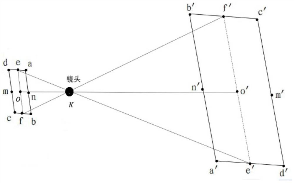
[0196] Because in embodiment 1, in the window arrangement obtained, the area to be arranged in some windows falls on the edge or corner of the window, and does not cover the center point of the window, accounting for only a small part. And often the part that needs attention is closer to the center of the window, which is more in line with the observation habits of ordinary people. Therefore, on the basis of the obtained window array, move the array to make the center of the array coincide with the center of the smallest positive circumscribed rectangle, and then remove all windows whose centers do not fall within the hierarchical area. Part of the area covered by the window;

[0197] In said step 7), the following steps are included:

[0198] ① Use this level area as the area to be arranged;

[0199] ②Calculate the smallest positive circumscribed rectangle of the area to be arranged, and set its width to W b High is H b, arrange n on this minimum positive circumscribed re...

Embodiment 3

[0212] Because in embodiment 2, there will still be cases where the area to be arranged in some windows includes the center of the window but may still be biased to a certain side, and the array area itself obtained at the beginning often exceeds the minimum positive circumscribed rectangle of the hierarchical area Size, these problems make the arrangement of windows still have a certain degree of randomness;

[0213] In said step 7), the following steps are included:

[0214] ① Use this level area as the area to be arranged;

[0215] ②Calculate the smallest positive circumscribed rectangle of the area to be arranged, and set its width to W b High is H b , arrange n on this minimum positive circumscribed rectangle w ×n h windows to form an array;

[0216] in

[0217]

[0218] ( is the symbol for rounding up), this is represented by n w ×n h The width w of the array of windows 4 , high h 4 respectively w 4 =n w ×w f , h 4 =n h × h f ;

[0219] ② Calculate ...


PUM


Abstract

The invention discloses a method for performing automatic cruise in a selected range in a three-dimensional map. The method comprises the following steps: 1) acquiring depth data; 2) selecting an area to be monitored; 3) performing multi-layer division, and distinguishing each layer through a clustering algorithm; 4) calculating the focal length and magnification times required by cruising of the monitoring equipment in the area; 5) selecting other hierarchical regions; 6) calculating the window size of the view field of the monitoring equipment reflected in the depth map during cruising according to the magnification required by the monitoring equipment during cruising; (7) arranging the hierarchical regions selected in the step (6) according to the size of a window; according to the method, multi-level, high-definition and full-coverage monitoring of the monitored area is achieved, standardization of the operation process is achieved, the working quality is guaranteed, meanwhile, the working efficiency is improved, and the labor cost is saved.

Description

technical field [0001] The invention relates to an automatic cruising method, in particular to a method for automatic cruising in a selected range in a three-dimensional map. Background technique [0002] At present, in the fields of forest fire prevention, pest control, public security management, endangered animal detection, pollution source detection, poaching and deforestation control, aftershock detection, etc., it is necessary to scan and observe all-weather global or local key areas in large monitoring areas. Therefore, It is necessary to set appropriate preset positions, control parameters and cruise paths for the monitoring equipment installed in the above-mentioned areas to ensure the realization of multi-level, all-round, all-weather, fully automatic, high-definition, and high-frequency monitoring of the above-mentioned areas. [0003] The current common operation process is: according to the terrain, environment, and monitoring clarity requirements of the area wh...

Claims


Application Information

Patent Timeline
IPC IPC(8): G05D1/02
CPCG05D1/0246
Inventor 付春秋
Owner 重庆富沛和科技有限公司
Learn More