
Navigation device and method

a technology of navigation device and navigation method, which is applied in the direction of navigation instruments, traffic control systems, instruments, etc., can solve the problems of inability to include transient road alterations, inability to accurately determine the location of the road, etc., to achieve dramatic accelerated processing and faster time frame

Inactive Publication Date: 2010-12-30
TOMTOM INT BV
View PDF28 Cites 94 Cited by
  • Summary
  • Abstract
  • Description
  • Claims
  • Application Information

AI Technical Summary

Benefits of technology

[0025]It is an object of the present invention to provide a PND or navigation system, a method of operating such, and a computer program by means of which such are controlled which allows a PND or navigation system to provide enhanced map data correction.BRIEF SUMMARY OF THE INVENTION
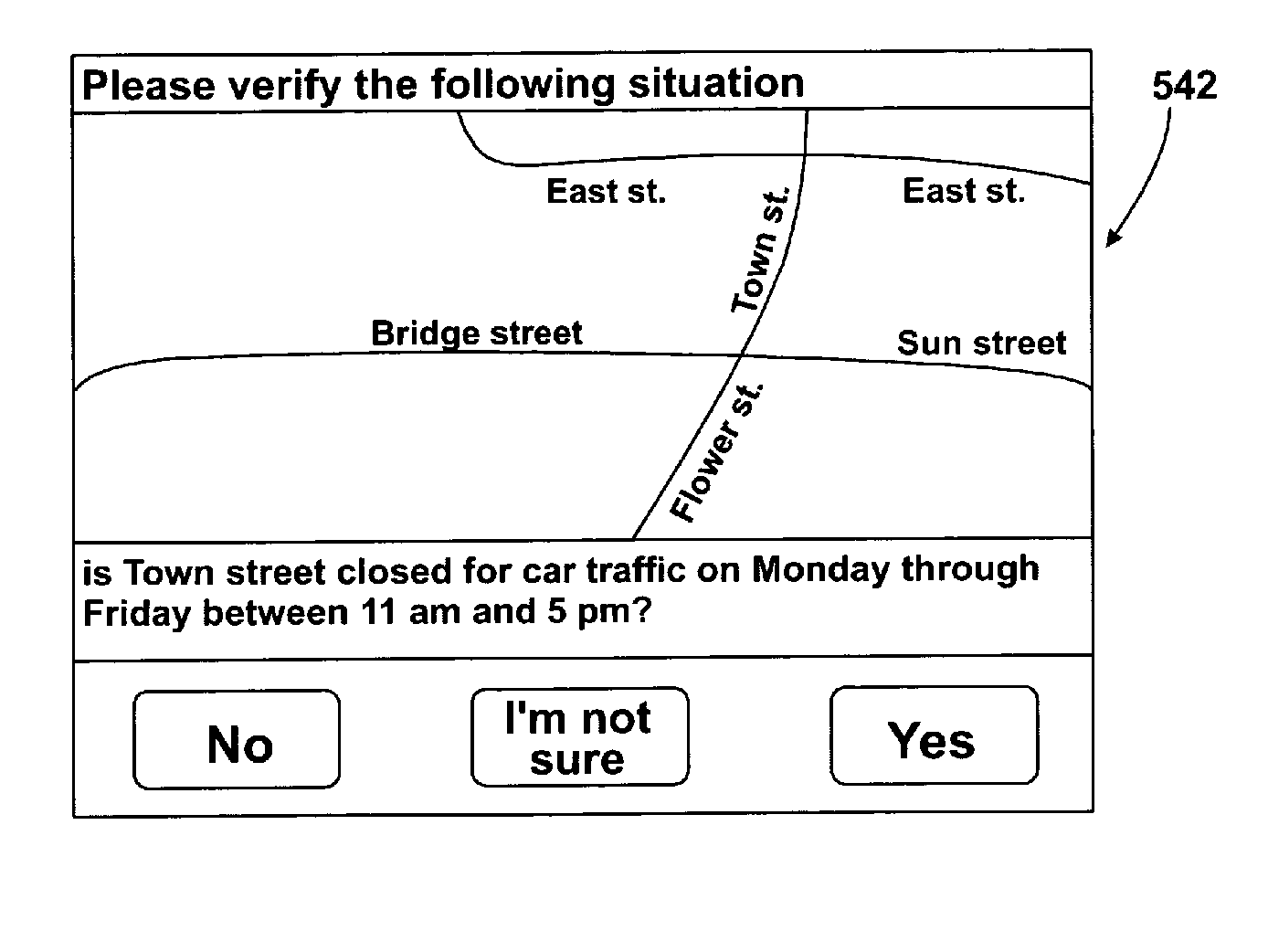
[0029]Preferably, the prompt is a request of the user to confirm the veracity of the error identified at that geospatial location. Alternatively, the prompt may be in an approve / reject form, but in any event, the prompt allows a user a simple and quick means of creating qualifying information relating to a respective error identified in the map data correction files at that time local to the device or system.
[0050]The usefulness of adding an identifying (bit-wise) flag and / or meta-data to GPS trace log data has the advantage for post-processing of this data, particularly when such data is processed to determine where there might be issues or inconsistencies with map data. For instance, GPS trace log data from devices (usually submitted by means of downloads from devices to a connected PC and thence over the internet to a back end processing facility of device / map data manufacturers) will typically contain only GPS data and a time stamp, or differential values for these characteristics from initial GPS and time readings. As can be imagined, vast amounts of GPS trace log data may be recorded, and require lengthy and resource-hungry analysis using known map-matching techniques to determine map errors. This process can be dramatically accelerated by only processing GPS trace log data which has been flagged in the device during recordation thereof (again using map-matching techniques). This being the case, the post-processing is restricted to only flagged data, map errors can be confirmed, verified or rejected in a much quicker time frame. Such flagging might also usefully occur when any unexpected automatic route-re-planning is conducted by the device.

Problems solved by technology

One disadvantage with current map provider-originated data files is that their level of detail only increases with every successive version release.
As such, these occur only relatively infrequently, and therefore it is possible for map information to be outdated by changes in road layouts and the implementation of access limitations often occurring in cities and to a lesser extent, in extra-urban regions.
Additionally, map data does not generally include transient road alterations, such as may be caused by road works, carriageway reductions or alterations, or pedestrianization of roads previously mapped as vehicular thoroughfares.
Indeed, as a result of the various processes used in the creation of digital map data, it is often the case that map data files installed in new PNDs and navigation systems already tend to be at least a year or so out of date by the time the device or system is delivered to the end user.

Method used


Image

  • Navigation device and method
  • Navigation device and method
  • Navigation device and method

Examples


Embodiment Construction

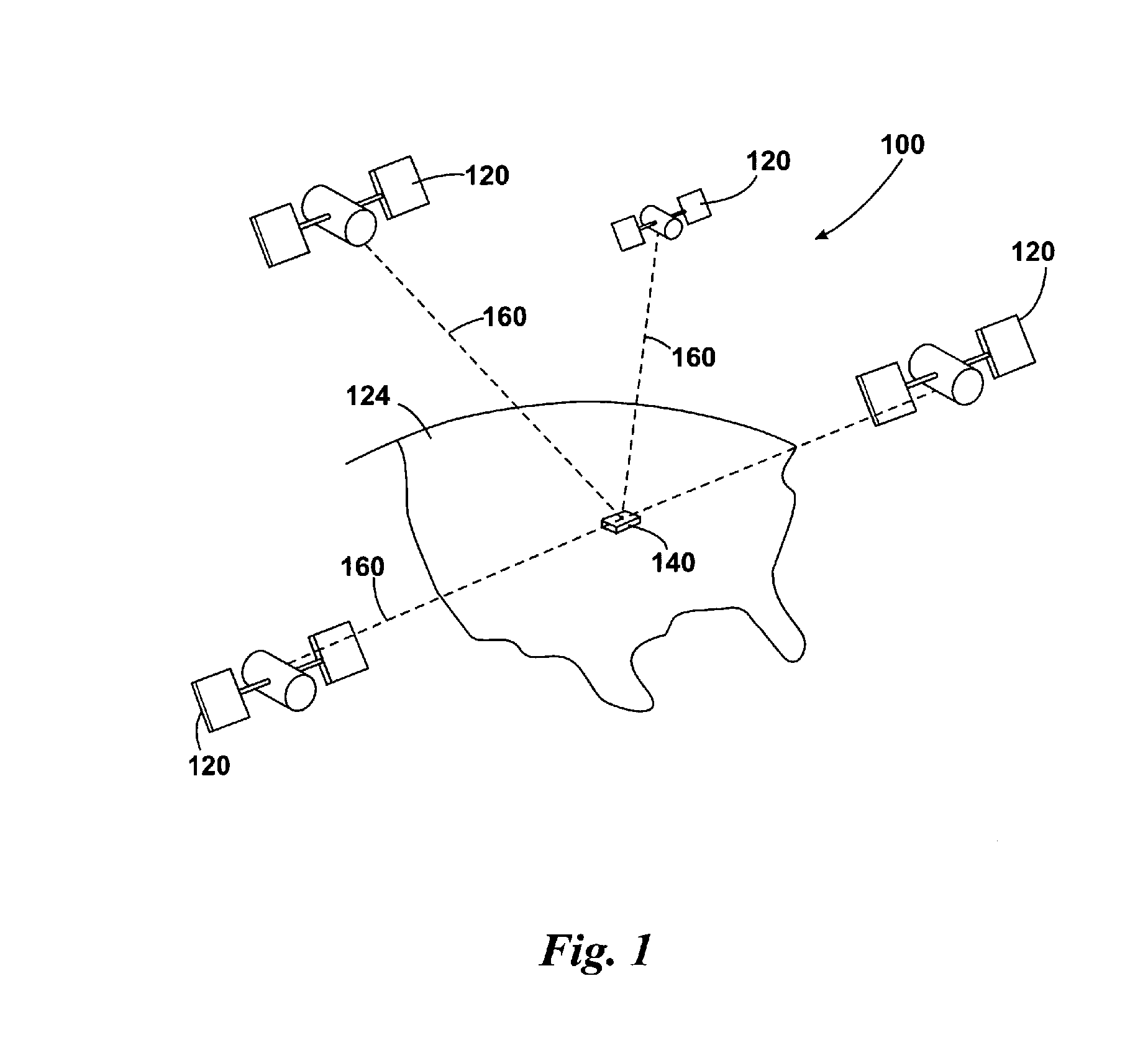
[0078]FIG. 1 illustrates an example view of Global Positioning System (GPS), usable by navigation devices. Such systems are known and are used for a variety of purposes. In general, GPS is a satellite-radio based navigation system capable of determining continuous position, velocity, time, and in some instances direction information for an unlimited number of users. Formerly known as NAVSTAR, the GPS incorporates a plurality of satellites which work with the earth in extremely precise orbits. Based on these precise orbits, GPS satellites can relay their location to any number of receiving units.

[0079]The GPS system is implemented when a device, specially equipped to receive GPS data, begins scanning radio frequencies for GPS satellite signals. Upon receiving a radio signal from a GPS satellite, the device determines the precise location of that satellite via one of a plurality of different conventional methods. The device will continue scanning, in most instances, for signals until ...


PUM


Abstract

A method of operating a PND or navigation system is described, together with a PND or navigation system for performing such a method. The PND or navigation system includes memory storing map data consisting of base map data files, a display, GPS signal reception and processing device, such together forming a basis for navigation, route guidance, and map information display. In at least one embodiment, the method includes correlating the current location with the map data to derive map-specific parameters for that location and comparing the map-specific parameters with a motion-specific parameter, a vehicle-specific parameter, or the current location to determine whether the current location, motion or vehicle-related characteristic is permissible or appropriate therefore; and in the event that the current location, motion, or vehicle-related characteristic and derived map-specific parameter are seemingly at odds with one another, performing at least one secondary action. The secondary action may include but is not limited to the issuing of an approve / reject prompt to the user, or the automatic creation, modification or deletion of a new or pre-existing correction.

Description

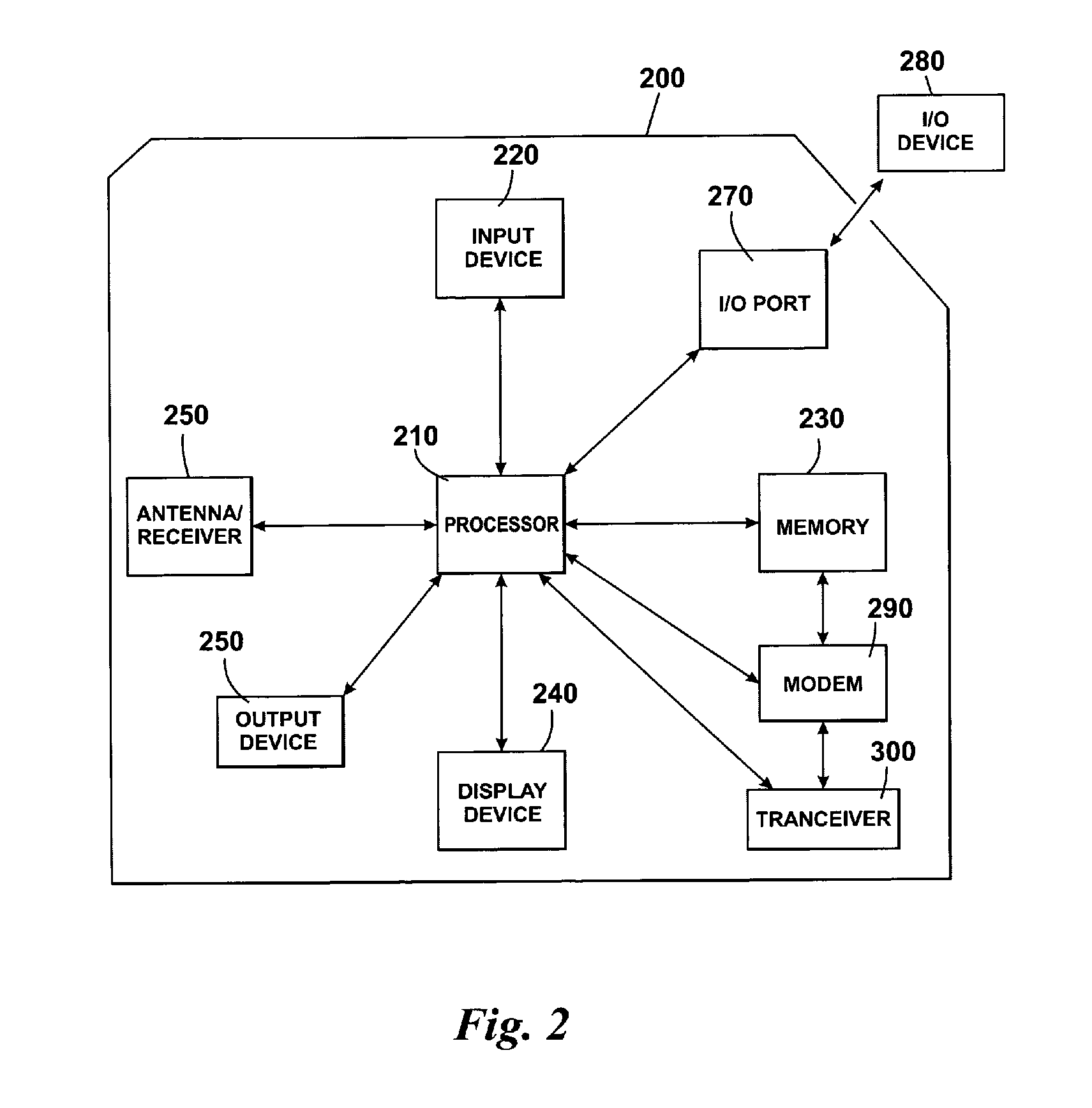
BACKROUND OF THE INVENTION[0001]Portable navigation devices (PNDs) including GPS (Global Positioning System) signal reception and processing means are well known and are widely employed as in-car navigation systems. In essence, modern PNDs comprise:[0002]a processor,[0003]memory (at least one of volatile and non-volatile, and commonly both),[0004]map data stored within said memory,[0005]a software operating system and optionally one or more additional programs executing thereon, to control the functionality of the device and provide various features,[0006]a GPS antenna by which satellite-broadcast signals including location data can be received and subsequently processed to determine a current location of the device,[0007]optionally, electronic gyroscopes and accelerometers which produce signals capable of being processed to determine the current angular and linear acceleration, and in turn, and in conjunction with location information derived from the GPS signal, velocity and relat...

Claims


Application Information

Patent Timeline
Patent Type & Authority Applications(United States)
IPC IPC(8): G01C21/00G01C21/36G01S19/42
CPCG01C21/32G01C21/36G01C21/3664G01C21/3896G01C21/3859
Inventor GEELEN, PIETERTHOMASSEN, ERIKROOSEN, MAREIJENEEF, EDWINKUCHEIKO, SERGEIJONES, RORY
Owner TOMTOM INT BV
Learn More