

GPS tuner
- Summary
- Abstract
- Description
- Claims
- Application Information
AI Technical Summary
Benefits of technology
Problems solved by technology
Method used
Image

Examples
Embodiment Construction
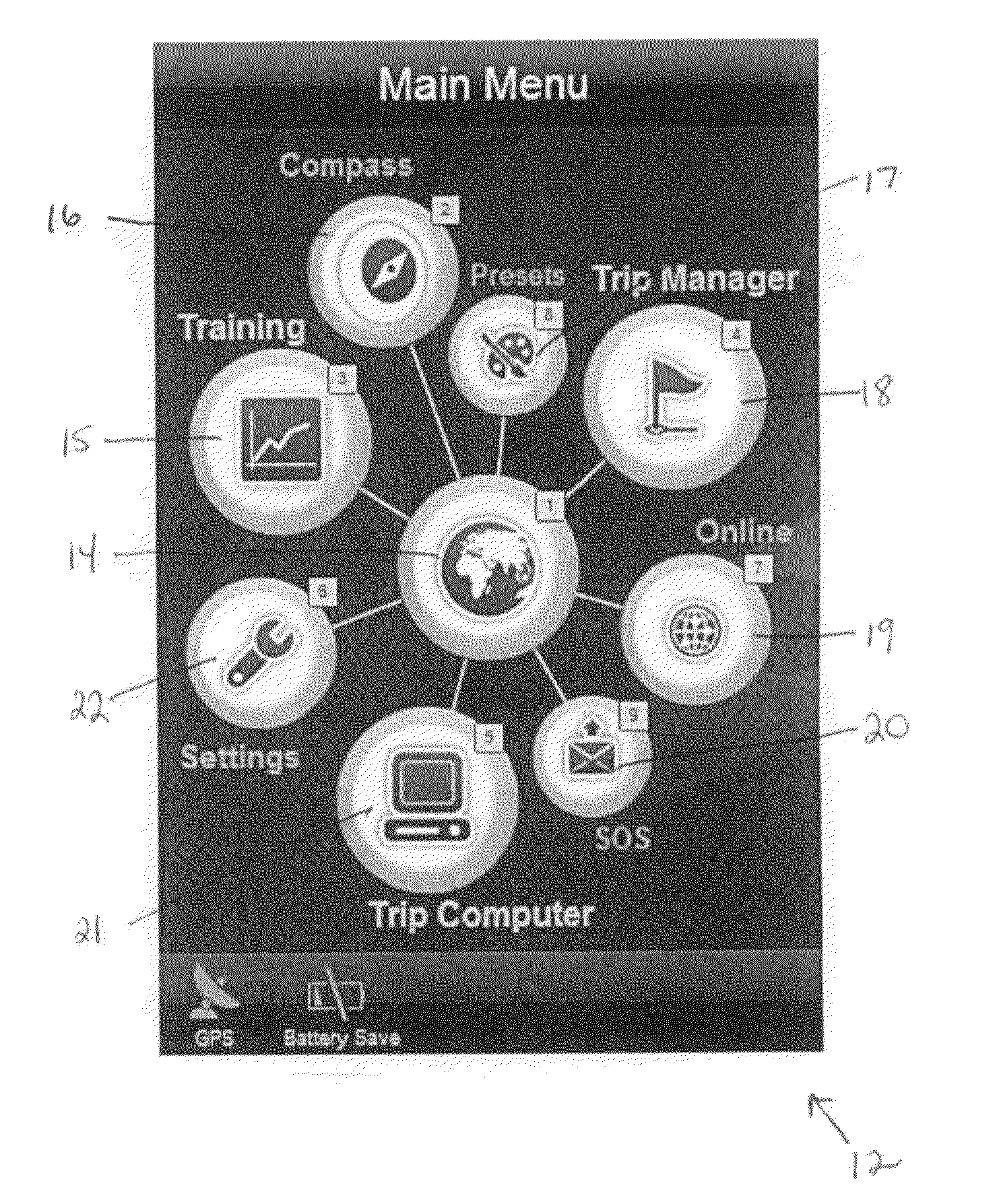
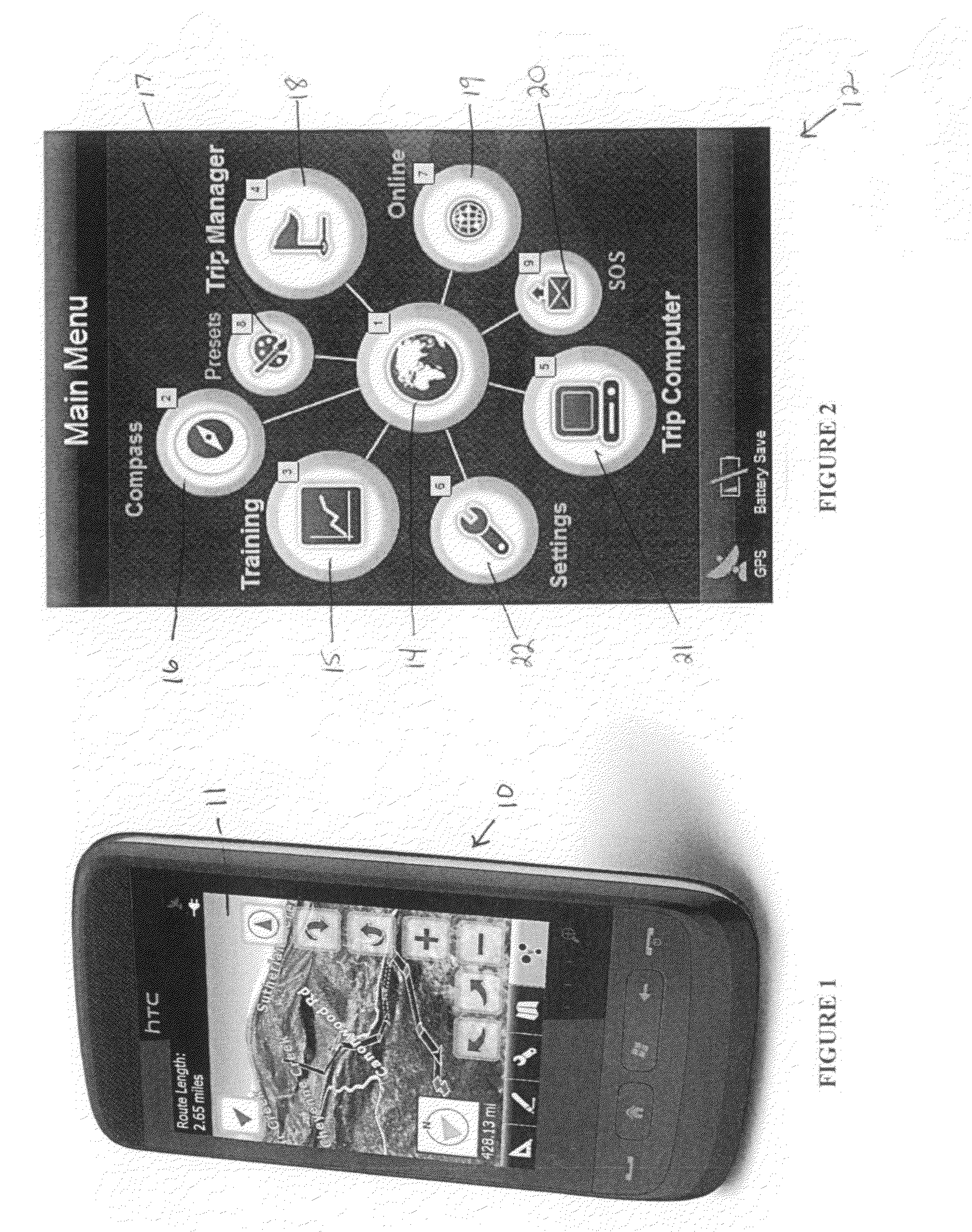
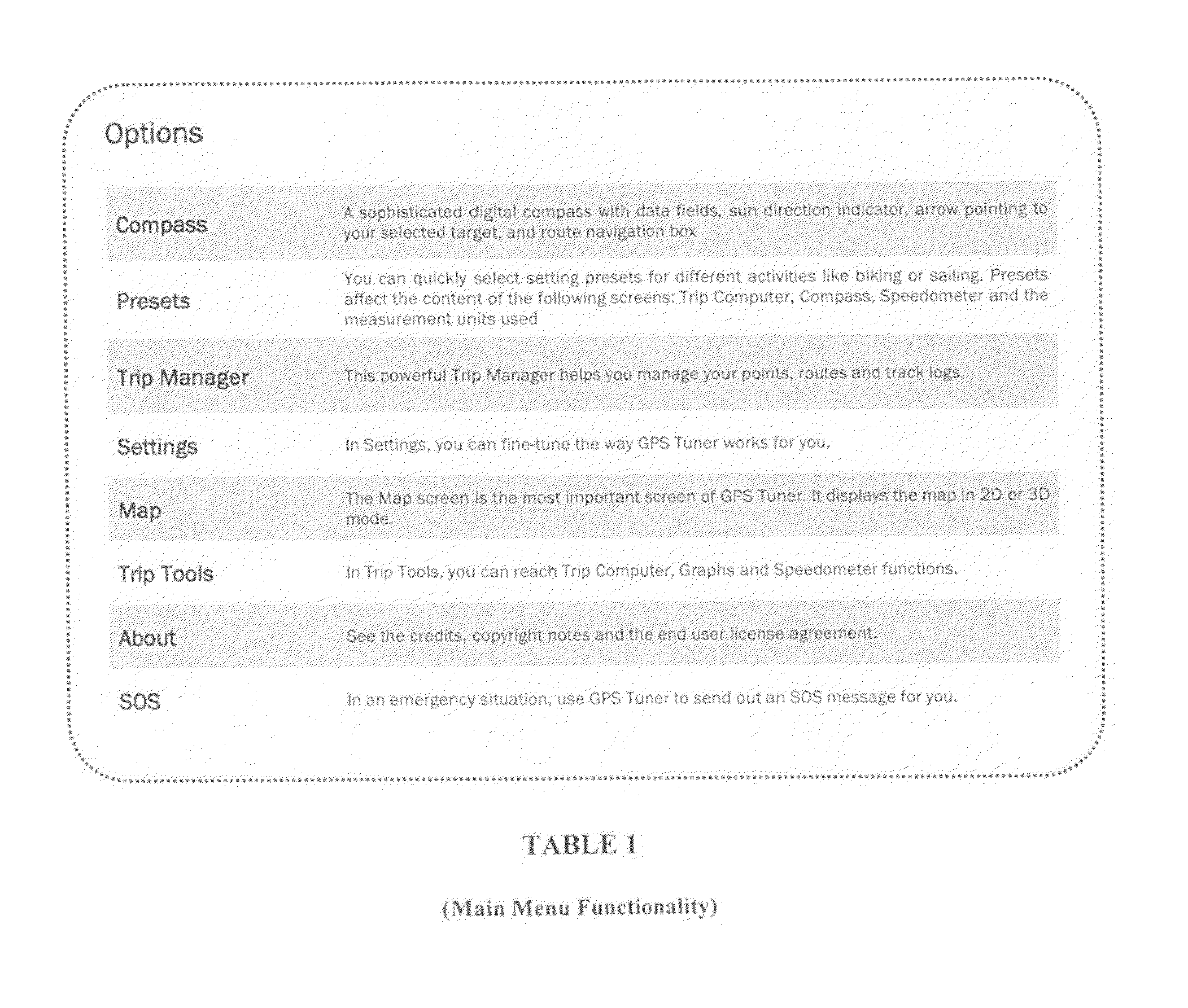
[0100]A GPS tuner is disclosed herein in the form of software which provides high precision measurement, mapping, and Geocaching tools. The software is designed so that it may be implemented on a computing device, preferably a mobile computing device. An exemplary computing system, upon which the software may be utilized, is discussed hereinafter.
[0101]In one embodiment, the software of the current invention may preferably run on a computer system utilizing an underlying operating system, such as Windows Mobile, which is running on a PDA, a Pocket PC, or a Smartphone, such as, for example, the pocket PC 10 depicted in FIG. 1. The device utilized may need to meet certain minimum requirements, such as being capable of running the Microsoft® Windows Mobile™ 5 operating system with a 300 MHz ARM processor (400 MHz recommended), a 64 MB RAM (128 MB recommended), a touch screen display, and approximately a 2 GB file storage space for map content (SD Card or Internal Flash memory). The sof...
PUM
 Abstract
Description
Claims
Application Information