

Seismic data analysis using ocean bottom node data collection
a technology of seismic data and ocean bottom node, which is applied in the field of seismic data acquisition and analysis, can solve the problems of uncertainty in the measurement of clock drift, the difficulty of detecting the drift of the ocean bottom node, so as to minimize the error and minimize the rms error
- Summary
- Abstract
- Description
- Claims
- Application Information
AI Technical Summary
Benefits of technology
Problems solved by technology
Method used
Image

Examples
working example
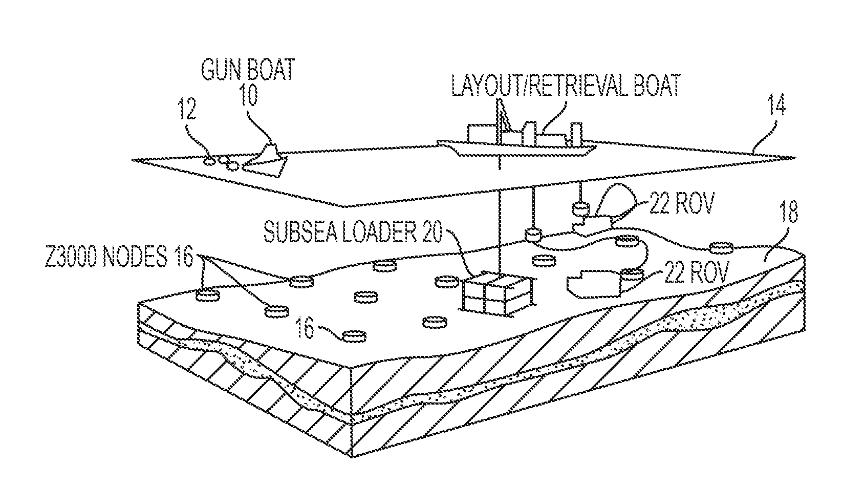
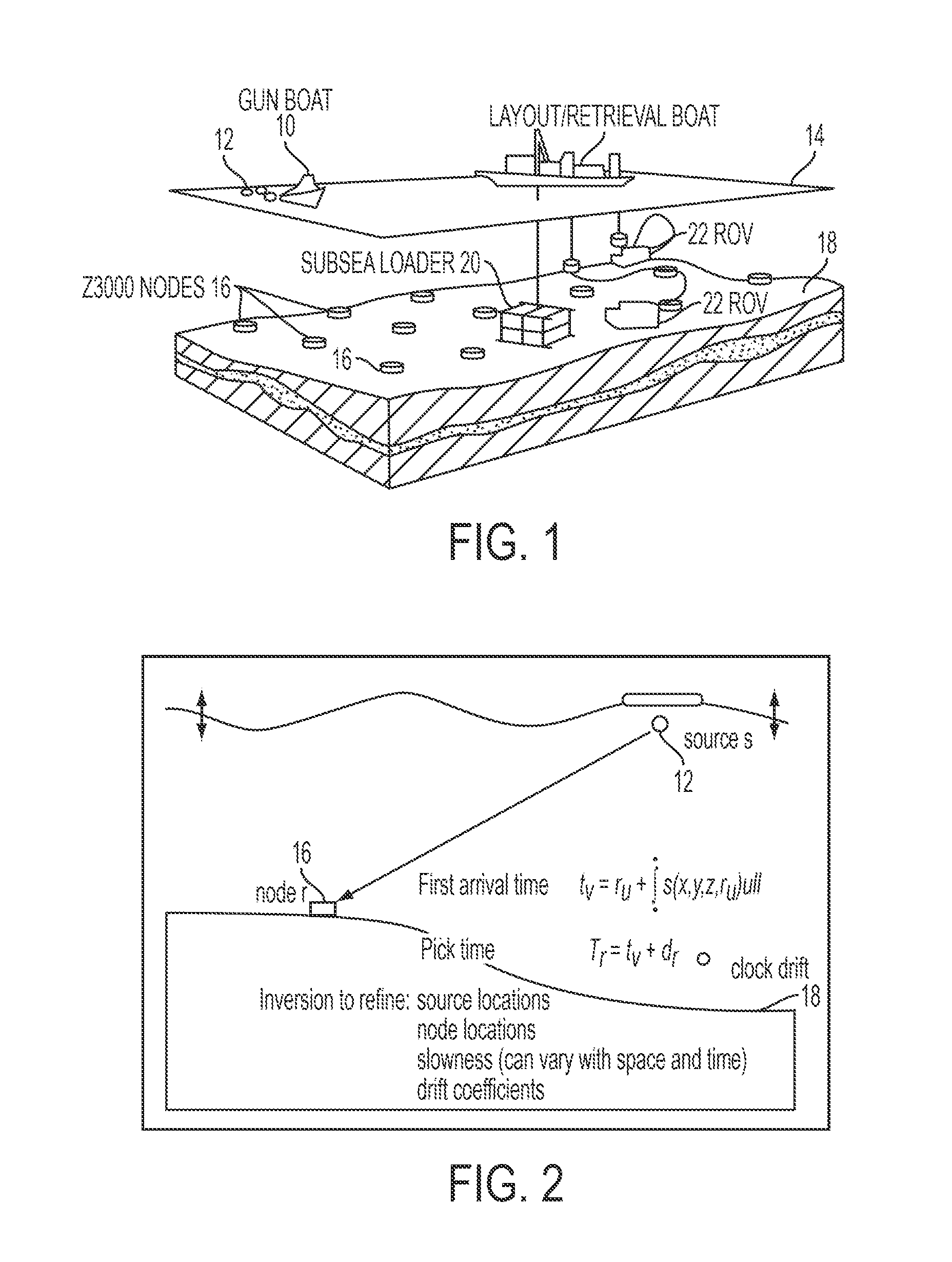
[0056]A deep water node survey, with water depths ranging from 1600 m to 2300 m, is used to demonstrate the travel time inversion process. The north-western corner of the example survey was affected by a steep water bottom, in places greater than 8 degrees. The shooting patch on the survey was acquired in approximately 64 days.
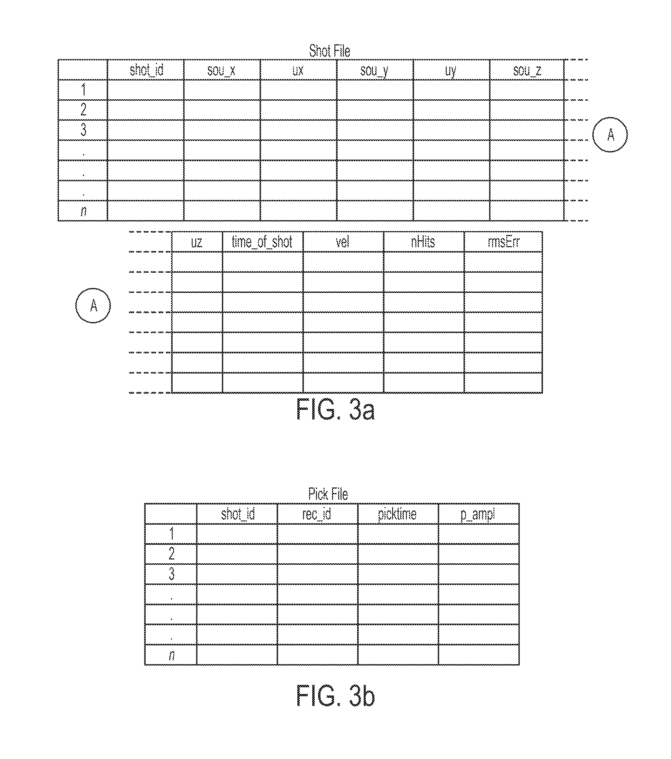
[0057]For the example survey, picks with correlation coefficients less than 0.92 were rejected from the travel time inversion. The typical cause for lower correlation coefficients was the presence of interfering refracted arrivals. Otherwise, OBN recording in deep water environments is typically very quiet, with few “noisy” traces eliminated by this step.
[0058]In reference to FIG. 6, this graphic shows the measured interval velocity at 1350 m depth of each water column transit of the ROVs and subsea loaders. The vertical axis is velocity and the horizontal axis is the Julian day of the measurement. Two ROVs were used, the dark blue diamonds and light blue circ...
PUM
 Abstract
Description
Claims
Application Information