

High-performance location management platform
a high-performance, location management technology, applied in the direction of electric/magnetic computing, instruments, computing models, etc., can solve the problems of large size of the simple database system for determining landmarks or zones from latitude and longitude, large computational resources, and irregular shape of the zones being used, so as to eliminate mass-storage accesses and speed up translation.
- Summary
- Abstract
- Description
- Claims
- Application Information
AI Technical Summary
Benefits of technology
Problems solved by technology
Method used
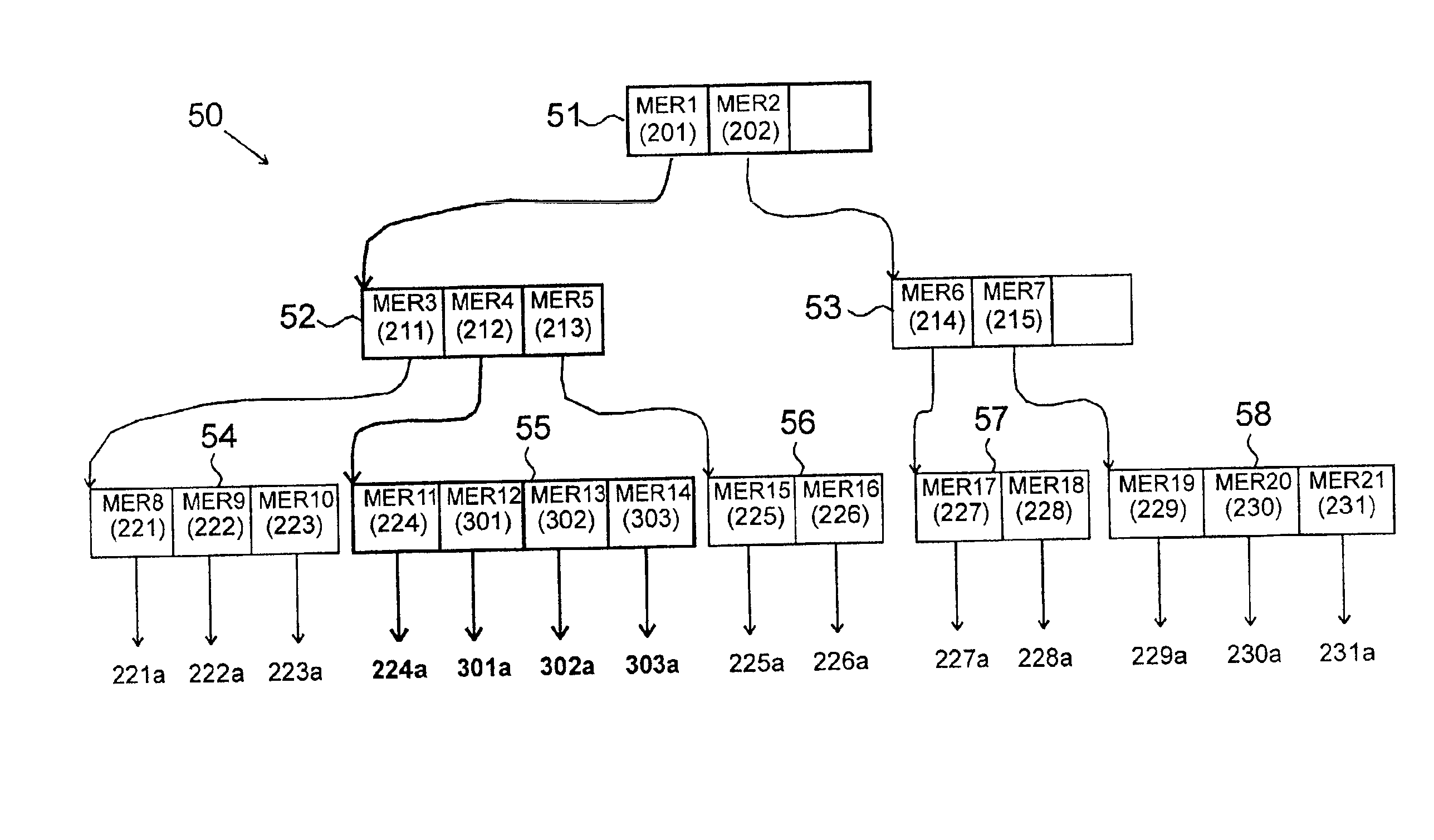
Image

Examples
Embodiment Construction
Applications
The invention's applications are a suite of computer programs that operate as a Location Management Platform program, or LMP, in a wireless telephony system. The invention provides multiple services, including E911 service, location-based call billing, 411 franchise zone location, and GLSB, or the Geographic Location Services Broker, for determining accurate street addresses.
The E911 Application
The first application is E911, for emergency services. E911 service is mandated by the FCC to determine the caller's location and send out emergency services to that location. In Phase 1 of the mandate, the location must be specified in terms of the cell of origin, or in effect the area around the cell tower where the call originated. In Phase 2, the location must be specified within 250 feet.
When a caller makes an E911 call, one approach is to have the network communicate with the cellphone through three or more cell towers. Position determining equipment, or PDE, uses the inputs...
PUM
 Abstract
Description
Claims
Application Information