Position estimation using a network of a global-positioning receivers

network technology, applied in the field of positioning estimation using a global positioning receiver network, can solve the problems of reducing difficult for civilian users to achieve accurate, and inability to access the most accurate parts of the satellite signal, so as to increase the accuracy of estimating the rover's position, maintain or improve the accuracy of the rover's position estimation, and increase the spacing between the rover and the base station

Active Publication Date: 2005-09-27
TOPCON GPS
View PDF5 Cites 47 Cited by
  • Summary
  • Abstract
  • Description
  • Claims
  • Application Information

AI Technical Summary

Benefits of technology

[0017]Accordingly, it is an object of the present invention to increase the accuracy of estimating the rover's position using information from one or more baselines associated with two or more base stations.
[0018]It is a further object of the present invention to enable the spacing between the rover and the base stations to increase while maintaining or improving the accuracy of the estimation of the rover's position.

Problems solved by technology

Civilian users cannot access the most accurate parts of the satellite signals, which makes it difficult for civilian users to achieve accurate results.
In addition, there are sources of noise and error that degrade the accuracy of the satellite signals, and consequently reduce the accuracy of computed values of position.

Method used


Image

  • Position estimation using a network of a global-positioning receivers
  • Position estimation using a network of a global-positioning receivers
  • Position estimation using a network of a global-positioning receivers

Examples


embodiment implementations

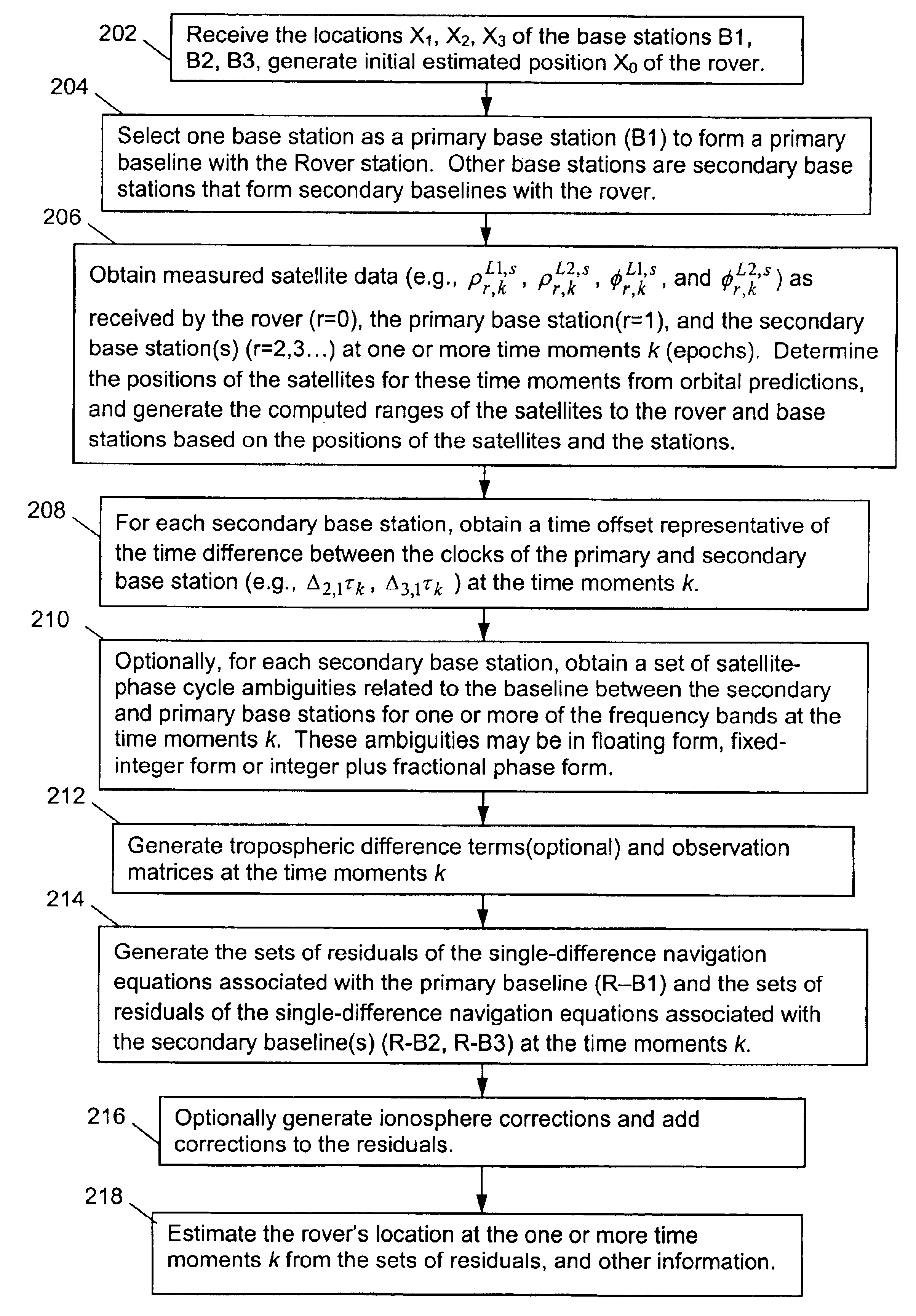
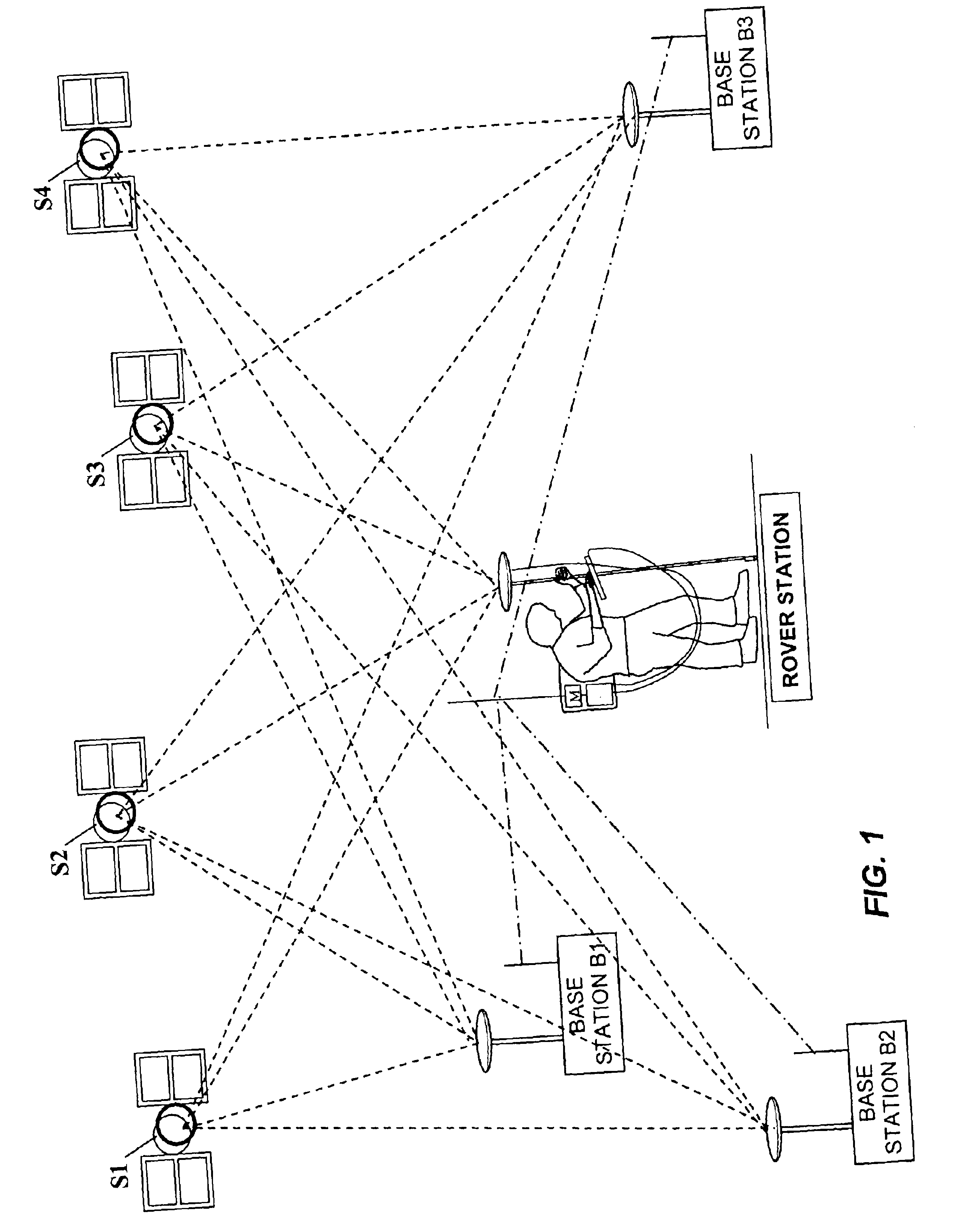
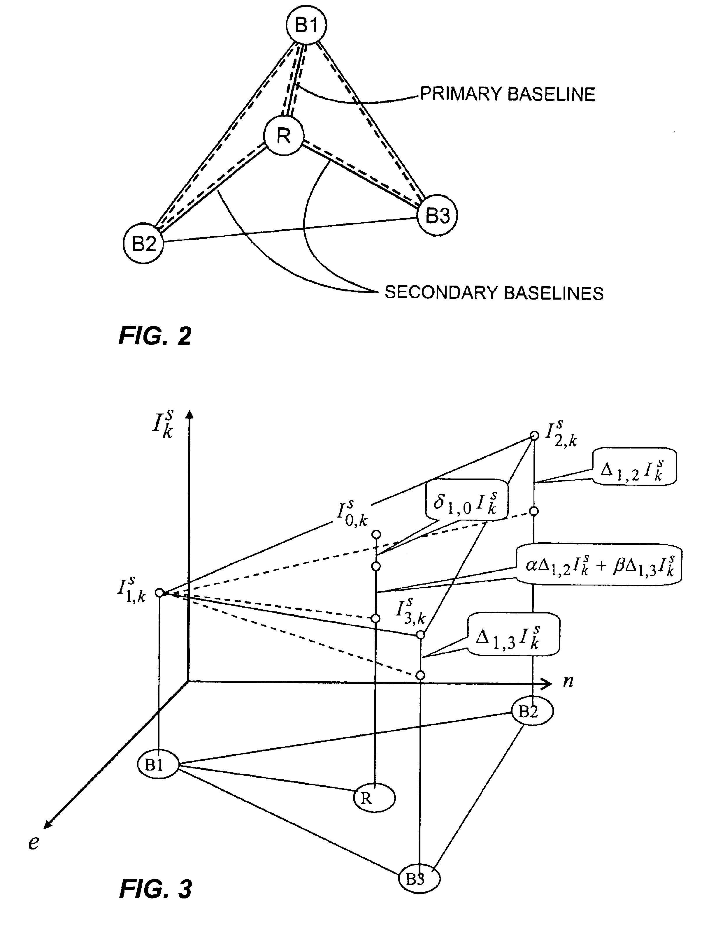
[0114]Having thus described three general groups of embodiments, we now describe an exemplary rover station 100 in FIG. 5 that may be used to implement any of the above-described embodiments. A description of rover station 100 is provided in conjunction with a flow diagram shown in FIG. 6. Referring to FIG. 5, rover 100 comprises a GPS antenna 101 for receiving navigation satellite signals, an RF antenna 102 for receiving information from the base stations, a main processor 110, an instruction memory 112 a data memory 114 for processor 110, and a keyboard / display 115 for interfacing with a human user. Memories 112 and 114 may be separate, or different sections of the same memory bank. Rover 100 further comprises a satellite-signal demodulator 120 for generating the navigation data ρ0,kL1,s, ρ0,kL2,s, φ0,kL1,s, and φ0,kL2,s for each epoch k from the signals received by GPS antenna 101, which is provided to processor 110. Rover 100 also comprises a base-station information demodulator...


PUM


Abstract

Disclosed are methods and apparatuses for determining the position of a roving receiver in a coordinate system using at least two base-station receivers, which are located at fixed and known positions within the coordinate system. The knowledge of the precise locations of the base-station receivers makes it possible to better account for one or all of carrier ambiguities, receiver time offsets, and atmospheric effects encountered by the rover receiver, and to thereby increase the accuracy of the estimated receiver position of the rover. Baselines are established between the rover and each base-station, and baselines are established between the base stations. Navigation equations, which have known quantities and unknown quantities, are established for each baseline. Unknowns for the baseline between base stations are estimated, and then used to correlate and reduce the number of unknowns associated with rover baselines, thereby improving accuracy of the rover's estimated position.

Description

CROSS-REFERENCE TO RELATED APPLICATION[0001]This application claims priority under 35 U.S.C. §119(e) to Provisional U.S. Patent Application Ser. No. 60 / 413,205, filed Sep. 23, 2002, the entire contents of which are incorporated herein by reference.FIELD OF THE INVENTION[0002]The present invention relates to estimating the precise position of a stationary or moving object using multiple satellite signals and a network of multiple receivers. The present invention is particularly suited to position estimation in real-time kinetic environments where it is desirable to take into account the spatial distribution of the ionosphere delay.BACKGROUND OF THE INVENTION[0003]Satellite navigation systems, such as GPS (USA) and GLONASS (Russia), are intended for accurate self-positioning of different users possessing special navigation receivers. A navigation receiver receives and processes radio signals broadcast by satellites located within line-of-sight distance, and from this, computes the pos...

Claims


Application Information

Patent Timeline
Patent Type & Authority Patents(United States)
IPC IPC(8): G01S5/14G01S19/44G01C15/00G01S1/00G01S5/00G01S19/04H04W64/00
CPCG01C15/00G01S19/04G01S19/44G01S19/32G01S19/33
Inventor RAPOPORT, LEV BORISOVICHZINOVIEV, ALEXEI EUGENYEVICH
Owner TOPCON GPS
Why Eureka
Try Eureka