Remote sensing image data compression method capable of maintaining measurement performance
A technology for data compression and remote sensing images, applied in image communication, digital video signal modification, television, etc.
- Summary
- Abstract
- Description
- Claims
- Application Information
AI Technical Summary
Problems solved by technology
Method used
Image
Examples
Embodiment Construction
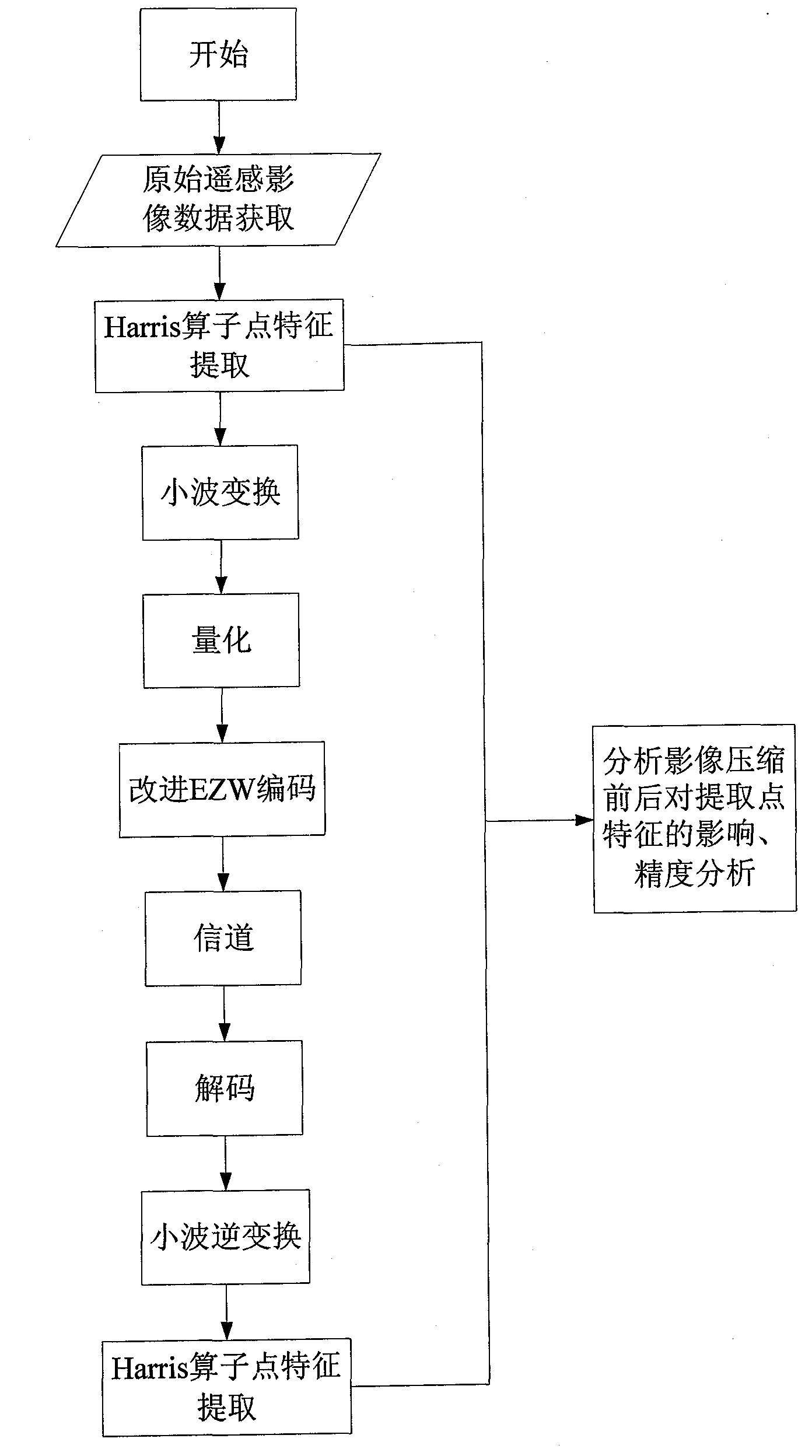
[0073] The invention provides a data compression method that maintains the performance of remote sensing image measurement, such as figure 1 ,Specific steps are as follows:
[0074] Step 1), collecting remote sensing image data with different resolutions, such as Figure 4 The digitized aerial remote sensing image of the urban area shown in (a) with an actual size of 230×230mm and a scanning resolution of 25μm, and, Figure 4 Figure (b) shows the digital aerial remote sensing image with the actual size of 180×180mm and the scanning resolution of 25μm, mainly vegetation. Collect some common characteristics of remote sensing images, such as average value, variance, entropy value, average energy, clarity, autocorrelation coefficient and information entropy, etc., such as Figure 10 shown;
[0075] Let the digital remote sensing image be f(x, y), and its pixel f(i, j)=a k , k={1, 2, 3,...L}, i, j are the abscissa and ordinate of the pixel respectively, L is the maximum gray va...
PUM
 Abstract
Description
Claims
Application Information
 - R&D
- Intellectual Property
- Life Sciences
- Materials
- Tech Scout
- Unparalleled Data Quality
- Higher Quality Content
- 60% Fewer Hallucinations
Browse by: Latest US Patents, China's latest patents, Technical Efficacy Thesaurus, Application Domain, Technology Topic, Popular Technical Reports.
© 2025 PatSnap. All rights reserved.Legal|Privacy policy|Modern Slavery Act Transparency Statement|Sitemap|About US| Contact US: help@patsnap.com


