Massive geographic information system (GIS) information ultrahigh resolution displaying method

A display method and GIS server technology, applied in the field of GIS map display, can solve the problems that it is difficult to meet the ultra-high resolution display of massive GIS information, cannot expand and increase the map display capability of the system, and does not make full use of the splicing screen display resolution, etc., to achieve enhanced super High-resolution display capability, improved overall computing capability, high scalability and maintainability

Active Publication Date: 2014-08-13
广东瀚阳轨道信息科技有限公司
View PDF5 Cites 18 Cited by
  • Summary
  • Abstract
  • Description
  • Claims
  • Application Information

AI Technical Summary

Problems solved by technology

The image resolution of this map information display method is limited by the display output resolution of the GIS computer. The range and resolution of the displayed map are limited. Requirements for Super-resolu

Method used


Image

  • Massive geographic information system (GIS) information ultrahigh resolution displaying method
  • Massive geographic information system (GIS) information ultrahigh resolution displaying method
  • Massive geographic information system (GIS) information ultrahigh resolution displaying method

Examples


Embodiment Construction

[0026] The present invention will be further described in detail below in conjunction with the embodiments and the accompanying drawings, but the embodiments of the present invention are not limited thereto.

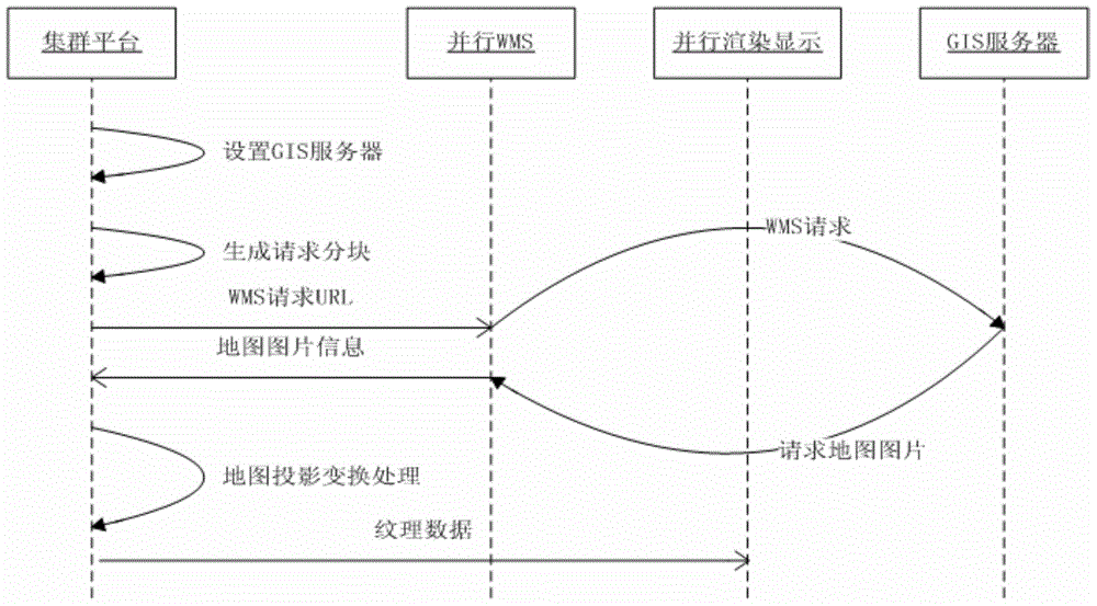
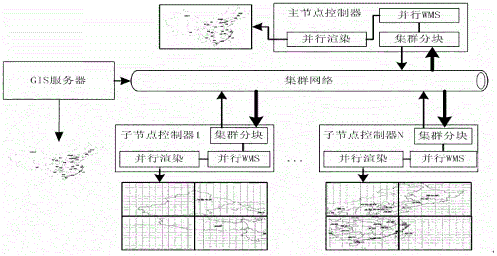
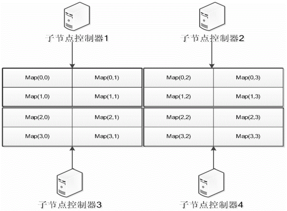
[0027] The super-high-resolution display method of massive GIS information of the present invention is based on a computer cluster platform, and the computer cluster platform includes a master node controller and a plurality of sub-node controllers, and the master node controller is respectively connected with a plurality of sub-node controllers through a computer network, Each sub-node controller is also configured with multiple display units. Such as figure 1 As shown, the display method of the present invention includes the following steps:

[0028]S1, the master node controller sets the GIS server: first check the validity of the GIS server IP address and port, if the GIS server IP address and port are valid data, then the master node controller sends data instructi...


PUM


Abstract

The invention provides a geographic information system (GIS) information ultrahigh resolution displaying method. The method is a splicing displaying method which includes acquiring GIS map information through cluster map sub blocks and WMS service in parallel on the basis of the computer cluster parallel processing, utilizing map projection transformation distribution to process data and conducting parallel texture rendering displaying through a graphic processing unit (GPU). A computer cluster is utilized to acquire, process and display map information, and the massive GIS map processing and displaying problem can be effectively solved. According to a cluster map sub block technology, sub block processing is conducted on a high resolution map according to cluster node machines, the resolution of the displayed map can be expanded by increasing the number of the node machines and is not limited by the resolution of a display screen, and ultrahigh resolution GIS information displaying can be achieved.

Description

technical field [0001] The invention relates to a GIS (Geographic Information System or Geo-Information system) map display technology, in particular to a super-high-resolution display method for massive GIS information. Background technique [0002] In recent years, my country's GIS information construction has developed rapidly, and it has been widely used in transportation, military public security, land management, urban management, disaster prevention and mitigation, resource investigation, water conservancy and electricity, agriculture, forestry, animal husbandry, and lifeline project management. With the rapid development of satellite technology, the development of GIS systems based on specific systems and specific environments has become a research hotspot in the industry. GIS spatial data has the characteristics of large data volume, various forms, and complex structure. In order to better utilize the spatial visualization advantages of GIS information and realize t...

Claims


Application Information

Patent Timeline
IPC IPC(8): G06F3/14G06T1/00H04L29/08
Inventor 孙峻岭罗明宇刘其军归强徐明
Owner 广东瀚阳轨道信息科技有限公司
Why Eureka
Try Eureka