Method and device for splicing strip of airborne laser scanning system

An airborne laser scanning and flight belt technology, applied in special data processing applications, instruments, electrical digital data processing, etc., can solve problems affecting point clouds, spatial drift, and absolute accuracy of three-dimensional coordinates

Inactive Publication Date: 2015-10-21
SOUTH CHINA UNIV OF TECH
View PDF3 Cites 21 Cited by
  • Summary
  • Abstract
  • Description
  • Claims
  • Application Information

AI Technical Summary

Problems solved by technology

[0004] Because of the existence of these errors, systematic errors can be eliminated as much as possible, but random errors cannot be eliminated
This will cause "spatial drift" between adjacent flight strips, so simply integrating the flight strips in a coordinate system will serious

Method used


Image

  • Method and device for splicing strip of airborne laser scanning system
  • Method and device for splicing strip of airborne laser scanning system
  • Method and device for splicing strip of airborne laser scanning system

Examples


Embodiment 1

[0069] In this embodiment, self-developed airborne laser scanning hardware system and ground station software are used. The hardware part includes the UAV airborne platform, laser scanner, differential GPS system, and inertial navigation unit (IMU). The scanning system first obtains the position information between the point cloud and the scanner, and then jointly calculates the 3D point cloud of the surrounding environment, that is, the 3D coordinates of the space environment ( x, y, z), the point cloud data is finally saved in the standard LAS format point cloud storage file.

[0070] The software part, that is, the ground station part, transmits these data packets to the data layer of the ground station through the UDP protocol. The data layer first performs the "seventeenth order Kalman" filter on the received original data, and then performs data calculation, which can be obtained Accurate point cloud data. After the ground station receives the data and calculates the p...

Embodiment 2

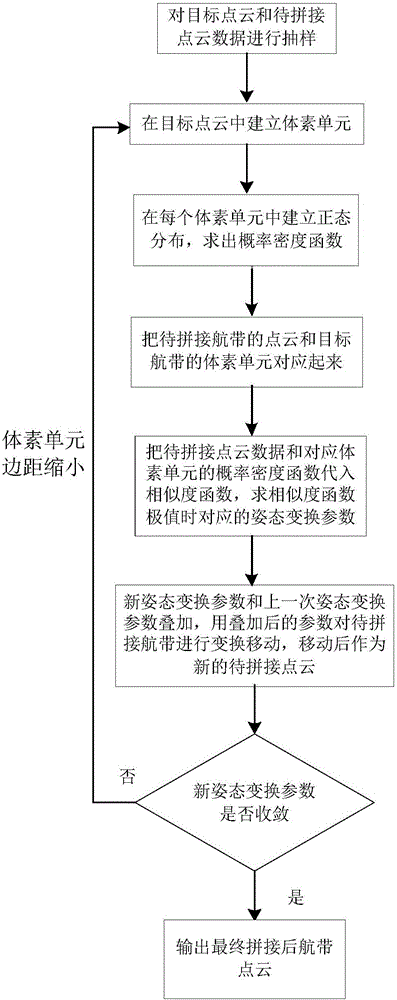
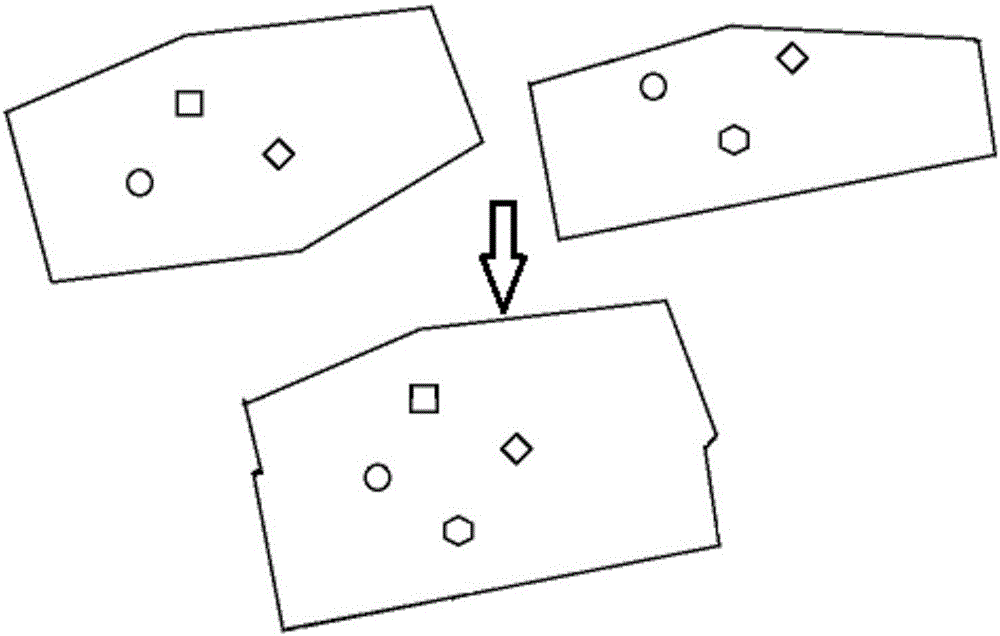
[0131] like Figure 8 as shown, Figure 8 It is a structural block diagram of the flight belt splicing device of the airborne laser scanning system in the second embodiment. It can be seen that this embodiment discloses a flight belt splicing device of the airborne laser scanning system, which has the following modules: parameter initialization module, voxel unit Division module, normal distribution establishment module, voxel unit correspondence module, attitude transformation parameter solution module, point cloud set space movement module

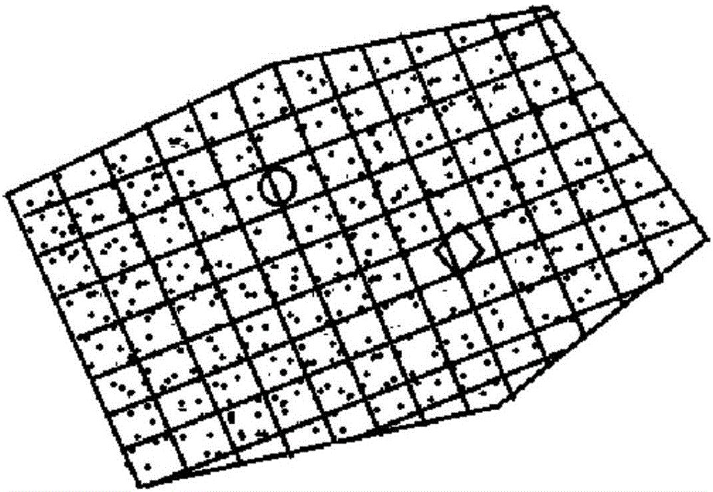
[0132] Among them, the parameter initialization module 801 is used to perform sampling and filtering on the target point cloud data and the point cloud data to be spliced ​​to obtain the sampled target point cloud set and the collection of point clouds to be spliced X = { x → 1 , ... , x ...


PUM


Abstract

The invention discloses a method and a device for splicing strips of an airborne laser scanning system. The method comprises: using a three-dimensional normal distribution transformation algorithm as a splicing algorithm in strip splicing, dividing voxel units in point cloud data of the airborne laser scanning system, establishing normal distribution in the voxel units, mean values and variance of the normal distribution representing characteristics of the voxel units; and then establishing a similarity function, and obtaining offset of strips when value of the similarity function is maximum; and adjusting adjacent strips according to the offset, to finally splice a plurality of strips together. In addition, through contrast experiment analysis, methods and parameters on three aspects of sample rate before strip splicing, data organization method in a strip splicing process, and discretization are selected to be more proper. The method has higher robustness, shorter splicing time, and better splicing precision, and memory utilization rate of a computer is lower.

Description

technical field [0001] The present invention relates to the technical field of terrain surveying, in particular to a method and device for splicing airborne laser scanning systems, especially suitable for terrain scanning and processing based on unmanned aerial vehicle platforms, and provides a new splicing of flight strips Implementation. Background technique [0002] Airborne LiDAR scanning (Light Detection and Ranging, LiDAR) technology has developed rapidly and has become another technological revolution in the field of surveying and mapping after GPS technology. LiDAR technology integrates flight control system, laser scanner, inertial measurement unit (IMU), differential GPS and other technologies, can obtain "true three-dimensional" point cloud data and generate high-precision digital elevation model (Digital Elevation Model, DEM for short) ). It uses the spot of the laser beam on the object to accurately locate the distance between the platform and the object. On t...

Claims


Application Information

Patent Timeline
IPC IPC(8): G06F19/00
Inventor 黄志安裴海龙黄紫健
Owner SOUTH CHINA UNIV OF TECH
Why Eureka
Try Eureka