
Pavement asphalt thickness detection method based on vehicle-mounted laser scanning spot cloud
A vehicle-mounted laser scanning, asphalt thickness technology, applied in measuring devices, optical devices, image data processing, etc., to improve detection accuracy, ensure safety and quality, and improve detection time and cost.
- Summary
- Abstract
- Description
- Claims
- Application Information
AI Technical Summary
Problems solved by technology
Method used
Image

Examples
Embodiment
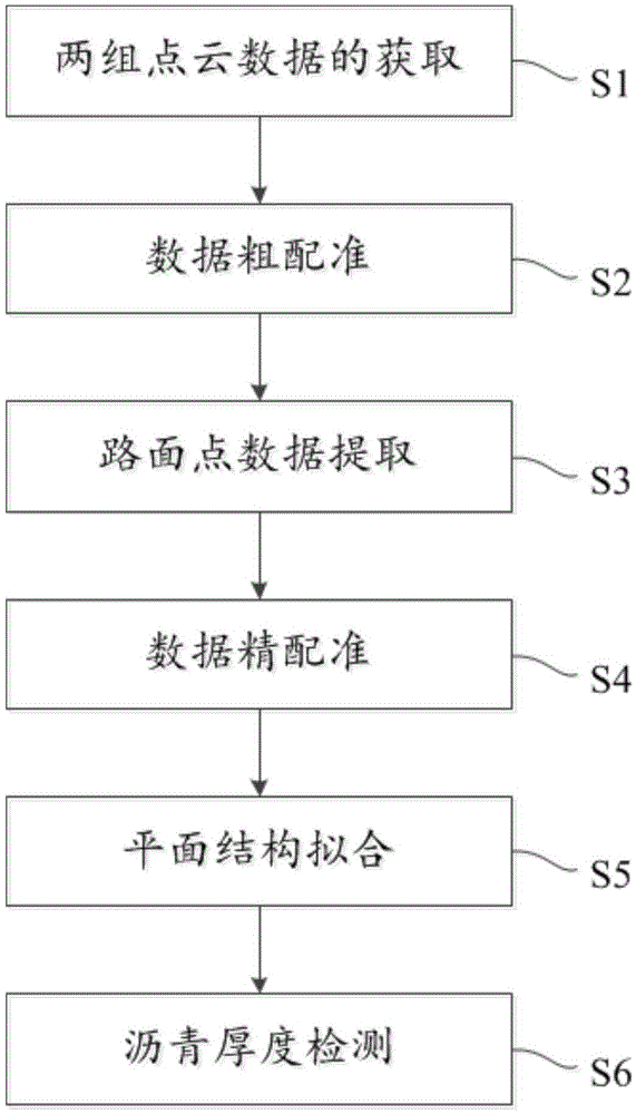
[0055] see figure 1 , the invention discloses a method for detecting the thickness of asphalt on road surfaces in road renovation projects based on vehicle-mounted laser scanning point clouds, which includes the following steps:
[0056] S1. Acquisition of two sets of point cloud data
[0057] The point cloud data set is obtained by two scans using the on-board laser scanning system. The first scan obtains the road point cloud data set of the bare surface before asphalt paving in the road reconstruction project, and the second scan obtains the road point cloud data set of the asphalt pavement after the road reconstruction project is paved with asphalt.
[0058] S2. Coarse data registration
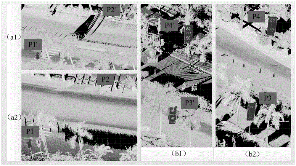
[0059]Two sets of point cloud datasets collected at different times and in different scanning projects need to be registered in the same coordinate system before processing. The two sets of point cloud data have different road points, but for roadside traffic signs, street light poles, ...
PUM
 Abstract
Description
Claims
Application Information