Multi-path error correcting method based on height angle

A multi-path error and altitude angle technology, which is applied in the direction of instruments, measuring devices, satellite radio beacon positioning systems, etc., can solve the problems of complex calculation, weak versatility, and large influence of noise on calculation results, and achieve simple and applicable calculation Strong, increase the effect of environmental impact coefficient

Active Publication Date: 2018-12-07
SOUTHEAST UNIV +1
View PDF7 Cites 10 Cited by
  • Summary
  • Abstract
  • Description
  • Claims
  • Application Information

AI Technical Summary

Problems solved by technology

[0004] Purpose of the invention: Aiming at technical problems such as poor versatility, large noise influence on calculation results, and complex calculations in existing multipath error correction methods, the purpose of this invention is to provide a method that can significantly improve universality, stability, and positioning accuracy. Multipath Error Correction Method Based on Satellite Altitude Angle

Method used


Image

  • Multi-path error correcting method based on height angle
  • Multi-path error correcting method based on height angle
  • Multi-path error correcting method based on height angle

Examples


Embodiment Construction

[0036] The technical solutions of the present invention will be further described below in conjunction with the accompanying drawings and specific embodiments.

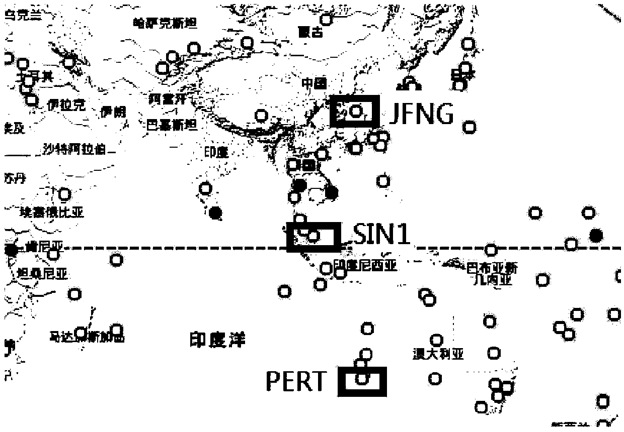
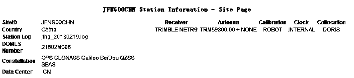
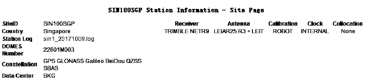
[0037] In the process of multi-system combined pseudo-range single-point positioning, first use the observation files and ephemeris files of each system to calculate the satellite elevation angle at the observation time of each satellite, and use the correlation between the multipath error and the satellite elevation angle , using the trigonometric function of the altitude angle to construct the calculation model of the multipath error; according to the relationship between the multipath error and the observed geographical environment, set the environmental impact coefficient to meet the application under different conditions; use the calculated multipath error to calculate the pseudorange observation value Correction is carried out to obtain more accurate pseudo-range observation data; the method is tested by using th...


PUM


Abstract

The invention discloses a multi-path error correcting method based on a satellite height angle. The method comprises the following steps of 1), in a positioning process of a multi-system combined pseudo-range single point, performing calculation by means of an observation file and an ephemeris file of each system; by means of relativity between a multi-path error and the satellite height angle, constructing a multi-path error calculation model by means of a trigonometric function of the height angle; 2), according to relativity between the multi-path error and an observed geographical environment, setting an environment influence factor for satisfying application in different conditions; and 3), correcting a pseudo-range observed value by means of the multi-path error obtained through calculation. The multi-path error correcting method has advantages of simple operation and high interference resistance. Compared with an existing double-frequency pseudo-range-carrier combined multi-patherror correcting method based on cycle slip detection, the multi-path error correcting method has an advantage of improving positioning precision by more than 30%.

Description

technical field [0001] The invention relates to a global navigation satellite system (GNSS) satellite positioning error correction method, in particular to a multi-path error correction method based on satellite elevation angle. Background technique [0002] GNSS (Global Navigation Satellite System) has the remarkable characteristics of high precision, all-weather, and no geographical restrictions. In order to provide high-precision positioning services, it is necessary to effectively correct various errors. The multipath effect is that during the propagation process of the GNSS satellite signal, the signal reflected or refracted by the surrounding environment of the observation station is received by the receiver, which makes the deviation between the received signal and the direct signal. The multipath effect not only affects the positioning accuracy, but also can as a criterion for assessing data quality. [0003] At present, the processing of multipath effects mainly f...

Claims


Application Information

Patent Timeline
Patent Type & Authority Applications(China)
IPC IPC(8): G01S19/22
CPCG01S19/22
Inventor 潘树国高旺赵珏陈伏州
Owner SOUTHEAST UNIV
Why Eureka
Try Eureka