Land area measurement method and system

A technology of land area and measurement method, which is applied in the direction of electric/magnetic area measurement, radio wave measurement system, measurement device, etc., can solve the problems of GPS positioning accuracy and calculation result errors, difficult to popularize, low positioning accuracy, etc. The effect of area measurement accuracy, ease of use, and ease of promotion

Active Publication Date: 2019-06-14
土流集团有限公司
View PDF11 Cites 11 Cited by
  • Summary
  • Abstract
  • Description
  • Claims
  • Application Information

AI Technical Summary

Problems solved by technology

The existing land area measurement includes the following methods: 1) simple pull wire or measuring tape as a measuring tool, the disadvantage of this method is that it is only suitable for measuring small pieces of land with regular shapes; 2) using GPS positioning system, embedded single-chip microcomputer development Area measuring instruments or price calculators, such as Jiangsu University’s patent “GPS-Based Farmland Operation Area Measurement System and Measurement Method” (zl200910036283.4), Veichuang Technology Beidou GPS Mu Meter, and the American “GPS Area Measuring Instrument-Journey 300” , Yili A5 hand-held high-precision GPS mu meter, all use GPS positioning, go around and measure the land for a week, automatically record the coordinates of the measurement route, and then process the positioning information by the single-chip computer to calculate the corresponding area; this method is insufficient The reason is that equipment with high positioning accuracy is expensive and is not suitable for popularization. The area calculation error of low positioning accuracy is large, and the use experience is not good and it is difficult to promote; 3) Real-time monitoring of agricultural machinery operation width and walking distance, and then calculate the area and price, such as Hebei Agricultural University's patent "Method and device for automatic online measurement of real-time actual cutting width of grain" (zl200520113683.1), and Beijing Agricultural Information Technology Research Center's patent "A harvested area measurement and billing system and method" (zl200710175342. 7), the harvesting width is detected by ultrasonic waves, and the output operation area is calculated in real time by the single-chip computer; Zhao Jinzhou's patent "farming area measurement meter for agricultural machinery and vehicles" (zl200820028159.4), including universal scale measurement by adsorption and installation on the axles of different agricultural machinery and vehicles Disk and calculator, moving contact lever and moving contact and static contact for accumulatively measuring the tire driving circumference data, through the contact between the moving contact lever and the moving contact and static contact during tillage, the accumulated tire circumference data , plus the scale conversion data of less than one circle on the scale measuring disk, the length and width can be measured, and then the area and price can be calculated. The disadvantage of this method is that it is laborious to operate due to the poor measurement environment and complicated working conditions. The error in the measurement result will be relatively large, and the reliability is not enough
[0003] At present, GPS has been widely used in military, surveying and mapping, transportation, tourism, exploration and other fields. With the continuous development of mobile devices and wireless network technology, direct use of mobile phone GPS positioning modules for land measurement has become the mainstream trend in the land transfer market. , such as Chinese patent 201610187343.2, the patent name is a method and system for measuring land area through smart phones, and a method for measuring land area through smart phones is reported. Simple and convenient, it can measure the area of ​​various shapes of land, and the calculation speed is fast, but the disadvantage is that the positioning accuracy in land measurement is low, such as poor network stability and large environmental interference, resulting in large positioning errors. These errors affect The error of GPS positioning accuracy and calculation results is large

Method used


Image

  • Land area measurement method and system
  • Land area measurement method and system
  • Land area measurement method and system

Examples


Embodiment Construction

[0035] The present invention will be described in detail below with reference to the accompanying drawings and examples.

[0036] The land area measurement system provided by the present embodiment includes a data acquisition module, a data correction module, a data result calculation module and a data display module, and adopts the above-mentioned system to carry out the land area measurement method, including the following steps:

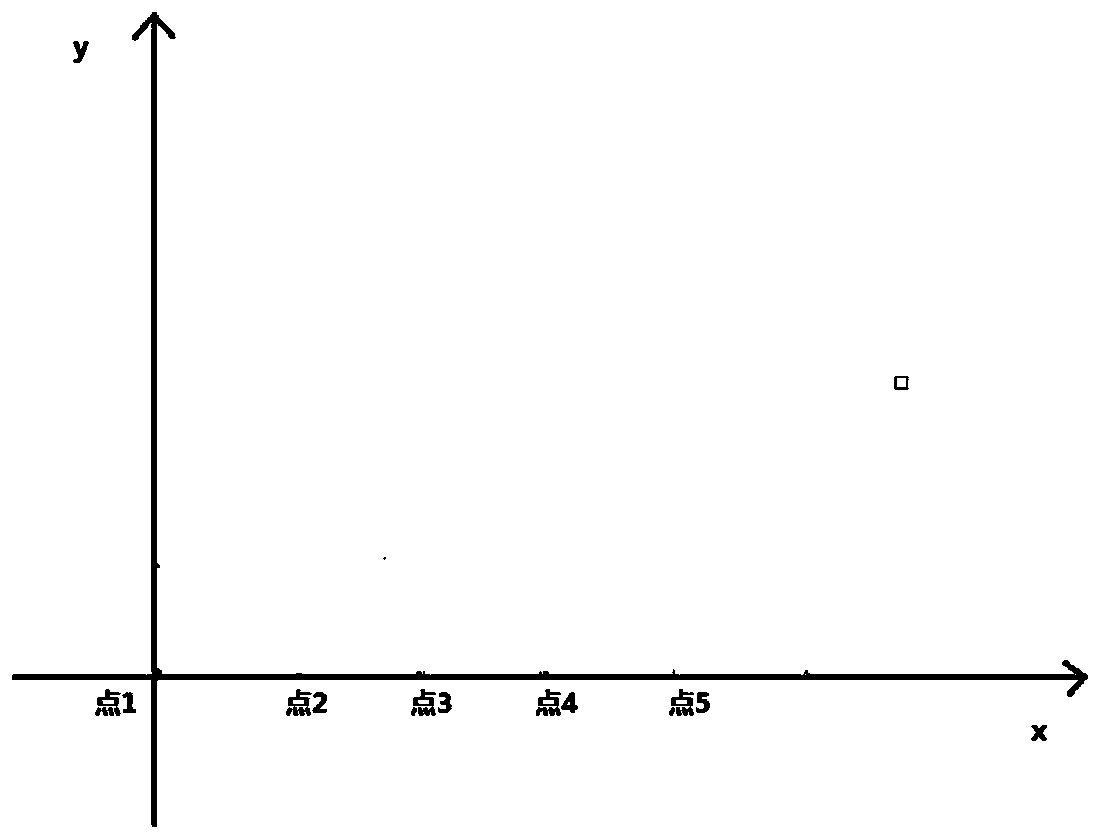
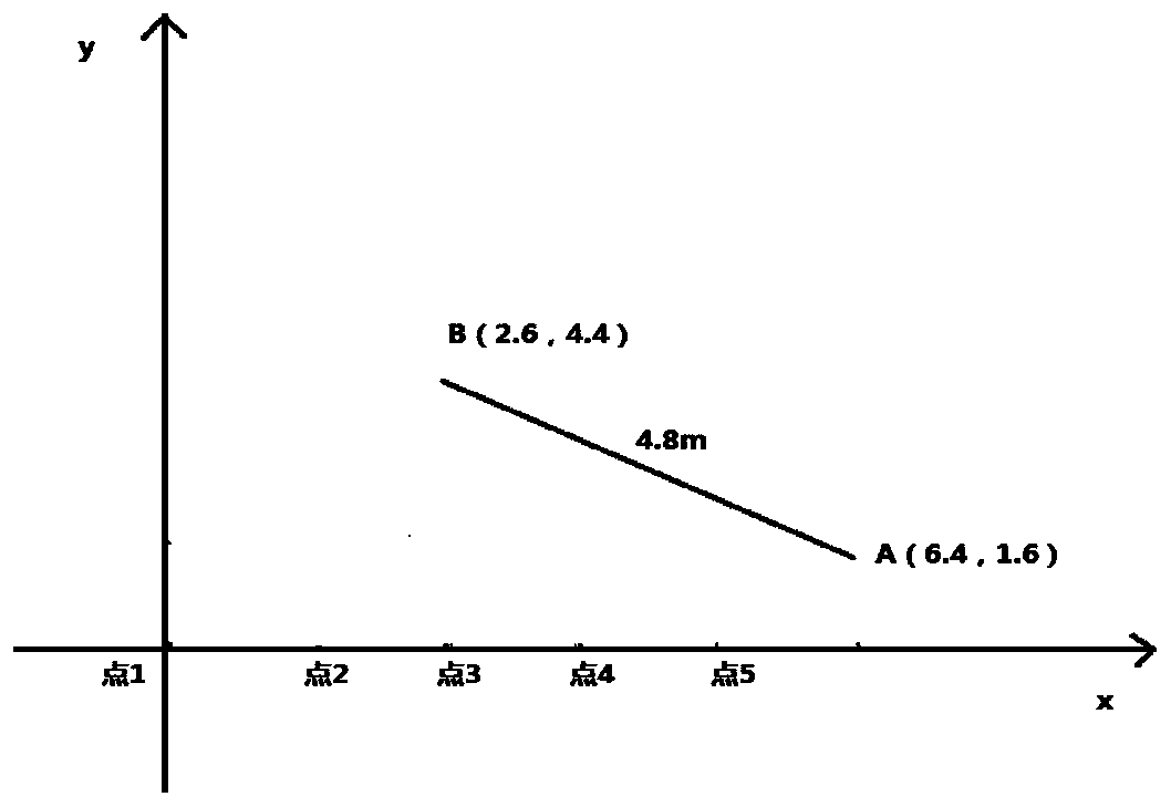
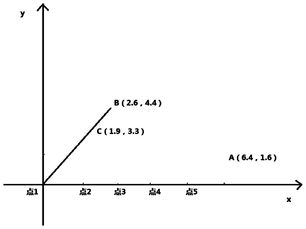
[0037] (1) Click to start the measurement, go around the measurement area, and use the GPS receiving module of the mobile phone to receive the positioning information sent by the GPS at regular intervals and record it;

[0038] (2) The data acquisition module reads the latitude and longitude data of each sampling point in the GPS receiving module, converts the positioning information into positioning coordinates and saves them, and generates the original survey route map according to these positioning coordinates;

[0039] (3) After the calculatio...


PUM


Abstract

The invention provides a land area measurement method which is implemented by a land area measurement system. The system comprises a data collection module, a data correction module, a data result calculation module and a data display module. The land area measurement method comprises the following steps of clicking to start measurement, bypassing a measurement area, receiving positioning information transmitted by a GPS (Global Positioning System) through a mobile phone GPS receiving module, and recording the positioning information; enabling the mobile phone GPS receiving module to automatically convert the positioning information into coordinate points and saving the coordinate points, enabling the positioning coordinate points to generate an original measurement route map, and generating a measurement route map based on a mobile phone built-in Baidu map or Gaode map; establishing a calculation coordinate system, correcting each positioning coordinate point, calculating according tothe corrected data in the third step; and displaying a path of a user and an area S of a graphic. According to the land area measurement method provided by the invention, the coordinate is correctedthrough a new correction algorithm, thereby greatly improving the area measurement precision; and the method is strong in practicability and convenient to popularize.

Description

technical field [0001] The invention belongs to the technical field of land area measurement, in particular to a method for measuring land area through a smart phone, and a system for measuring land area through a smart phone. Background technique [0002] With the continuous growth of the land transfer market, both the supply and demand sides hope to quickly obtain data such as the area and slope of the land through simple and convenient tools. The existing land area measurement includes the following methods: 1) simple pull wire or measuring tape as a measuring tool, the disadvantage of this method is that it is only suitable for measuring small pieces of land with regular shapes; 2) using GPS positioning system, embedded single-chip microcomputer development Area measuring instruments or price calculators, such as Jiangsu University’s patent “GPS-Based Farmland Operation Area Measurement System and Measurement Method” (zl200910036283.4), Veichuang Technology Beidou GPS Mu...

Claims


Application Information

Patent Timeline
Patent Type & Authority Applications(China)
IPC IPC(8): G01B7/32G01S19/14
Inventor 谢佳王祥飞
Owner 土流集团有限公司
Why Eureka
Try Eureka